Estimated Value: $820,000 - $859,000
3
Beds
2
Baths
1,864
Sq Ft
$447/Sq Ft
Est. Value
About This Home
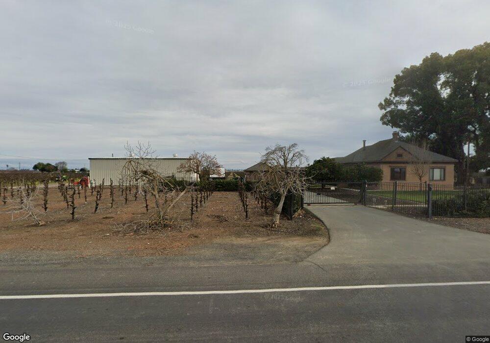
This home is located at 14770 N Davis Rd, Lodi, CA 95242 and is currently estimated at $833,357, approximately $447 per square foot. 14770 N Davis Rd is a home located in San Joaquin County with nearby schools including Ellerth E. Larson Elementary School, Lodi Middle School, and Tokay High School.
Ownership History
Date
Name
Owned For
Owner Type
Purchase Details
Closed on
Mar 26, 2013
Sold by
Casalta Francisca
Bought by
Cusumano Gary M and Cusumano Diana L
Current Estimated Value
Purchase Details
Closed on
Oct 20, 2009
Sold by
Casalta Francisca and Guthrie Jack
Bought by
Casalta Francisca
Purchase Details
Closed on
Jul 14, 2004
Sold by
Lagno John J
Bought by
Lagno John J
Purchase Details
Closed on
Oct 25, 1993
Sold by
Lagno John J
Bought by
Lagno John J
Home Financials for this Owner
Home Financials are based on the most recent Mortgage that was taken out on this home.
Original Mortgage
$150,000
Interest Rate
6.95%
Create a Home Valuation Report for This Property
The Home Valuation Report is an in-depth analysis detailing your home's value as well as a comparison with similar homes in the area
Home Values in the Area
Average Home Value in this Area
Purchase History
| Date | Buyer | Sale Price | Title Company |
|---|---|---|---|
| Cusumano Gary M | -- | Chicago Title Company | |
| Casalta Francisca | -- | None Available | |
| Lagno John J | -- | -- | |
| Lagno John J | -- | Chicago Title Company |
Source: Public Records
Mortgage History
| Date | Status | Borrower | Loan Amount |
|---|---|---|---|
| Previous Owner | Lagno John J | $150,000 |
Source: Public Records
Tax History Compared to Growth
Tax History
| Year | Tax Paid | Tax Assessment Tax Assessment Total Assessment is a certain percentage of the fair market value that is determined by local assessors to be the total taxable value of land and additions on the property. | Land | Improvement |
|---|---|---|---|---|
| 2025 | $5,615 | $482,705 | $221,651 | $261,054 |
| 2024 | $5,472 | $473,241 | $217,305 | $255,936 |
| 2023 | $5,413 | $463,963 | $213,045 | $250,918 |
| 2022 | $5,302 | $454,868 | $208,868 | $246,000 |
| 2021 | $5,391 | $445,948 | $204,773 | $241,175 |
| 2020 | $4,905 | $441,378 | $202,674 | $238,704 |
| 2019 | $4,807 | $432,723 | $198,700 | $234,023 |
| 2018 | $4,740 | $424,238 | $194,804 | $229,434 |
| 2017 | $4,634 | $415,923 | $190,985 | $224,938 |
| 2016 | $4,345 | $407,769 | $187,241 | $220,528 |
| 2014 | $4,226 | $393,779 | $180,817 | $212,962 |
Source: Public Records
Map
Nearby Homes
- 21759 N Davis Rd
- 481 W Highway 12
- 23181 Devries Rd
- 68 Taylor Rd
- 209 E Highway 12
- 2967 Fuchsia Dr
- 291 E Highway 12
- 2830 Mcintosh Dr
- 2826 Cameo St
- 2911 Zinnia Way
- 15840 Devries Rd Unit 15740
- 1536 Empire Dr
- 2891 Wisteria Dr
- 2892 Cammie Ln
- 2933 Coronado Dr
- 2926 La Jolla Way
- 2921 Coronado Dr
- 2875 Hickory Ln
- Arbor Plan at Gateway - Wisteria Collection
- Terrace Plan at Gateway - Wisteria Collection
- 1230 W Highway 12
- 14602 N Davis Rd
- 1844 W Highway 12
- 14472 N Davis Rd
- 14401 N Davis Rd
- 1311 W Highway 12
- 1790 Larson Rd
- 14343 N Davis Rd
- 15279 N Davis Rd
- 14330 N Davis Rd
- 1851 W Highway 12
- 1990 W Highway 12
- 903 W Highway 12
- 14190 N Davis Rd
- 2100 W Highway 12
- 15521 N Davis Rd
- 15271 Moore Rd
- 15550 Moore Rd
- 1617 Larson Rd
- 2201 W Highway 12