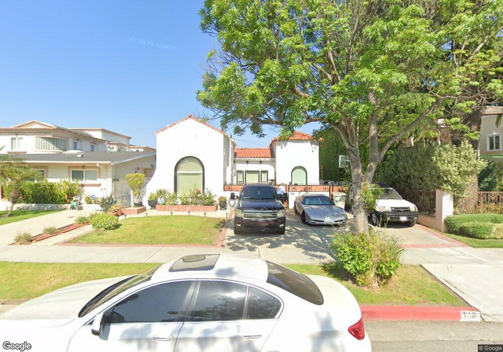
148 S Clark Dr Beverly Hills, CA 90211
Estimated Value: $2,408,000 - $2,570,000
3
Beds
2
Baths
1,498
Sq Ft
$1,668/Sq Ft
Est. Value
About This Home
This home is located at 148 S Clark Dr, Beverly Hills, CA 90211 and is currently estimated at $2,498,810, approximately $1,668 per square foot. 148 S Clark Dr is a home located in Los Angeles County with nearby schools including Horace Mann Elementary School, Beverly Hills High School, and Harkham Hillel Hebrew Academy.
Ownership History
Date
Name
Owned For
Owner Type
Purchase Details
Closed on
Mar 31, 2008
Sold by
Baker Aurora M
Bought by
Bornn Baker Aurora M and Bornn Baker Trust
Current Estimated Value
Purchase Details
Closed on
Jan 30, 2004
Sold by
Baker Philip H
Bought by
Baker Aurora M and Philip H Baker Trust
Purchase Details
Closed on
Nov 13, 2003
Sold by
Bank Of America Na
Bought by
Baker Philip H
Purchase Details
Closed on
May 16, 1994
Sold by
Baker Philip H
Bought by
Bank Of America National Tr & Svgs Assn
Create a Home Valuation Report for This Property
The Home Valuation Report is an in-depth analysis detailing your home's value as well as a comparison with similar homes in the area
Home Values in the Area
Average Home Value in this Area
Purchase History
| Date | Buyer | Sale Price | Title Company |
|---|---|---|---|
| Bornn Baker Aurora M | -- | None Available | |
| Baker Aurora M | -- | None Available | |
| Baker Aurora M | -- | -- | |
| Baker Philip H | -- | -- | |
| Bank Of America National Tr & Svgs Assn | -- | -- |
Source: Public Records
Tax History Compared to Growth
Tax History
| Year | Tax Paid | Tax Assessment Tax Assessment Total Assessment is a certain percentage of the fair market value that is determined by local assessors to be the total taxable value of land and additions on the property. | Land | Improvement |
|---|---|---|---|---|
| 2025 | $29,550 | $1,459,606 | $1,089,514 | $370,092 |
| 2024 | $29,550 | $2,448,000 | $1,836,000 | $612,000 |
| 2023 | $1,995 | $149,571 | $107,188 | $42,383 |
| 2022 | $1,943 | $146,639 | $105,087 | $41,552 |
| 2021 | $1,879 | $143,765 | $103,027 | $40,738 |
| 2019 | $1,828 | $139,503 | $99,972 | $39,531 |
| 2018 | $1,634 | $136,768 | $98,012 | $38,756 |
| 2016 | $1,550 | $131,459 | $94,207 | $37,252 |
| 2015 | $1,487 | $129,485 | $92,792 | $36,693 |
| 2014 | $1,451 | $126,950 | $90,975 | $35,975 |
Source: Public Records
Map
Nearby Homes
- 209 S Swall Dr
- 240 S Swall Dr
- 143 N Arnaz Dr Unit 204
- 143 N Arnaz Dr Unit 304
- 138 N Swall Dr
- 121 N Almont Dr Unit 303
- 121 N Almont Dr Unit 103
- 869 S Wooster St Unit 103
- 130 S Carson Rd
- 858 S Shenandoah St
- 828 S Bedford St Unit 202
- 200 N Swall Dr Unit PH53
- 272 S Doheny Dr Unit 1
- 152 S Oakhurst Dr Unit 304
- 489 S Willaman Dr
- 8642 Gregory Way Unit 204
- 300 N Swall Dr Unit 307
- 300 N Swall Dr Unit 106
- 300 N Swall Dr Unit 305
- 300 N Swall Dr Unit 452
- 144 S Clark Dr
- 152 S Clark Dr
- 156 S Clark Dr
- 140 S Clark Dr Unit A
- 140 S Clark Dr Unit C
- 136 S Clark Dr
- 149 S Clark Dr
- 153 S Clark Dr
- 145 S Clark Dr
- 157 S Clark Dr
- 132 S Clark Dr
- 143 S Clark Dr
- 200 S Clark Dr
- 137 S Clark Dr
- 128 S Clark Dr
- 143 S Robertson Blvd Unit B
- 204 S Clark Dr
- 133 S Clark Dr
- 201 S Clark Dr
- 124 S Clark Dr