Estimated Value: $178,000 - $225,000
--
Bed
1
Bath
980
Sq Ft
$201/Sq Ft
Est. Value
About This Home
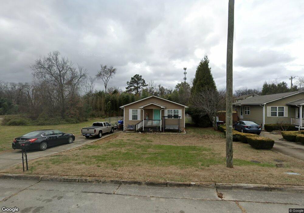
This home is located at 148 W Bell St, Alcoa, TN 37701 and is currently estimated at $197,040, approximately $201 per square foot. 148 W Bell St is a home located in Blount County with nearby schools including Alcoa Elementary School, Alcoa Middle School, and Alcoa High School.
Ownership History
Date
Name
Owned For
Owner Type
Purchase Details
Closed on
Jan 20, 2009
Sold by
Blount County Habitat For
Bought by
Jennings Angela S
Current Estimated Value
Home Financials for this Owner
Home Financials are based on the most recent Mortgage that was taken out on this home.
Original Mortgage
$78,864
Outstanding Balance
$49,982
Interest Rate
5.23%
Estimated Equity
$147,058
Purchase Details
Closed on
Oct 11, 2006
Bought by
Blount County Habitat For Humanity
Purchase Details
Closed on
Mar 20, 1986
Bought by
Lundy Leslie and Barbara Jean
Create a Home Valuation Report for This Property
The Home Valuation Report is an in-depth analysis detailing your home's value as well as a comparison with similar homes in the area
Home Values in the Area
Average Home Value in this Area
Purchase History
| Date | Buyer | Sale Price | Title Company |
|---|---|---|---|
| Jennings Angela S | -- | -- | |
| Blount County Habitat For Humanity | $34,000 | -- | |
| Lundy Leslie | $1,000 | -- |
Source: Public Records
Mortgage History
| Date | Status | Borrower | Loan Amount |
|---|---|---|---|
| Open | Lundy Leslie | $78,864 |
Source: Public Records
Tax History Compared to Growth
Tax History
| Year | Tax Paid | Tax Assessment Tax Assessment Total Assessment is a certain percentage of the fair market value that is determined by local assessors to be the total taxable value of land and additions on the property. | Land | Improvement |
|---|---|---|---|---|
| 2024 | $1,263 | $38,500 | $7,500 | $31,000 |
| 2023 | $1,263 | $38,500 | $7,500 | $31,000 |
| 2022 | $1,113 | $23,475 | $4,750 | $18,725 |
| 2021 | $1,113 | $23,475 | $4,750 | $18,725 |
| 2020 | $1,113 | $23,475 | $4,750 | $18,725 |
| 2019 | $1,113 | $23,475 | $4,750 | $18,725 |
| 2018 | $948 | $21,400 | $2,250 | $19,150 |
| 2017 | $948 | $21,400 | $2,250 | $19,150 |
| 2016 | $948 | $21,400 | $2,250 | $19,150 |
| 2015 | $880 | $21,400 | $2,250 | $19,150 |
| 2014 | $1,113 | $21,400 | $2,250 | $19,150 |
| 2013 | $1,113 | $27,075 | $0 | $0 |
Source: Public Records
Map
Nearby Homes
- 232 W Stephenson St
- 1536 Tsuga Dr
- 1420 St Thomas Way
- 1574 Tsuga Dr
- 1439 St Thomas Way
- 1334 Mountain Quail Cir
- 1569 Ashwood Place
- 1330 Mountain Quail Cir
- 1424 Mountain Quail Cir
- 304 W Lincoln Rd
- 1321 Nobel St Unit E
- 552 N Wright Rd
- 252 Glascock St
- 1533 Springbrook Rd
- 275 Glascock St
- 102 Oakdale St
- 0 N Wright Rd
- 1340 Dalton St
- 239 Lindsay St
- 119 Pinedale St
- 146 W Bell St
- 144 W Bell St
- 171 W Franklin St
- 171 W Bell St
- 163 W Franklin St
- 142 W Bell St
- 181 W Bell St
- 157 W Bell St
- 159 W Franklin St
- 140 W Bell St
- 151 W Franklin St
- 149 W Bell St
- 166 W Edison St
- 138 W Bell St
- 174 W Edison St
- 154 W Franklin St
- 180 W Edison St
- 145 W Franklin St
- 150 W Edison St
- 136 W Bell St