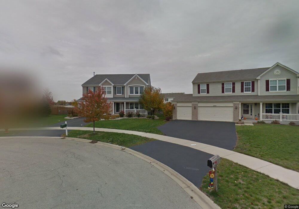
14846 Independence Ct Unit 2 Plainfield, IL 60544
West Plainfield NeighborhoodEstimated Value: $507,000 - $568,000
4
Beds
3
Baths
3,183
Sq Ft
$169/Sq Ft
Est. Value
About This Home
This home is located at 14846 Independence Ct Unit 2, Plainfield, IL 60544 and is currently estimated at $538,927, approximately $169 per square foot. 14846 Independence Ct Unit 2 is a home located in Will County with nearby schools including Lincoln Elementary School, Richard Ira Jones Middle School, and Plainfield North High School.
Ownership History
Date
Name
Owned For
Owner Type
Purchase Details
Closed on
Nov 21, 2003
Sold by
Drh Cambridge Homes Inc
Bought by
Mccormick Robert John and Mccormick Justine Louise
Current Estimated Value
Home Financials for this Owner
Home Financials are based on the most recent Mortgage that was taken out on this home.
Original Mortgage
$297,750
Outstanding Balance
$138,134
Interest Rate
6.01%
Mortgage Type
Purchase Money Mortgage
Estimated Equity
$400,793
Create a Home Valuation Report for This Property
The Home Valuation Report is an in-depth analysis detailing your home's value as well as a comparison with similar homes in the area
Home Values in the Area
Average Home Value in this Area
Purchase History
| Date | Buyer | Sale Price | Title Company |
|---|---|---|---|
| Mccormick Robert John | $331,000 | First American |
Source: Public Records
Mortgage History
| Date | Status | Borrower | Loan Amount |
|---|---|---|---|
| Open | Mccormick Robert John | $297,750 |
Source: Public Records
Tax History Compared to Growth
Tax History
| Year | Tax Paid | Tax Assessment Tax Assessment Total Assessment is a certain percentage of the fair market value that is determined by local assessors to be the total taxable value of land and additions on the property. | Land | Improvement |
|---|---|---|---|---|
| 2024 | $10,534 | $150,892 | $30,220 | $120,672 |
| 2023 | $10,534 | $136,282 | $27,294 | $108,988 |
| 2022 | $9,448 | $122,399 | $24,514 | $97,885 |
| 2021 | $8,924 | $114,391 | $22,910 | $91,481 |
| 2020 | $8,796 | $111,146 | $22,260 | $88,886 |
| 2019 | $8,485 | $105,904 | $21,210 | $84,694 |
| 2018 | $8,465 | $103,653 | $19,730 | $83,923 |
| 2017 | $8,203 | $98,501 | $18,749 | $79,752 |
| 2016 | $8,000 | $93,945 | $17,882 | $76,063 |
| 2015 | $7,561 | $88,004 | $16,751 | $71,253 |
| 2014 | $7,561 | $84,897 | $16,160 | $68,737 |
| 2013 | $7,561 | $84,897 | $16,160 | $68,737 |
Source: Public Records
Map
Nearby Homes
- Siena Plan at Keller Farm - Andare Series
- Sonoma Plan at Keller Farm - Andare Series
- Napa Plan at Keller Farm - Andare Series
- Rutherford Plan at Keller Farm - Andare Series
- 14901 S Mccarthy Cir
- 14958 S Dyer Ln
- 14934 S Dyer Ln
- 14940 S Dyer Ln
- 14938 S Dyer Ln
- 14824 S Henebry Ln
- 14844 S Henebry Ln
- 14951 S Dyer Ln
- 14949 S Dyer Ln
- 14933 S Dyer Ln
- Chelsea Plan at Keller Farm - Townhome Series
- Amherst Plan at Keller Farm - Townhome Series
- Chatham Plan at Keller Farm - Townhome Series
- 510 E Plainfield West Rd
- 25309 Federal Cir
- 14901 S Dyer Ln
- 14858 Independence Ct
- 14834 Independence Ct
- 14849 Colonial Pkwy Unit 2
- 14861 Colonial Pkwy Unit 2
- 14837 Colonial Pkwy
- 14822 Independence Ct Unit 2
- 14825 Colonial Pkwy Unit 2
- 14859 Independence Ct
- 14847 Independence Ct Unit 2
- 14812 Independence Ct
- 14811 Colonial Pkwy
- 14835 Independence Ct
- 25103 Patriot Ct Unit 2
- 14823 Independence Ct
- 25102 Patriot Ct
- 14813 Independence Ct Unit 2
- 25101 Liberty Grove Blvd
- 25113 Patriot Ct Unit 2
- 25112 Patriot Ct Unit 2
- 14746 Independence Dr Unit 3