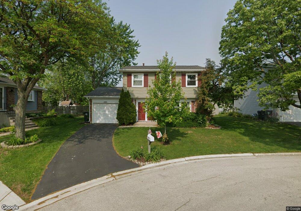
1485 Port Arthur Ct Hoffman Estates, IL 60192
South Ridge NeighborhoodEstimated Value: $359,000 - $449,000
3
Beds
2
Baths
1,801
Sq Ft
$231/Sq Ft
Est. Value
About This Home
This home is located at 1485 Port Arthur Ct, Hoffman Estates, IL 60192 and is currently estimated at $416,026, approximately $230 per square foot. 1485 Port Arthur Ct is a home located in Cook County with nearby schools including Frank C. Whiteley Elementary School, Plum Grove Jr High School, and William Fremd High School.
Ownership History
Date
Name
Owned For
Owner Type
Purchase Details
Closed on
Jan 31, 2023
Sold by
Cotshott Lynne
Bought by
Meschewski Eric J and Meschewski Brittany N
Current Estimated Value
Home Financials for this Owner
Home Financials are based on the most recent Mortgage that was taken out on this home.
Original Mortgage
$297,000
Outstanding Balance
$287,546
Interest Rate
6.25%
Mortgage Type
New Conventional
Estimated Equity
$128,480
Purchase Details
Closed on
Jul 20, 2001
Sold by
Valencia Angela
Bought by
Cotshott Lynne
Home Financials for this Owner
Home Financials are based on the most recent Mortgage that was taken out on this home.
Original Mortgage
$166,450
Interest Rate
7.14%
Mortgage Type
FHA
Purchase Details
Closed on
Jan 26, 2000
Sold by
Holtz Paul W and Holtz Robin
Bought by
Valencia Angela
Home Financials for this Owner
Home Financials are based on the most recent Mortgage that was taken out on this home.
Original Mortgage
$130,500
Interest Rate
10.5%
Create a Home Valuation Report for This Property
The Home Valuation Report is an in-depth analysis detailing your home's value as well as a comparison with similar homes in the area
Home Values in the Area
Average Home Value in this Area
Purchase History
| Date | Buyer | Sale Price | Title Company |
|---|---|---|---|
| Meschewski Eric J | $322,000 | Old Republic National Title | |
| Cotshott Lynne | -- | -- | |
| Valencia Angela | $145,000 | -- |
Source: Public Records
Mortgage History
| Date | Status | Borrower | Loan Amount |
|---|---|---|---|
| Open | Meschewski Eric J | $297,000 | |
| Previous Owner | Cotshott Lynne | $166,450 | |
| Previous Owner | Valencia Angela | $130,500 |
Source: Public Records
Tax History Compared to Growth
Tax History
| Year | Tax Paid | Tax Assessment Tax Assessment Total Assessment is a certain percentage of the fair market value that is determined by local assessors to be the total taxable value of land and additions on the property. | Land | Improvement |
|---|---|---|---|---|
| 2024 | $7,874 | $29,000 | $4,593 | $24,407 |
| 2023 | $7,579 | $29,000 | $4,593 | $24,407 |
| 2022 | $7,579 | $29,000 | $4,593 | $24,407 |
| 2021 | $7,656 | $26,193 | $3,189 | $23,004 |
| 2020 | $7,562 | $26,193 | $3,189 | $23,004 |
| 2019 | $7,485 | $29,039 | $3,189 | $25,850 |
| 2018 | $6,716 | $24,633 | $2,934 | $21,699 |
| 2017 | $6,609 | $24,633 | $2,934 | $21,699 |
| 2016 | $6,388 | $24,633 | $2,934 | $21,699 |
| 2015 | $6,577 | $23,786 | $2,679 | $21,107 |
| 2014 | $6,470 | $23,786 | $2,679 | $21,107 |
| 2013 | $6,589 | $24,799 | $2,679 | $22,120 |
Source: Public Records
Map
Nearby Homes
- 4320 Lombardy Ln
- 1404 W Sapphire Dr
- 4658 Burnham Dr
- 4797 Amber Cir
- 13 Chipping Campden Dr
- 4760 Amber Cir
- 4827 Turnberry Dr
- 3925 Charlemagne Dr
- 4090 N Parkside Dr
- 1195 Old Timber Ct
- 26 Forest Ln
- 3991 Whispering Trails Dr
- 1208 Old Timber Ln
- 4850 Prestwick Place
- 39 Forest Ln
- 4890 Prestwick Place
- 16 Forest Ln
- 4944 Somerton Dr
- 3835 Huntington Blvd
- 3960 Colony Ct
- 1475 Port Arthur Ct
- 1490 Port Arthur Ct
- 1480 Port Arthur Ct
- 1465 Port Arthur Ct
- 1480 Stone Harbor Ct
- 1470 Port Arthur Ct
- 4335 Lombardy Ln
- 4331 Lombardy Ln
- 1470 Stone Harbor Ct
- 1495 Westbury Dr
- 1485 Westbury Dr
- 4370 N Sturbridge Dr
- 4360 N Sturbridge Dr Unit 3
- 1490 Stone Harbor Ct
- 1475 Westbury Dr
- 1460 Stone Harbor Ct
- 4325 Lombardy Ln
- 4380 N Sturbridge Dr
- 1465 Westbury Dr
- 1495 Stone Harbor Ct