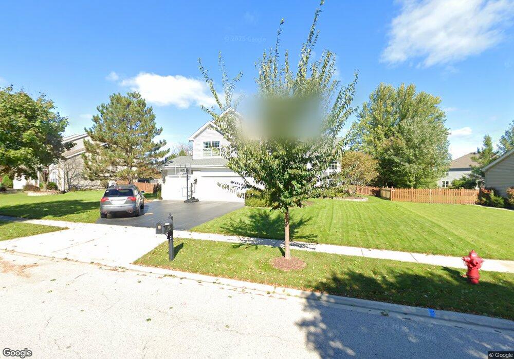
1489 Anvil Ct Bartlett, IL 60103
South Tri Village NeighborhoodEstimated Value: $514,719 - $615,000
4
Beds
3
Baths
2,503
Sq Ft
$228/Sq Ft
Est. Value
About This Home
This home is located at 1489 Anvil Ct, Bartlett, IL 60103 and is currently estimated at $571,930, approximately $228 per square foot. 1489 Anvil Ct is a home located in DuPage County with nearby schools including Wayne Elementary School, Kenyon Woods Middle School, and South Elgin High School.
Ownership History
Date
Name
Owned For
Owner Type
Purchase Details
Closed on
Jul 25, 2023
Sold by
Burns Stephen T and Burns Lori A
Bought by
Stephen T Burns And Lori A Burns Trust and Burns
Current Estimated Value
Purchase Details
Closed on
Dec 10, 1996
Sold by
American National Bk & Tr Co Of Chicago
Bought by
Burns Stephen T and Burns Lori A
Home Financials for this Owner
Home Financials are based on the most recent Mortgage that was taken out on this home.
Original Mortgage
$200,000
Interest Rate
7.6%
Mortgage Type
Balloon
Create a Home Valuation Report for This Property
The Home Valuation Report is an in-depth analysis detailing your home's value as well as a comparison with similar homes in the area
Home Values in the Area
Average Home Value in this Area
Purchase History
| Date | Buyer | Sale Price | Title Company |
|---|---|---|---|
| Stephen T Burns And Lori A Burns Trust | -- | None Listed On Document | |
| Burns Stephen T | $266,500 | -- |
Source: Public Records
Mortgage History
| Date | Status | Borrower | Loan Amount |
|---|---|---|---|
| Previous Owner | Burns Stephen T | $200,000 |
Source: Public Records
Tax History
| Year | Tax Paid | Tax Assessment Tax Assessment Total Assessment is a certain percentage of the fair market value that is determined by local assessors to be the total taxable value of land and additions on the property. | Land | Improvement |
|---|---|---|---|---|
| 2024 | $12,155 | $158,331 | $39,404 | $118,927 |
| 2023 | $11,179 | $143,650 | $35,750 | $107,900 |
| 2022 | $10,886 | $130,580 | $33,220 | $97,360 |
| 2021 | $10,581 | $123,960 | $31,540 | $92,420 |
| 2020 | $11,032 | $128,030 | $30,590 | $97,440 |
| 2019 | $10,889 | $123,460 | $29,500 | $93,960 |
| 2018 | $11,072 | $121,790 | $29,100 | $92,690 |
| 2017 | $10,764 | $116,940 | $27,940 | $89,000 |
| 2016 | $10,563 | $111,700 | $26,690 | $85,010 |
| 2015 | $10,550 | $105,730 | $25,260 | $80,470 |
| 2014 | $9,644 | $101,340 | $27,350 | $73,990 |
| 2013 | $11,569 | $103,760 | $28,000 | $75,760 |
Source: Public Records
Map
Nearby Homes
- 1432 Steeplechase Rd
- 1267 Appaloosa Way
- 1411 Steeplechase Rd
- 1301 Filly Ln
- 1575 Old Forge Rd
- 30W030 Schick Rd
- 1489 Polo Ct
- 31W141 Army Trail Rd
- 968 Hyacynth Ln
- 4N707 White Oak Ln
- 29W725 Army Trail Rd
- 1015 Confederation Dr
- 1024 Confederation Dr
- 1190 Buttercup Ln
- 812 W Appletree Ln
- 776 W Appletree Ln Unit 4
- 1221 Driftwood Ln
- 4N446 Mountain Ash Dr
- 1074 - 1078 Sante Fe Stre St
- 30W440 Whitney Rd
- 1485 Anvil Ct
- 1493 Anvil Ct
- 1469 Anvil Ct
- 1490 Anvil Ct
- 1488 Anvil Ct
- 1475 Anvil Ct
- 1486 Anvil Ct
- 1459 Anvil Ct
- 1465 Anvil Ct
- 1492 Anvil Ct
- 1455 Anvil Ct
- 1461 Anvil Ct
- 1494 Anvil Ct
- 1494 Anvil Ct Unit 10
- 1496 Anvil Ct
- 1498 Anvil Ct
- 1480 Anvil Ct Unit 10
- 1470 Anvil Ct
- 1468 Anvil Ct Unit 10
- 1472 Anvil Ct
Your Personal Tour Guide
Ask me questions while you tour the home.