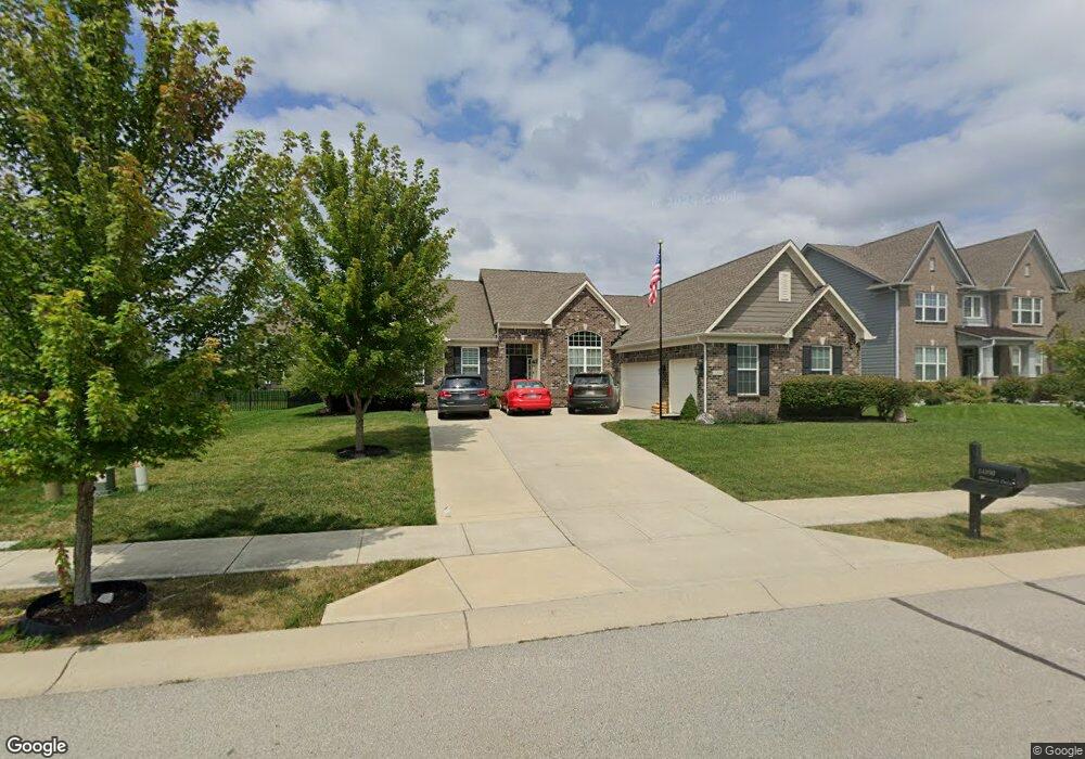
14890 Dennison Dr Fishers, IN 46037
Estimated Value: $536,000 - $656,000
4
Beds
3
Baths
2,523
Sq Ft
$238/Sq Ft
Est. Value
About This Home
This home is located at 14890 Dennison Dr, Fishers, IN 46037 and is currently estimated at $599,996, approximately $237 per square foot. 14890 Dennison Dr is a home with nearby schools including Overland Park Elementary School, Southeastern Elementary School, and Hamilton Southeastern Intermediate / Junior High.
Ownership History
Date
Name
Owned For
Owner Type
Purchase Details
Closed on
Apr 28, 2014
Sold by
Rh Of Indiana Lp
Bought by
Harris James R and Harris Amy L
Current Estimated Value
Home Financials for this Owner
Home Financials are based on the most recent Mortgage that was taken out on this home.
Original Mortgage
$294,540
Outstanding Balance
$225,144
Interest Rate
4.41%
Mortgage Type
New Conventional
Estimated Equity
$374,852
Purchase Details
Closed on
Nov 25, 2013
Sold by
Saratoga Development Llc
Bought by
Rh Of Indiana Lp
Create a Home Valuation Report for This Property
The Home Valuation Report is an in-depth analysis detailing your home's value as well as a comparison with similar homes in the area
Home Values in the Area
Average Home Value in this Area
Purchase History
| Date | Buyer | Sale Price | Title Company |
|---|---|---|---|
| Harris James R | -- | None Available | |
| Rh Of Indiana Lp | -- | None Available |
Source: Public Records
Mortgage History
| Date | Status | Borrower | Loan Amount |
|---|---|---|---|
| Open | Harris James R | $294,540 |
Source: Public Records
Tax History Compared to Growth
Tax History
| Year | Tax Paid | Tax Assessment Tax Assessment Total Assessment is a certain percentage of the fair market value that is determined by local assessors to be the total taxable value of land and additions on the property. | Land | Improvement |
|---|---|---|---|---|
| 2024 | $5,893 | $527,400 | $71,700 | $455,700 |
| 2023 | $5,893 | $508,900 | $71,700 | $437,200 |
| 2022 | $5,405 | $449,000 | $71,700 | $377,300 |
| 2021 | $4,796 | $399,000 | $71,700 | $327,300 |
| 2020 | $4,698 | $386,800 | $71,700 | $315,100 |
| 2019 | $4,699 | $386,900 | $68,500 | $318,400 |
| 2018 | $4,753 | $390,200 | $68,500 | $321,700 |
| 2017 | $4,601 | $384,300 | $68,500 | $315,800 |
| 2016 | $4,578 | $382,600 | $68,500 | $314,100 |
| 2014 | $1,710 | $172,900 | $68,500 | $104,400 |
Source: Public Records
Map
Nearby Homes
- 15063 Mancroft Dr
- 14790 E 136th St
- 0 E 136th St Unit MBR22040185
- 15311 Forest Glade Dr
- 15104 Downham Dr
- 13538 Longrise Ln
- 15175 Swallow Falls Way
- 15163 Farrington Way
- 15472 Cardonia Rd
- 15131 Farrington Way
- 15198 Swallow Falls Way
- 15464 Cardonia Rd
- 15147 Farrington Way
- 15444 Postman Rd
- Springfield Plan at Abbott Commons - Heritage
- 15511 Postman Rd
- 15363 Alperton Rd
- Kingston Plan at Abbott Commons - Venture
- Chartwell Plan at Abbott Commons - Heritage
- Davidson Plan at Abbott Commons - Venture
- 14898 Dennison Dr
- 14882 Dennison Dr
- 14953 Mancroft Dr
- 14943 Mancroft Dr
- 14889 Dennison Dr
- 14906 Dennison Dr
- 14881 Dennison Dr
- 14973 Mancroft Dr
- 14897 Dennison Dr
- 14873 Dennison Dr
- 14914 Dennison Dr
- 14983 Mancroft Dr
- 14905 Dennison Dr
- 13470 Moorcroft Dr
- 14993 Mancroft Dr
- 14913 Dennison Dr
- 14910 Bonner Cir
- 14942 Bonner Cir
- 13471 Mancroft Dr
- 14922 Dennison Dr