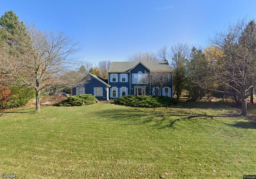
1490 Spring Hill Dr Algonquin, IL 60102
Estimated Value: $446,955 - $498,000
4
Beds
--
Bath
2,602
Sq Ft
$185/Sq Ft
Est. Value
About This Home
This home is located at 1490 Spring Hill Dr, Algonquin, IL 60102 and is currently estimated at $482,239, approximately $185 per square foot. 1490 Spring Hill Dr is a home located in Kane County with nearby schools including Westfield Community School, Kenneth E Neubert Elementary School, and Harry D Jacobs High School.
Ownership History
Date
Name
Owned For
Owner Type
Purchase Details
Closed on
Apr 19, 2003
Sold by
Mckirahan Mark
Bought by
Lasalle Bank Na and Trust #131124
Current Estimated Value
Purchase Details
Closed on
May 14, 1996
Sold by
Mckirahan Robin D
Bought by
Mckirahan Mark C
Purchase Details
Closed on
Nov 22, 1995
Sold by
Quilty John M and Quilty Debbie A
Bought by
Mckirahan Mark C and Mckirahan Robin D
Home Financials for this Owner
Home Financials are based on the most recent Mortgage that was taken out on this home.
Original Mortgage
$203,150
Interest Rate
7.45%
Create a Home Valuation Report for This Property
The Home Valuation Report is an in-depth analysis detailing your home's value as well as a comparison with similar homes in the area
Purchase History
| Date | Buyer | Sale Price | Title Company |
|---|---|---|---|
| Lasalle Bank Na | -- | -- | |
| Mckirahan Mark C | -- | Chicago Title Insurance Co | |
| Mckirahan Mark C | $258,500 | First American Title |
Source: Public Records
Mortgage History
| Date | Status | Borrower | Loan Amount |
|---|---|---|---|
| Previous Owner | Mckirahan Mark C | $203,150 |
Source: Public Records
Tax History
| Year | Tax Paid | Tax Assessment Tax Assessment Total Assessment is a certain percentage of the fair market value that is determined by local assessors to be the total taxable value of land and additions on the property. | Land | Improvement |
|---|---|---|---|---|
| 2024 | $9,703 | $135,617 | $25,228 | $110,389 |
| 2023 | $9,280 | $122,023 | $22,699 | $99,324 |
| 2022 | $8,728 | $110,433 | $22,699 | $87,734 |
| 2021 | $8,474 | $104,270 | $21,432 | $82,838 |
| 2020 | $8,310 | $101,926 | $20,950 | $80,976 |
| 2019 | $8,652 | $103,443 | $19,888 | $83,555 |
| 2018 | $8,528 | $98,496 | $26,182 | $72,314 |
| 2017 | $8,189 | $92,138 | $24,492 | $67,646 |
| 2016 | $8,402 | $89,212 | $23,714 | $65,498 |
| 2015 | -- | $83,595 | $22,221 | $61,374 |
| 2014 | -- | $76,178 | $21,607 | $54,571 |
| 2013 | -- | $78,509 | $22,268 | $56,241 |
Source: Public Records
Map
Nearby Homes
- SWC Talaga and Algonquin Rd
- 1002 Interloch Ct Unit 152
- 1850 White Oak Dr
- 1621 Glengarry Ct Unit 131
- 18 Peach Tree Ct Unit 4154
- 2051 Carlisle St
- 1900 Waverly Ln
- 2054 Peach Tree Ln Unit 4171
- 2069 Peach Tree Ln Unit 4116
- 2161 Burnham Ct
- 1530 Westbourne Pkwy
- 1540 Westbourne Pkwy
- 1460 Lancaster Ln
- 1030 Glenmont St
- 2224 Barrett Dr
- 1200 Hillside View
- 615 Harper Dr
- 301 Cold Spring St
- 1000 Glenmont St
- 681 Majestic Dr
- 1480 Spring Hill Dr
- 1450 Gaslight Dr
- 1499 Hanson Rd
- 1440 Gaslight Dr
- 1499 Spring Hill Dr
- 1430 Gaslight Dr
- 12070 Hanson Rd
- 1455 Gaslight Dr
- 1495 Spring Hill Dr
- 1420 Gaslight Dr
- 1445 Gaslight Dr
- 1435 Gaslight Dr
- 1601 Kensington Dr
- 12079 Kingston Place
- 1611 Kensington Dr
- 1460 Spring Hill Dr
- 1485 Spring Hill Dr
- 1410 Gaslight Dr
- 12043 Kingston Place
- 12014 Hanson Rd
Your Personal Tour Guide
Ask me questions while you tour the home.