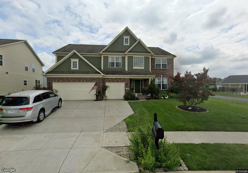
14943 Mancroft Dr Fishers, IN 46037
Estimated Value: $575,000 - $653,000
4
Beds
4
Baths
3,974
Sq Ft
$153/Sq Ft
Est. Value
About This Home
This home is located at 14943 Mancroft Dr, Fishers, IN 46037 and is currently estimated at $607,667, approximately $152 per square foot. 14943 Mancroft Dr is a home with nearby schools including Overland Park Elementary School, Southeastern Elementary School, and Hamilton Southeastern Intermediate / Junior High.
Ownership History
Date
Name
Owned For
Owner Type
Purchase Details
Closed on
Jun 13, 2014
Sold by
Rh Of Indiana Lp
Bought by
Webner Peter Joachim and Webner Sondra Ann
Current Estimated Value
Home Financials for this Owner
Home Financials are based on the most recent Mortgage that was taken out on this home.
Original Mortgage
$365,394
Outstanding Balance
$276,084
Interest Rate
4.18%
Mortgage Type
New Conventional
Estimated Equity
$331,583
Purchase Details
Closed on
Dec 9, 2013
Sold by
Saratoga Developments Llc
Bought by
Rh Of Indiana Lp
Create a Home Valuation Report for This Property
The Home Valuation Report is an in-depth analysis detailing your home's value as well as a comparison with similar homes in the area
Home Values in the Area
Average Home Value in this Area
Purchase History
| Date | Buyer | Sale Price | Title Company |
|---|---|---|---|
| Webner Peter Joachim | -- | None Available | |
| Rh Of Indiana Lp | -- | None Available |
Source: Public Records
Mortgage History
| Date | Status | Borrower | Loan Amount |
|---|---|---|---|
| Open | Webner Peter Joachim | $365,394 |
Source: Public Records
Tax History Compared to Growth
Tax History
| Year | Tax Paid | Tax Assessment Tax Assessment Total Assessment is a certain percentage of the fair market value that is determined by local assessors to be the total taxable value of land and additions on the property. | Land | Improvement |
|---|---|---|---|---|
| 2024 | $6,127 | $527,900 | $71,000 | $456,900 |
| 2023 | $5,897 | $509,200 | $71,000 | $438,200 |
| 2022 | $5,398 | $449,200 | $71,000 | $378,200 |
| 2021 | $4,791 | $398,600 | $71,000 | $327,600 |
| 2020 | $4,692 | $386,300 | $71,000 | $315,300 |
| 2019 | $4,693 | $386,400 | $67,800 | $318,600 |
| 2018 | $4,706 | $386,400 | $67,800 | $318,600 |
| 2017 | $4,457 | $372,400 | $67,800 | $304,600 |
| 2016 | $4,510 | $377,000 | $67,800 | $309,200 |
| 2014 | $1,383 | $67,800 | $67,800 | $0 |
Source: Public Records
Map
Nearby Homes
- 15063 Mancroft Dr
- 14790 E 136th St
- 0 E 136th St Unit MBR22040185
- 15311 Forest Glade Dr
- 15104 Downham Dr
- 13538 Longrise Ln
- 15175 Swallow Falls Way
- 15163 Farrington Way
- 15472 Cardonia Rd
- 15131 Farrington Way
- 15198 Swallow Falls Way
- 15464 Cardonia Rd
- 15147 Farrington Way
- 15444 Postman Rd
- Springfield Plan at Abbott Commons - Heritage
- 15511 Postman Rd
- 15363 Alperton Rd
- Kingston Plan at Abbott Commons - Venture
- Chartwell Plan at Abbott Commons - Heritage
- Davidson Plan at Abbott Commons - Venture
- 14953 Mancroft Dr
- 14890 Dennison Dr
- 14882 Dennison Dr
- 13470 Moorcroft Dr
- 13471 Mancroft Dr
- 14898 Dennison Dr
- 14973 Mancroft Dr
- 13470 Mancroft Dr
- 13482 Moorcroft Dr
- 14906 Dennison Dr
- 14983 Mancroft Dr
- 14889 Dennison Dr
- 14984 Mancroft Dr
- 13484 Mancroft Dr
- 14881 Dennison Dr
- 14873 Dennison Dr
- 14993 Mancroft Dr
- 14897 Dennison Dr
- 13499 Mancroft Dr
- 14914 Dennison Dr