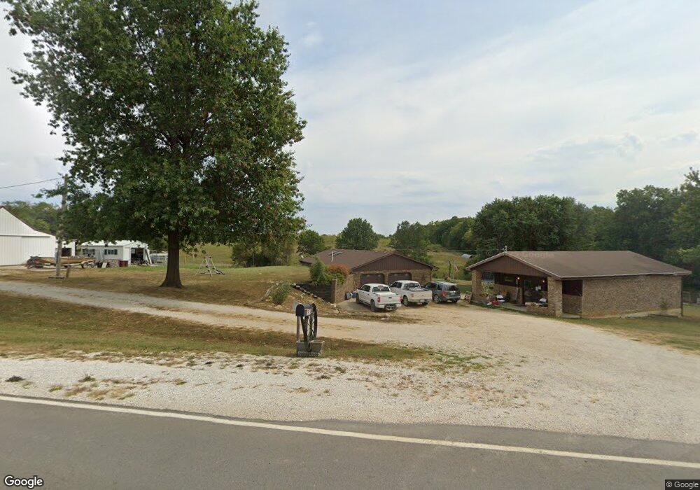
14978 State Highway C Huntsville, MO 65259
Estimated Value: $167,000 - $292,340
2
Beds
2
Baths
1,400
Sq Ft
$181/Sq Ft
Est. Value
About This Home
This home is located at 14978 State Highway C, Huntsville, MO 65259 and is currently estimated at $253,335, approximately $180 per square foot. 14978 State Highway C is a home located in Randolph County with nearby schools including Westran Elementary School, Westran Middle School, and Westran High School.
Ownership History
Date
Name
Owned For
Owner Type
Purchase Details
Closed on
May 14, 2021
Sold by
Avila Michelle
Bought by
Avila William
Current Estimated Value
Purchase Details
Closed on
Aug 23, 2017
Sold by
Perry Lisa
Bought by
Redhead Properties Llc
Purchase Details
Closed on
Aug 3, 2017
Sold by
Maddox Angela
Bought by
Avila Michelle L and Avila William D
Purchase Details
Closed on
Sep 25, 2014
Sold by
Alfred Henry Alfred Henry and Wienhaus Marilyn Rose
Bought by
Wienhaus Michael A and Wienhaus Ashley M
Create a Home Valuation Report for This Property
The Home Valuation Report is an in-depth analysis detailing your home's value as well as a comparison with similar homes in the area
Home Values in the Area
Average Home Value in this Area
Purchase History
| Date | Buyer | Sale Price | Title Company |
|---|---|---|---|
| Avila William | -- | None Available | |
| Redhead Properties Llc | -- | None Available | |
| Avila Michelle L | -- | None Available | |
| Wienhaus Michael A | -- | -- |
Source: Public Records
Tax History Compared to Growth
Tax History
| Year | Tax Paid | Tax Assessment Tax Assessment Total Assessment is a certain percentage of the fair market value that is determined by local assessors to be the total taxable value of land and additions on the property. | Land | Improvement |
|---|---|---|---|---|
| 2025 | $1,453 | $33,910 | $2,622 | $31,288 |
| 2024 | $1,453 | $29,510 | $2,280 | $27,230 |
| 2023 | $1,477 | $29,510 | $2,280 | $27,230 |
| 2022 | $1,413 | $28,410 | $2,280 | $26,130 |
| 2021 | $1,418 | $28,500 | $2,280 | $26,220 |
| 2020 | $1,418 | $28,500 | $2,280 | $26,220 |
| 2019 | $1,512 | $30,330 | $2,280 | $28,050 |
| 2018 | $1,513 | $30,250 | $2,280 | $27,970 |
| 2017 | $1,514 | $30,250 | $0 | $0 |
| 2016 | $1,452 | $29,050 | $0 | $0 |
| 2014 | -- | $27,030 | $0 | $0 |
| 2013 | -- | $27,030 | $0 | $0 |
Source: Public Records
Map
Nearby Homes
- 0 State Highway T
- 23393 Gazelle St
- 23245 Gazelle St
- 28156 State Highway T
- 28730 State Highway T
- 201 S Lake Cir
- 30663 E Press St
- 181 E Randolph St
- 0 County Road 1270
- 35581 Hwy Y
- 0 Hwy Z Hwy Unit HMS2549151
- 2399 Highway Z
- 0 County Road 1265
- 2546 County Road 1265
- 3078 County Road 1265
- 1533 County Road 1265
- 2898 County Road 1265
- 2145 County Road 1265
- 34648 U S 63
- 1533 County Road 1268