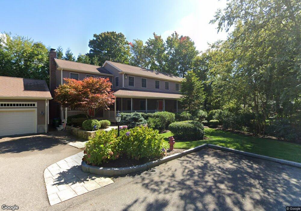
15 Atkinson St Newton Lower Falls, MA 02462
Newton Lower Falls NeighborhoodEstimated Value: $2,014,000 - $2,342,000
4
Beds
4
Baths
3,328
Sq Ft
$651/Sq Ft
Est. Value
About This Home
This home is located at 15 Atkinson St, Newton Lower Falls, MA 02462 and is currently estimated at $2,166,399, approximately $650 per square foot. 15 Atkinson St is a home located in Middlesex County with nearby schools including Angier Elementary School, Charles E Brown Middle School, and Newton South High School.
Create a Home Valuation Report for This Property
The Home Valuation Report is an in-depth analysis detailing your home's value as well as a comparison with similar homes in the area
Home Values in the Area
Average Home Value in this Area
Tax History Compared to Growth
Tax History
| Year | Tax Paid | Tax Assessment Tax Assessment Total Assessment is a certain percentage of the fair market value that is determined by local assessors to be the total taxable value of land and additions on the property. | Land | Improvement |
|---|---|---|---|---|
| 2025 | $18,934 | $1,932,000 | $829,800 | $1,102,200 |
| 2024 | $18,307 | $1,875,700 | $805,600 | $1,070,100 |
| 2023 | $17,849 | $1,753,300 | $622,200 | $1,131,100 |
| 2022 | $17,078 | $1,623,400 | $576,100 | $1,047,300 |
| 2021 | $16,479 | $1,531,500 | $543,500 | $988,000 |
| 2020 | $15,989 | $1,531,500 | $543,500 | $988,000 |
| 2019 | $15,538 | $1,486,900 | $527,700 | $959,200 |
| 2018 | $15,060 | $1,391,900 | $474,000 | $917,900 |
| 2017 | $14,602 | $1,313,100 | $447,200 | $865,900 |
| 2016 | $13,966 | $1,227,200 | $417,900 | $809,300 |
| 2015 | $13,316 | $1,146,900 | $390,600 | $756,300 |
Source: Public Records
Map
Nearby Homes
- 45 Moulton St
- 25 Columbia St
- 17 Deforest Rd
- 7 Crescent St
- 2084 Washington St
- 45 E Quinobequin Rd
- 34 Palmer Rd
- 2 Longfellow Rd
- 8 Old Town Rd
- 12 Bird Hill Ave
- 10 Bird Hill Ave
- 177 Varick Rd
- 27 Oakwood Rd
- 135 Orchard Ave
- 41 Orchard Ave
- 10 Lorraine Cir
- 20 Oakland Street Front
- 54 Colburn Rd
- 33 Metacomet Rd
- 17 Lasell St
- 73 Cornell St
- 63 Cornell St
- 14 Swallow Dr
- 20 Swallow Dr
- 8 Swallow Dr
- 59 Cornell St Unit 61
- 18 Baker Place
- 18 Baker Place Unit 1
- 10 Baker Place
- 26 Swallow Dr
- 77 Cornell St
- 30 Baker Place
- 30 Baker Place Unit 30
- 0 Atkinson St
- 4 Neal St
- 85 Cornell St
- 9 Swallow Dr
- 32 Swallow Dr
- 19 Swallow Dr
- 5 Baker Place