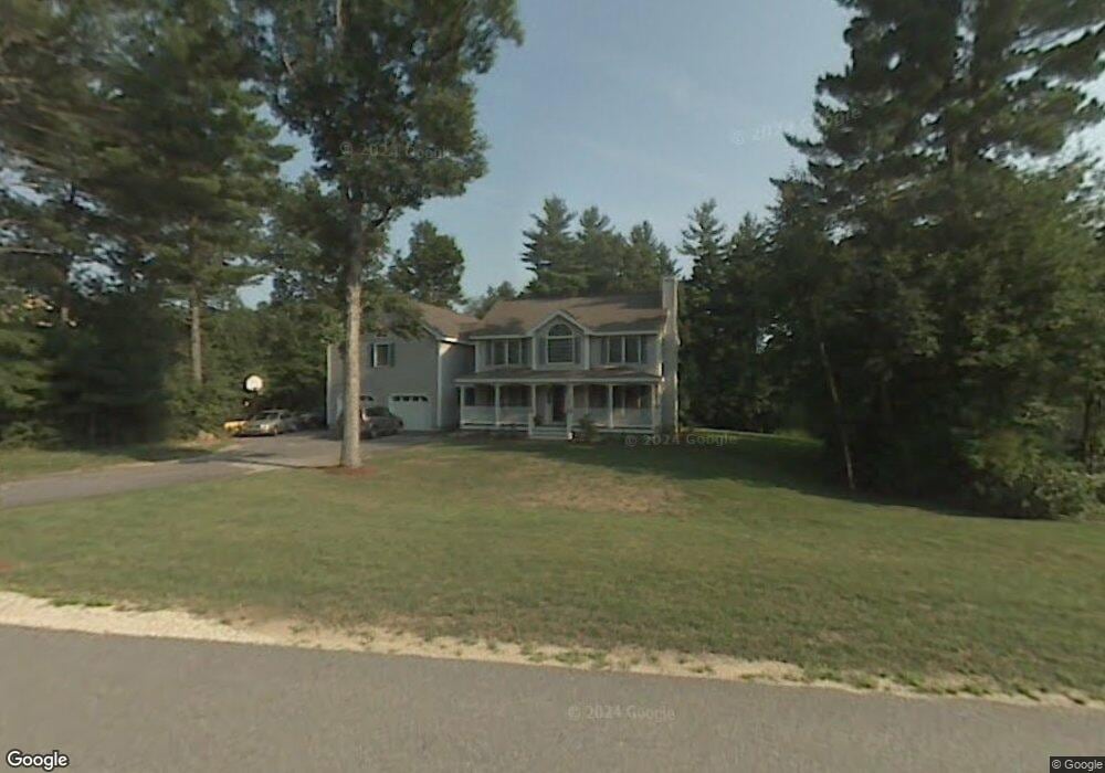
15 Burgess St Litchfield, NH 03052
Estimated Value: $698,000 - $864,000
3
Beds
2
Baths
3,305
Sq Ft
$236/Sq Ft
Est. Value
About This Home
This home is located at 15 Burgess St, Litchfield, NH 03052 and is currently estimated at $779,293, approximately $235 per square foot. 15 Burgess St is a home with nearby schools including Griffin Memorial School, Litchfield Middle School, and Campbell High School.
Ownership History
Date
Name
Owned For
Owner Type
Purchase Details
Closed on
Jun 29, 2021
Sold by
Rosa Anthony J
Bought by
Keohane Julie and Keohane Patrick E
Current Estimated Value
Home Financials for this Owner
Home Financials are based on the most recent Mortgage that was taken out on this home.
Original Mortgage
$360,000
Outstanding Balance
$326,644
Interest Rate
2.9%
Mortgage Type
Purchase Money Mortgage
Estimated Equity
$452,649
Purchase Details
Closed on
Jan 31, 2017
Sold by
Stapf Joanne and Rosa Anthony J
Bought by
Rosa Anthony J
Purchase Details
Closed on
Apr 19, 2013
Sold by
Rosa Anthony J
Bought by
Stapf Joanne and Rosa Anthony J
Home Financials for this Owner
Home Financials are based on the most recent Mortgage that was taken out on this home.
Original Mortgage
$280,900
Interest Rate
3.52%
Mortgage Type
Purchase Money Mortgage
Create a Home Valuation Report for This Property
The Home Valuation Report is an in-depth analysis detailing your home's value as well as a comparison with similar homes in the area
Home Values in the Area
Average Home Value in this Area
Purchase History
| Date | Buyer | Sale Price | Title Company |
|---|---|---|---|
| Keohane Julie | $510,000 | None Available | |
| Rosa Anthony J | -- | -- | |
| Stapf Joanne | -- | -- |
Source: Public Records
Mortgage History
| Date | Status | Borrower | Loan Amount |
|---|---|---|---|
| Open | Keohane Julie | $360,000 | |
| Previous Owner | Stapf Joanne | $280,900 |
Source: Public Records
Tax History Compared to Growth
Tax History
| Year | Tax Paid | Tax Assessment Tax Assessment Total Assessment is a certain percentage of the fair market value that is determined by local assessors to be the total taxable value of land and additions on the property. | Land | Improvement |
|---|---|---|---|---|
| 2024 | $10,238 | $492,700 | $178,200 | $314,500 |
| 2023 | $10,317 | $492,700 | $178,200 | $314,500 |
| 2022 | $9,376 | $492,700 | $178,200 | $314,500 |
| 2021 | $9,085 | $492,700 | $178,200 | $314,500 |
| 2020 | $9,149 | $492,400 | $178,200 | $314,200 |
| 2019 | $9,171 | $387,800 | $142,400 | $245,400 |
| 2017 | $8,780 | $390,400 | $142,400 | $248,000 |
| 2016 | $8,433 | $390,400 | $142,400 | $248,000 |
| 2015 | $7,956 | $390,400 | $142,400 | $248,000 |
| 2014 | $7,620 | $368,100 | $133,300 | $234,800 |
| 2013 | $7,578 | $368,400 | $133,300 | $235,100 |
Source: Public Records
Map
Nearby Homes
- 41 Century Ln
- 25 Chatfield Dr
- 1 Morrill St
- 0 Tallarico St Unit Lot 11 5056385
- 0 Tallarico St Unit 10 5044310
- 0 Tallarico St Unit 25 5043170
- 0 Tallarico St Unit 5041169
- 0 Tallarico St Unit 12 5033131
- 0 Tallarico St Unit 5 5032751
- 0 Tallarico St Unit 3 5032471
- 1 Tallarico St Unit 8
- 1 Tallarico St Unit 14
- 26 Moose Hollow Rd
- 34 Moose Hollow Rd
- 13 Moose Hollow Rd
- 490 Charles Bancroft Hwy
- 29 Rolling Ridge Rd
- 15 Alan Cir
- 24 Windsor Dr Unit 10
- 27 Windsor Dr Unit A