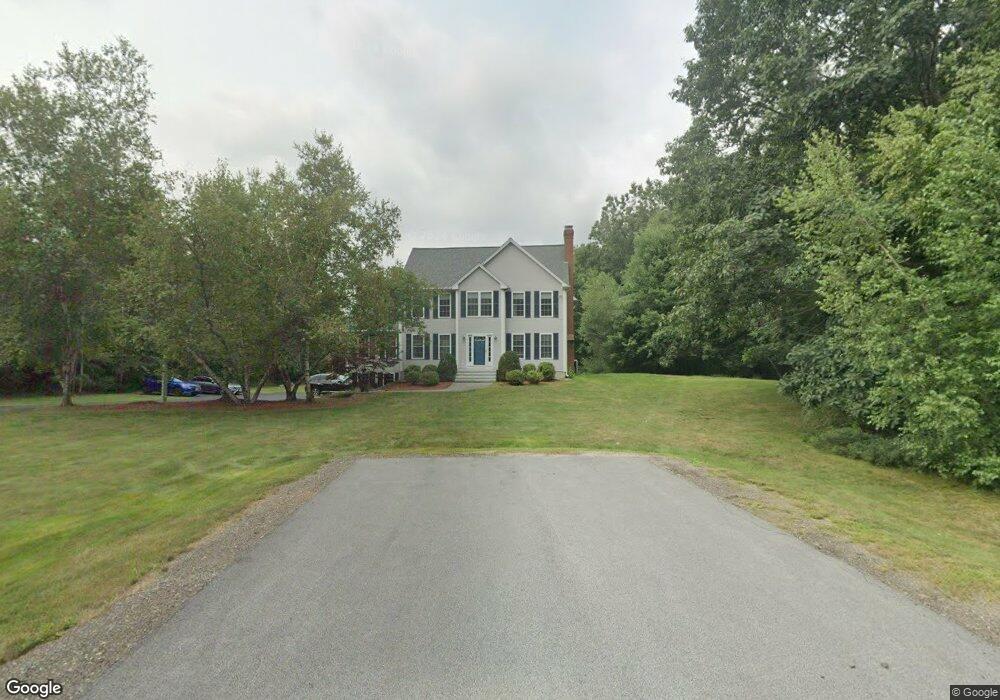
15 Christie Ln Stratham, NH 03885
Estimated Value: $1,114,000 - $1,427,000
4
Beds
3
Baths
3,658
Sq Ft
$351/Sq Ft
Est. Value
About This Home
This home is located at 15 Christie Ln, Stratham, NH 03885 and is currently estimated at $1,285,355, approximately $351 per square foot. 15 Christie Ln is a home located in Rockingham County with nearby schools including Stratham Memorial School, Cooperative Middle School, and Exeter High School.
Ownership History
Date
Name
Owned For
Owner Type
Purchase Details
Closed on
Jan 25, 2016
Sold by
Sapcoe Mark
Bought by
Sapcoe Ft and Sapcoe Mark
Current Estimated Value
Create a Home Valuation Report for This Property
The Home Valuation Report is an in-depth analysis detailing your home's value as well as a comparison with similar homes in the area
Home Values in the Area
Average Home Value in this Area
Purchase History
| Date | Buyer | Sale Price | Title Company |
|---|---|---|---|
| Sapcoe Ft | -- | -- |
Source: Public Records
Tax History Compared to Growth
Tax History
| Year | Tax Paid | Tax Assessment Tax Assessment Total Assessment is a certain percentage of the fair market value that is determined by local assessors to be the total taxable value of land and additions on the property. | Land | Improvement |
|---|---|---|---|---|
| 2024 | $13,372 | $1,019,200 | $430,200 | $589,000 |
| 2023 | $13,299 | $636,000 | $221,100 | $414,900 |
| 2022 | $11,774 | $629,300 | $221,100 | $408,200 |
| 2021 | $11,655 | $629,300 | $221,100 | $408,200 |
| 2020 | $11,895 | $627,700 | $221,100 | $406,600 |
| 2019 | $11,694 | $627,700 | $221,100 | $406,600 |
| 2018 | $11,466 | $546,000 | $180,600 | $365,400 |
| 2017 | $6,796 | $532,000 | $180,600 | $351,400 |
| 2016 | $10,622 | $520,700 | $180,600 | $340,100 |
| 2015 | $10,362 | $520,700 | $180,600 | $340,100 |
| 2014 | $10,367 | $520,700 | $180,600 | $340,100 |
| 2013 | $10,253 | $521,800 | $180,600 | $341,200 |
Source: Public Records
Map
Nearby Homes
- 177 Winnicutt Rd
- 8 Winterberry Ln
- Homesite 4 Windsong Place
- Homesite 1 Windsong Place
- 91 Lovering Rd
- 133R Stratham Heights Rd
- 18 Treat Farm Rd
- 16 Parkman Brook Ln
- 36 Winnicut Rd Unit 2
- 50 Thornhill Rd
- 44 High St
- 00 Scamman Rd
- 14 Balmoral Dr
- 31 Pinewood Dr
- 2 Sterling Hill Ln Unit 211
- 1 Sterling Hill Ln Unit 116
- 638 Post Rd
- 5 Sterling Hill Ln Unit 531
- 5 Sterling Hill Ln Unit 514
- 5 Sterling Hill Ln Unit 545