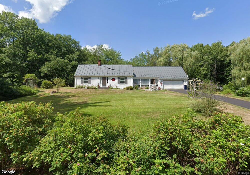
15 Ferry Ln Biddeford, ME 04005
South Biddeford NeighborhoodEstimated Value: $419,218 - $893,000
2
Beds
1
Bath
1,344
Sq Ft
$441/Sq Ft
Est. Value
About This Home
This home is located at 15 Ferry Ln, Biddeford, ME 04005 and is currently estimated at $593,055, approximately $441 per square foot. 15 Ferry Ln is a home located in York County with nearby schools including John F Kennedy Memorial School, Biddeford Primary School, and Biddeford Intermediate School.
Ownership History
Date
Name
Owned For
Owner Type
Purchase Details
Closed on
Jan 9, 2014
Sold by
Woodman Norman and Bartlett Cynthia W
Bought by
Kelley Sue E and Woodman Norman
Current Estimated Value
Purchase Details
Closed on
Dec 20, 2013
Sold by
Norman Woodman Ret and Woodman
Bought by
Kelley Sue E and Woodman Norman
Purchase Details
Closed on
Oct 2, 2012
Sold by
Norman Woodman Ret and Woodman
Bought by
Woodman-Bartlett Cynthia and Woodman Norman
Purchase Details
Closed on
Jan 8, 2010
Sold by
Woodman Donna L and Howard Sharlene
Bought by
Woodman Norman Ret
Create a Home Valuation Report for This Property
The Home Valuation Report is an in-depth analysis detailing your home's value as well as a comparison with similar homes in the area
Home Values in the Area
Average Home Value in this Area
Purchase History
| Date | Buyer | Sale Price | Title Company |
|---|---|---|---|
| Kelley Sue E | -- | -- | |
| Kelley Sue E | -- | -- | |
| Kelley Sue E | -- | -- | |
| Woodman Norman | -- | -- | |
| Kelley Sue E | -- | -- | |
| Woodman-Bartlett Cynthia | -- | -- | |
| Woodman-Bartlett Cynthia | -- | -- | |
| Woodman Norman Ret | -- | -- | |
| Woodman Norman Ret | -- | -- |
Source: Public Records
Tax History Compared to Growth
Tax History
| Year | Tax Paid | Tax Assessment Tax Assessment Total Assessment is a certain percentage of the fair market value that is determined by local assessors to be the total taxable value of land and additions on the property. | Land | Improvement |
|---|---|---|---|---|
| 2024 | $5,040 | $354,400 | $192,600 | $161,800 |
| 2023 | $4,609 | $351,300 | $189,500 | $161,800 |
| 2022 | $4,445 | $270,900 | $132,400 | $138,500 |
| 2021 | $4,184 | $229,500 | $114,000 | $115,500 |
| 2020 | $4,134 | $206,200 | $100,900 | $105,300 |
| 2019 | $4,120 | $206,200 | $100,900 | $105,300 |
| 2018 | $5,223 | $206,200 | $100,900 | $105,300 |
| 2017 | $4,062 | $202,400 | $100,900 | $101,500 |
| 2016 | $4,020 | $202,400 | $100,900 | $101,500 |
| 2015 | $3,941 | $202,400 | $100,900 | $101,500 |
| 2014 | $3,897 | $238,400 | $103,700 | $134,700 |
| 2013 | -- | $444,800 | $336,700 | $108,100 |
Source: Public Records
Map
Nearby Homes