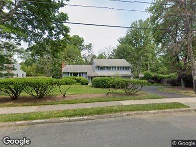
15 Linwood Cir Princeton, NJ 08540
Princeton North NeighborhoodEstimated Value: $1,304,692 - $1,615,000
--
Bed
--
Bath
2,360
Sq Ft
$600/Sq Ft
Est. Value
About This Home
This home is located at 15 Linwood Cir, Princeton, NJ 08540 and is currently estimated at $1,417,173, approximately $600 per square foot. 15 Linwood Cir is a home located in Mercer County with nearby schools including Littlebrook Elementary School, Princeton Middle School, and Princeton High School.
Ownership History
Date
Name
Owned For
Owner Type
Purchase Details
Closed on
Oct 13, 2021
Sold by
Miller Bruce P and Miller Margaret R
Bought by
Defoe Claire M and Miller Peter Conroy
Current Estimated Value
Home Financials for this Owner
Home Financials are based on the most recent Mortgage that was taken out on this home.
Interest Rate
2.99%
Purchase Details
Closed on
Sep 27, 2021
Sold by
Miller Bruce P and Miller Margaret R
Bought by
Defoe Claire M and Miller Peter Conroy
Home Financials for this Owner
Home Financials are based on the most recent Mortgage that was taken out on this home.
Interest Rate
2.99%
Purchase Details
Closed on
Sep 26, 1988
Bought by
Miller Bruce P and Miller Margaret R
Create a Home Valuation Report for This Property
The Home Valuation Report is an in-depth analysis detailing your home's value as well as a comparison with similar homes in the area
Home Values in the Area
Average Home Value in this Area
Purchase History
| Date | Buyer | Sale Price | Title Company |
|---|---|---|---|
| Defoe Claire M | -- | None Available | |
| Miller Bruce P | $445,000 | -- |
Source: Public Records
Mortgage History
| Date | Status | Borrower | Loan Amount |
|---|---|---|---|
| Open | Miller Bruce P | $250,000 | |
| Closed | Miller Bruce P | $325,000 |
Source: Public Records
Tax History Compared to Growth
Tax History
| Year | Tax Paid | Tax Assessment Tax Assessment Total Assessment is a certain percentage of the fair market value that is determined by local assessors to be the total taxable value of land and additions on the property. | Land | Improvement |
|---|---|---|---|---|
| 2024 | $18,709 | $744,200 | $478,000 | $266,200 |
| 2023 | $18,709 | $744,200 | $478,000 | $266,200 |
| 2022 | $17,931 | $737,300 | $478,000 | $259,300 |
| 2021 | $17,983 | $737,300 | $478,000 | $259,300 |
| 2020 | $17,843 | $737,300 | $478,000 | $259,300 |
| 2019 | $17,489 | $737,300 | $478,000 | $259,300 |
| 2018 | $17,194 | $737,300 | $478,000 | $259,300 |
| 2017 | $16,958 | $737,300 | $478,000 | $259,300 |
| 2016 | $16,692 | $737,300 | $478,000 | $259,300 |
| 2015 | $15,203 | $687,300 | $428,000 | $259,300 |
| 2014 | $15,018 | $687,300 | $428,000 | $259,300 |
Source: Public Records
Map
Nearby Homes
- 106 Leabrook Ln
- 77 Leabrook Ln
- 67 Randall Rd
- 131 Randall Rd
- 3 Governors Ln
- 5 Governors Ln
- 69 Erdman Ave
- 300 Ewing St
- 107 Snowden Ln
- 339 Hamilton Ave
- 109 Rollingmead St
- 14 Wheatsheaf Ln
- 185 Terhune Rd
- 59 Scott Ln
- 152 Terhune Rd
- 261 Moore St
- 171 Jefferson Rd
- 1 Markham Rd Unit 2E
- 45 Turner Ct
- 174 Jefferson Rd