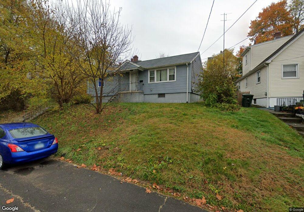
15 Lorraine St Bridgeport, CT 06604
Brooklawn-Saint Vincent NeighborhoodEstimated Value: $392,000 - $432,000
2
Beds
2
Baths
1,584
Sq Ft
$262/Sq Ft
Est. Value
About This Home
This home is located at 15 Lorraine St, Bridgeport, CT 06604 and is currently estimated at $415,396, approximately $262 per square foot. 15 Lorraine St is a home located in Fairfield County with nearby schools including Geraldine Johnson School, Central High School, and Catholic Academy of Bridgeport-St. Raphael Academy.
Ownership History
Date
Name
Owned For
Owner Type
Purchase Details
Closed on
Jun 5, 2023
Sold by
Sanon Remy
Bought by
Sanon Rachelle
Current Estimated Value
Purchase Details
Closed on
Dec 19, 2000
Sold by
Francois Jean L
Bought by
Sanon Remy
Purchase Details
Closed on
Oct 11, 1996
Sold by
Ferris Mary A and Affannato Lucrezia S
Bought by
Francois Jean L
Create a Home Valuation Report for This Property
The Home Valuation Report is an in-depth analysis detailing your home's value as well as a comparison with similar homes in the area
Home Values in the Area
Average Home Value in this Area
Purchase History
| Date | Buyer | Sale Price | Title Company |
|---|---|---|---|
| Sanon Rachelle | -- | None Available | |
| Sanon Rachelle | -- | None Available | |
| Sanon Remy | $42,000 | -- | |
| Sanon Remy | $42,000 | -- | |
| Francois Jean L | $45,000 | -- | |
| Francois Jean L | $45,000 | -- |
Source: Public Records
Mortgage History
| Date | Status | Borrower | Loan Amount |
|---|---|---|---|
| Previous Owner | Francois Jean L | $90,500 | |
| Previous Owner | Francois Jean L | $5,000 |
Source: Public Records
Tax History Compared to Growth
Tax History
| Year | Tax Paid | Tax Assessment Tax Assessment Total Assessment is a certain percentage of the fair market value that is determined by local assessors to be the total taxable value of land and additions on the property. | Land | Improvement |
|---|---|---|---|---|
| 2025 | $6,883 | $158,420 | $79,360 | $79,060 |
| 2024 | $6,883 | $158,420 | $79,360 | $79,060 |
| 2023 | $6,883 | $158,420 | $79,360 | $79,060 |
| 2022 | $6,883 | $158,420 | $79,360 | $79,060 |
| 2021 | $6,883 | $158,420 | $79,360 | $79,060 |
| 2020 | $5,823 | $107,850 | $40,060 | $67,790 |
| 2019 | $5,823 | $107,850 | $40,060 | $67,790 |
| 2018 | $5,864 | $107,850 | $40,060 | $67,790 |
| 2017 | $5,864 | $107,850 | $40,060 | $67,790 |
| 2016 | $5,864 | $107,850 | $40,060 | $67,790 |
| 2015 | $6,315 | $149,650 | $49,430 | $100,220 |
| 2014 | $6,315 | $149,650 | $49,430 | $100,220 |
Source: Public Records
Map
Nearby Homes
- 100 Lorraine St
- 125 E Eaton St
- 191 Oak St
- 318 Center St
- 309 Pequonnock St
- 31 Taft Ave
- 826 Norman St
- 687 Wood Ave
- 566 Wood Ave
- 78 Fairmount Ave
- 1373 Iranistan Ave
- 200 Harral Ave
- 665 W Taft Ave
- 75 Sanford Ave
- 184 Pacific St
- 113 Milne St Unit 115
- 414 Wood Ave
- 90 Tom Thumb St
- 1275 Capitol Ave
- 2345 Park Ave
- 25 Lorraine St
- 1532 North Ave
- 1542 North Ave
- 1 Lorraine St
- 35 Lorraine St
- 10 Lorraine St
- 4 Lorraine St
- 1522 North Ave
- 18 Lorraine St
- 1512 North Ave Unit A-3
- 30 Lorraine St
- 1548 North Ave Unit 1550
- 1548 North Ave Unit 2nd
- 41 Lorraine St
- 1566 North Ave
- 1566 North Ave Unit 1
- 1492 North Ave Unit 212
- 1492 North Ave Unit 211
- 1492 North Ave Unit 210
- 1492 North Ave Unit 209