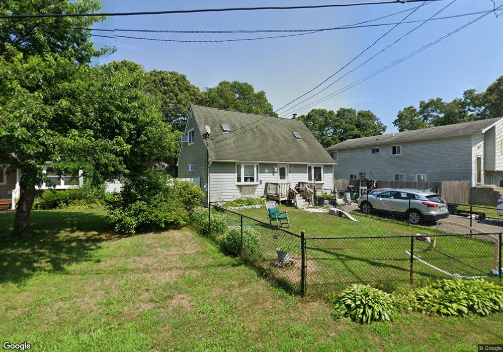
15 Maplewood Dr Shirley, NY 11967
Estimated Value: $486,000 - $1,383,000
4
Beds
1
Bath
1,365
Sq Ft
$524/Sq Ft
Est. Value
About This Home
This home is located at 15 Maplewood Dr, Shirley, NY 11967 and is currently estimated at $715,078, approximately $523 per square foot. 15 Maplewood Dr is a home located in Suffolk County with nearby schools including John S. Hobart Elementary School, William Paca Middle School, and William Floyd High School.
Ownership History
Date
Name
Owned For
Owner Type
Purchase Details
Closed on
Apr 25, 2019
Sold by
Munson Glenn and Munson Laurie
Bought by
Munson Glenn and Munson Laurie
Current Estimated Value
Purchase Details
Closed on
Jul 22, 2002
Sold by
Munson Glenn and Munson Nanciann T
Bought by
Munson Glenn and Munson Laurie
Home Financials for this Owner
Home Financials are based on the most recent Mortgage that was taken out on this home.
Original Mortgage
$110,000
Interest Rate
8.44%
Create a Home Valuation Report for This Property
The Home Valuation Report is an in-depth analysis detailing your home's value as well as a comparison with similar homes in the area
Home Values in the Area
Average Home Value in this Area
Purchase History
| Date | Buyer | Sale Price | Title Company |
|---|---|---|---|
| Munson Glenn | -- | -- | |
| Munson Glenn | $45,550 | Fidelity National Title Ins |
Source: Public Records
Mortgage History
| Date | Status | Borrower | Loan Amount |
|---|---|---|---|
| Previous Owner | Munson Glenn | $110,000 |
Source: Public Records
Tax History Compared to Growth
Tax History
| Year | Tax Paid | Tax Assessment Tax Assessment Total Assessment is a certain percentage of the fair market value that is determined by local assessors to be the total taxable value of land and additions on the property. | Land | Improvement |
|---|---|---|---|---|
| 2024 | $6,480 | $1,550 | $110 | $1,440 |
| 2023 | $6,480 | $1,550 | $110 | $1,440 |
| 2022 | $7,098 | $1,550 | $110 | $1,440 |
| 2021 | $7,098 | $1,550 | $110 | $1,440 |
| 2020 | $7,263 | $1,550 | $110 | $1,440 |
| 2019 | $7,263 | $0 | $0 | $0 |
| 2018 | -- | $1,550 | $110 | $1,440 |
| 2017 | $6,906 | $1,550 | $110 | $1,440 |
| 2016 | $7,505 | $1,700 | $110 | $1,590 |
| 2015 | -- | $1,700 | $110 | $1,590 |
| 2014 | -- | $1,950 | $110 | $1,840 |
Source: Public Records
Map
Nearby Homes
- 0 Maplewood Dr
- 59 Oakwood Dr
- 33 Ashwood Dr
- 14 Wellwood Dr
- 46 Arpage Dr E
- 11 Sagewood Dr
- 19 Birchwood Dr
- 516 Neighborhood Rd
- 52 Arpage Dr E
- 4 Beechwood Dr
- 514 Neighborhood Rd
- 43 Chanel Dr E
- 487 Neighborhood Rd
- 27 Pinewood Dr
- 55 Pinewood Dr
- 12 Deer Path
- 40 Pinewood Dr
- 5 Pinewood Dr
- 277 Commack Rd
- 279 Commack Rd
- 13 Maplewood Dr
- 17 Maplewood Dr
- 11 Maplewood Dr
- 19 Maplewood Dr
- 44 Oakwood Dr
- 40 Oakwood Dr
- 22 Maplewood Dr
- 24 Maplewood Dr
- 46 Oakwood Dr
- 18 Maplewood Dr
- 23 Maplewood Dr
- 48 Oakwood Dr
- 5 Cedarwood Dr
- 28 Maplewood Dr
- 7 Maplewood Dr
- 16 Maplewood Dr
- 36 Oakwood Dr
- 52 Oakwood Dr
- 30 Maplewood Dr
- 305 William Floyd Pkwy