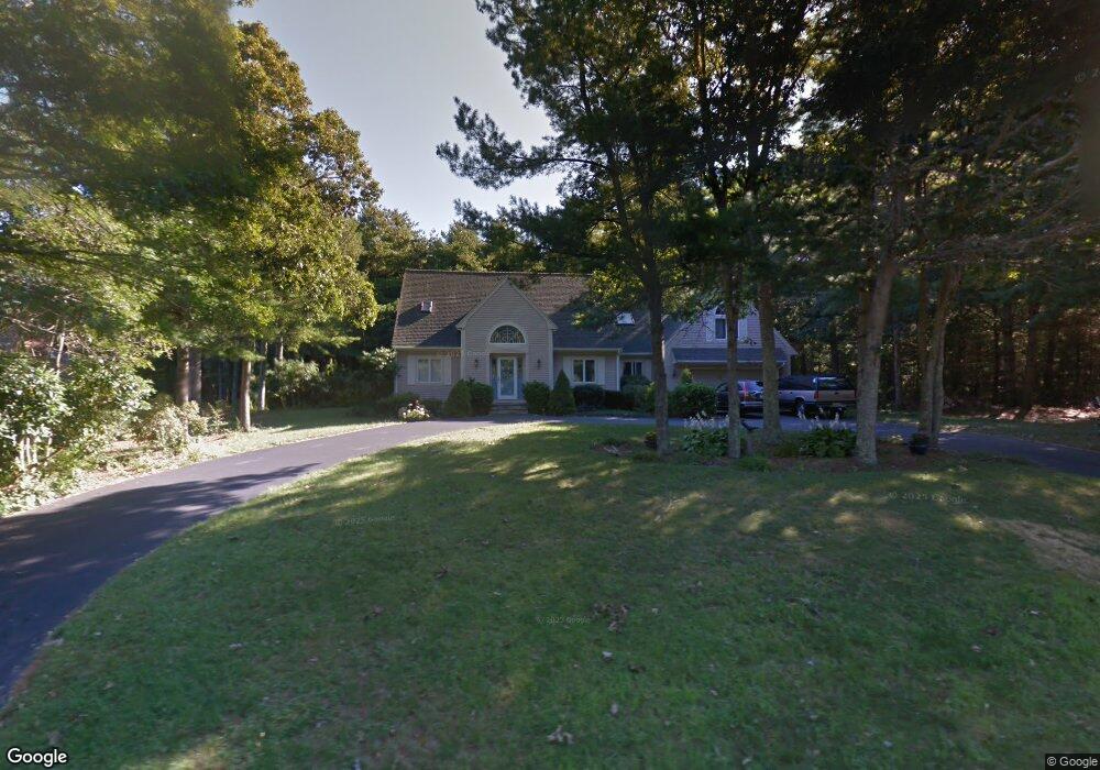
15 Marla Ln East Falmouth, MA 02536
Hatchville NeighborhoodEstimated Value: $967,000 - $1,051,000
4
Beds
4
Baths
2,201
Sq Ft
$458/Sq Ft
Est. Value
About This Home
This home is located at 15 Marla Ln, East Falmouth, MA 02536 and is currently estimated at $1,007,544, approximately $457 per square foot. 15 Marla Ln is a home located in Barnstable County with nearby schools including Mullen-Hall School, Morse Pond School, and Lawrence School.
Ownership History
Date
Name
Owned For
Owner Type
Purchase Details
Closed on
May 21, 2024
Sold by
Scharr George J and Scharr Suzan D
Bought by
George J Scharr 2024 T J and George Scharr
Current Estimated Value
Purchase Details
Closed on
Dec 21, 1989
Sold by
Holmes Philip R
Bought by
Adell Robert G
Home Financials for this Owner
Home Financials are based on the most recent Mortgage that was taken out on this home.
Original Mortgage
$185,500
Interest Rate
9.69%
Mortgage Type
Purchase Money Mortgage
Create a Home Valuation Report for This Property
The Home Valuation Report is an in-depth analysis detailing your home's value as well as a comparison with similar homes in the area
Home Values in the Area
Average Home Value in this Area
Purchase History
| Date | Buyer | Sale Price | Title Company |
|---|---|---|---|
| George J Scharr 2024 T J | -- | None Available | |
| George J Scharr 2024 T J | -- | None Available | |
| George J Scharr 2024 T J | -- | None Available | |
| Adell Robert G | $265,000 | -- | |
| Adell Robert G | $265,000 | -- |
Source: Public Records
Mortgage History
| Date | Status | Borrower | Loan Amount |
|---|---|---|---|
| Previous Owner | Adell Robert G | $222,000 | |
| Previous Owner | Adell Robert G | $50,000 | |
| Previous Owner | Adell Robert G | $213,000 | |
| Previous Owner | Adell Robert G | $185,500 |
Source: Public Records
Tax History Compared to Growth
Tax History
| Year | Tax Paid | Tax Assessment Tax Assessment Total Assessment is a certain percentage of the fair market value that is determined by local assessors to be the total taxable value of land and additions on the property. | Land | Improvement |
|---|---|---|---|---|
| 2025 | $5,838 | $994,500 | $270,700 | $723,800 |
| 2024 | $5,651 | $899,900 | $241,700 | $658,200 |
| 2023 | $5,268 | $761,200 | $193,400 | $567,800 |
| 2022 | $4,995 | $620,500 | $167,900 | $452,600 |
| 2021 | $4,792 | $563,800 | $160,600 | $403,200 |
| 2020 | $4,702 | $547,400 | $146,000 | $401,400 |
| 2019 | $4,611 | $538,700 | $146,000 | $392,700 |
| 2018 | $4,418 | $513,700 | $146,000 | $367,700 |
| 2017 | $4,256 | $498,900 | $146,000 | $352,900 |
| 2016 | $4,176 | $498,900 | $146,000 | $352,900 |
| 2015 | $4,086 | $498,900 | $146,000 | $352,900 |
| 2014 | $3,877 | $475,700 | $150,600 | $325,100 |
Source: Public Records
Map
Nearby Homes
- 273 Sandwich Rd
- 32 Jamie Ln
- 17 Pinewood Dr
- 149 Brick Kiln Rd
- 100 Tanglewood Dr
- 70 Meredith Dr
- 66 Braxton Rd
- 68 Deepwood Dr
- 25 Percival Rd
- 25 Harris Hill Rd
- 49 Broken Bow Ln
- 131 Heritage Cir
- 12 Beach Plum Path
- 12 Rock Hollow Dr
- 59 Whitecaps Dr
- 49 Saint Marks Rd
- 144 Strawberry Meadows
- 144 Strawberry Meadow Unit 144
- 33 John Parker Rd