A
Seller's Agent in 2016
Ashley Mundt
Sandcastle Realty

Estimated Value: $1,338,000 - $1,470,000
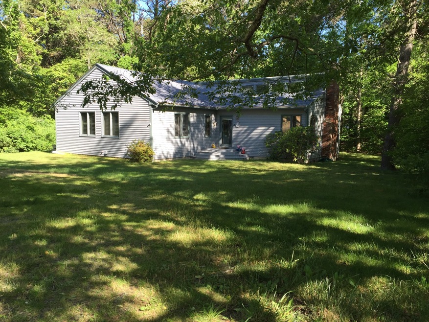
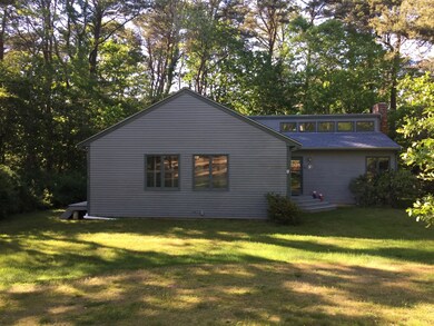
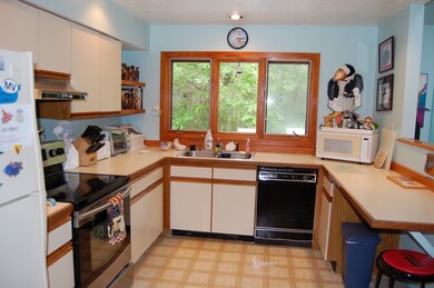
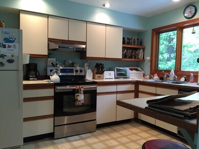
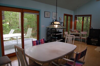
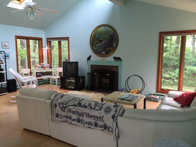
When entering this open concept home you are welcomed with an abundance of light and space. Easy universal level living in a contemporary home with ample storage space and cathedral ceilings inviting the outdoors inside. A wonderful year round 3 bedroom 2 full bath home in a well established neighborhood centrally located between the 3 major down Island towns. The house is a neutral backdrop waiting for your personal touches and could easily be transformed into a terrific summer rental getaway, just a few minutes drive to downtown Edgartown and the beaches of Katama. There is an over sized lot for your gardening pleasure and mature trees assure privacy when enjoying the quiet of lounging on the back deck. A full size basement could easily be finished for additional living space. Steps to bus and bike path.
Last Agent to Sell the Property
Ashley Mundt
Sandcastle Realty Listed on: 06/16/2016
Last Buyer's Agent
Trish Lyman
Compass | Point B
| Date | Buyer | Sale Price | Title Company |
|---|---|---|---|
| Foster Brian | $575,000 | -- | |
| Giglio Victoria | -- | -- |
| Date | Status | Borrower | Loan Amount |
|---|---|---|---|
| Open | Foster Brian | $564,585 | |
| Previous Owner | Giglio Victoria | $300,000 |
| Date | Event | Price | List to Sale | Price per Sq Ft |
|---|---|---|---|---|
| 09/09/2016 09/09/16 | Sold | $575,000 | -4.0% | $364 / Sq Ft |
| 06/29/2016 06/29/16 | Pending | -- | -- | -- |
| 06/16/2016 06/16/16 | For Sale | $599,000 | -- | $380 / Sq Ft |
| Year | Tax Paid | Tax Assessment Tax Assessment Total Assessment is a certain percentage of the fair market value that is determined by local assessors to be the total taxable value of land and additions on the property. | Land | Improvement |
|---|---|---|---|---|
| 2025 | $2,914 | $1,099,700 | $362,300 | $737,400 |
| 2024 | $2,706 | $1,061,000 | $362,300 | $698,700 |
| 2023 | $2,304 | $914,200 | $328,600 | $585,600 |
| 2022 | $2,144 | $707,500 | $328,600 | $378,900 |
| 2021 | $2,449 | $746,600 | $328,700 | $417,900 |
| 2020 | $2,009 | $599,700 | $298,800 | $300,900 |
| 2019 | $2,321 | $599,700 | $298,800 | $300,900 |
| 2018 | $2,183 | $564,200 | $298,800 | $265,400 |
| 2017 | $1,868 | $526,100 | $298,800 | $227,300 |
| 2016 | $1,802 | $497,700 | $289,400 | $208,300 |
| 2015 | $1,628 | $469,100 | $289,400 | $179,700 |
A
Seller's Agent in 2016
Ashley Mundt
Sandcastle Realty
T
Buyer's Agent in 2016
Trish Lyman
Compass | Point B
Source: LINK (Vineyard)
MLS Number: 30385
APN: EDGA-000007-000020-000001