Estimated Value: $1,019,000 - $1,607,000
3
Beds
2
Baths
2,180
Sq Ft
$624/Sq Ft
Est. Value
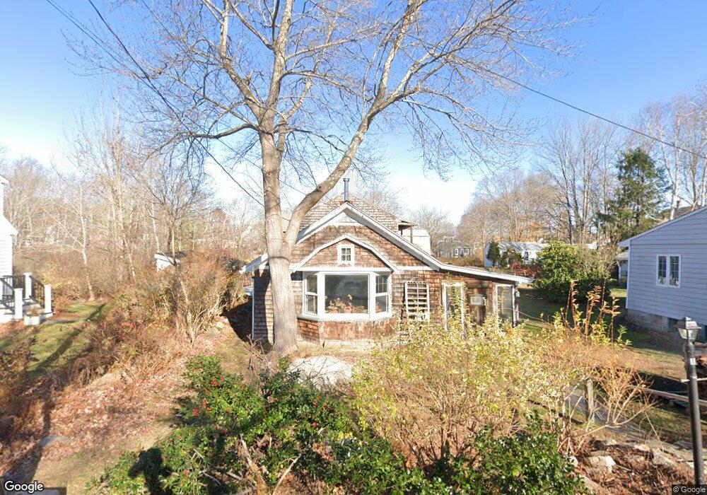
About This Home
This home is located at 15 Power Ave, Rye, NH 03870 and is currently estimated at $1,360,056, approximately $623 per square foot. 15 Power Ave is a home with nearby schools including Rye Elementary School, Rye Junior High School, and Rye Country Day School.
Ownership History
Date
Name
Owned For
Owner Type
Purchase Details
Closed on
Dec 17, 1997
Sold by
Ackerman Joel and Ackerman Brian
Bought by
Kaplarczyk Leona
Current Estimated Value
Home Financials for this Owner
Home Financials are based on the most recent Mortgage that was taken out on this home.
Original Mortgage
$80,000
Outstanding Balance
$13,427
Interest Rate
7.14%
Mortgage Type
Purchase Money Mortgage
Estimated Equity
$1,346,629
Purchase Details
Closed on
Apr 11, 1970
Bought by
Claudia J Hackett Ret
Create a Home Valuation Report for This Property
The Home Valuation Report is an in-depth analysis detailing your home's value as well as a comparison with similar homes in the area
Home Values in the Area
Average Home Value in this Area
Purchase History
| Date | Buyer | Sale Price | Title Company |
|---|---|---|---|
| Kaplarczyk Leona | $125,000 | -- | |
| Claudia J Hackett Ret | -- | -- |
Source: Public Records
Mortgage History
| Date | Status | Borrower | Loan Amount |
|---|---|---|---|
| Open | Claudia J Hackett Ret | $80,000 |
Source: Public Records
Tax History Compared to Growth
Tax History
| Year | Tax Paid | Tax Assessment Tax Assessment Total Assessment is a certain percentage of the fair market value that is determined by local assessors to be the total taxable value of land and additions on the property. | Land | Improvement |
|---|---|---|---|---|
| 2024 | $6,738 | $778,100 | $624,800 | $153,300 |
| 2023 | $6,248 | $778,100 | $624,800 | $153,300 |
| 2022 | $5,431 | $778,100 | $624,800 | $153,300 |
| 2021 | $5,975 | $584,600 | $447,000 | $137,600 |
| 2020 | $5,975 | $584,600 | $447,000 | $137,600 |
| 2019 | $5,975 | $584,600 | $447,000 | $137,600 |
| 2018 | $5,958 | $589,300 | $447,000 | $142,300 |
| 2017 | $5,958 | $589,300 | $447,000 | $142,300 |
| 2016 | $5,675 | $531,400 | $381,000 | $150,400 |
| 2013 | $5,669 | $516,800 | $381,000 | $135,800 |
Source: Public Records
Map
Nearby Homes
- 32 Cable Rd Unit 6
- 32 Cable Rd Unit 3
- 32 Cable Rd Unit 4
- 16 Richard Rd
- 6 Wildwood Ln
- 433 Central Rd
- 23 Straws Point
- 1 South Rd
- 78 South Rd
- 20 Causeway Rd
- 1643 Ocean Blvd
- 17 Pond Path
- 37 Central Rd
- 495 South Rd
- 850R Washington Rd
- 1191 - 1193 Ocean Blvd
- 21 Mountainview Terrace
- 665 Wallis Rd
- 665 Wallis Rd Unit 1
- 665 Wallis Rd Unit 2