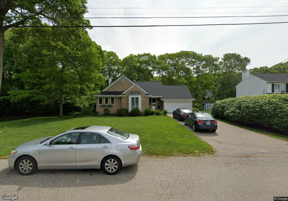
15 Red Brook Dr Westerly, RI 02891
Estimated Value: $628,116 - $759,000
3
Beds
2
Baths
2,708
Sq Ft
$262/Sq Ft
Est. Value
About This Home
This home is located at 15 Red Brook Dr, Westerly, RI 02891 and is currently estimated at $708,279, approximately $261 per square foot. 15 Red Brook Dr is a home located in Washington County with nearby schools including Westerly High School and St. Michael School.
Ownership History
Date
Name
Owned For
Owner Type
Purchase Details
Closed on
Jul 18, 2008
Sold by
Scorziello Dominic M and Scorziello Melody L
Bought by
Luzzi Joseph M and Luzzi Jodie
Current Estimated Value
Purchase Details
Closed on
Sep 30, 1998
Sold by
Greenway Richard P and Greenway Theresa A
Bought by
Scorziello Dominic M and Scorziello Meldoy L
Create a Home Valuation Report for This Property
The Home Valuation Report is an in-depth analysis detailing your home's value as well as a comparison with similar homes in the area
Home Values in the Area
Average Home Value in this Area
Purchase History
| Date | Buyer | Sale Price | Title Company |
|---|---|---|---|
| Luzzi Joseph M | $367,500 | -- | |
| Scorziello Dominic M | $172,500 | -- |
Source: Public Records
Mortgage History
| Date | Status | Borrower | Loan Amount |
|---|---|---|---|
| Open | Scorziello Dominic M | $101,000 | |
| Open | Scorziello Dominic M | $194,000 |
Source: Public Records
Tax History
| Year | Tax Paid | Tax Assessment Tax Assessment Total Assessment is a certain percentage of the fair market value that is determined by local assessors to be the total taxable value of land and additions on the property. | Land | Improvement |
|---|---|---|---|---|
| 2025 | $4,193 | $589,700 | $216,400 | $373,300 |
| 2024 | $4,302 | $438,500 | $154,600 | $283,900 |
| 2023 | $4,218 | $438,500 | $154,600 | $283,900 |
| 2022 | $4,192 | $438,500 | $154,600 | $283,900 |
| 2021 | $4,062 | $352,600 | $134,400 | $218,200 |
| 2020 | $3,988 | $352,600 | $134,400 | $218,200 |
| 2019 | $3,949 | $352,600 | $134,400 | $218,200 |
| 2018 | $3,854 | $324,400 | $124,100 | $200,300 |
| 2017 | $3,760 | $324,400 | $124,100 | $200,300 |
| 2016 | $3,789 | $324,400 | $124,100 | $200,300 |
| 2015 | $3,684 | $340,500 | $137,200 | $203,300 |
| 2014 | $3,623 | $340,500 | $137,200 | $203,300 |
Source: Public Records
Map
Nearby Homes
- 33 Whipple Ave
- 6 Wilder Ave
- 18 Timothy Dr
- 24 Abbey Ln Unit 13
- 19 Crestview Dr Unit C
- 23 Abbey Ln Unit 12
- 21 North Dr
- 7 Spring Pond Rd
- 8 Kettle Close
- 9 Compass Way Unit 101
- 1 Compass Way Unit A103
- 54 Sherwood Dr
- 174 River Rd
- 22 Summertime Cir
- 23 Summertime Cir
- 38 Summertime Cir
- 10 Tristam St
- 39 Summertime Cir
- 45 Summertime Cir
- 41 Summertime Cir Unit 41
Your Personal Tour Guide
Ask me questions while you tour the home.