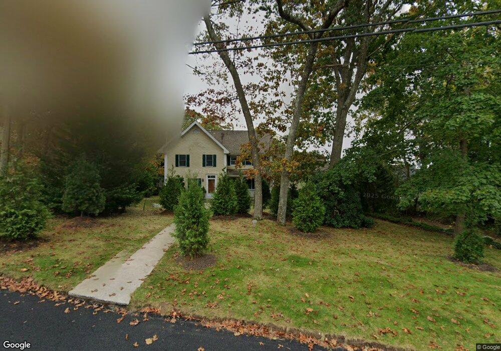
15 Riverview Ave Westerly, RI 02891
Estimated Value: $862,168 - $1,034,000
3
Beds
3
Baths
3,084
Sq Ft
$311/Sq Ft
Est. Value
About This Home
This home is located at 15 Riverview Ave, Westerly, RI 02891 and is currently estimated at $959,542, approximately $311 per square foot. 15 Riverview Ave is a home located in Washington County with nearby schools including Westerly High School and St. Michael School.
Ownership History
Date
Name
Owned For
Owner Type
Purchase Details
Closed on
Jun 22, 2023
Sold by
Shiller Judith M
Bought by
Judith M Shiller Lt and Shiller
Current Estimated Value
Purchase Details
Closed on
Apr 12, 2001
Sold by
Savas James and Savas Florence A
Bought by
Shiller William R and Shiller Judith M
Home Financials for this Owner
Home Financials are based on the most recent Mortgage that was taken out on this home.
Original Mortgage
$125,000
Interest Rate
7.03%
Create a Home Valuation Report for This Property
The Home Valuation Report is an in-depth analysis detailing your home's value as well as a comparison with similar homes in the area
Home Values in the Area
Average Home Value in this Area
Purchase History
| Date | Buyer | Sale Price | Title Company |
|---|---|---|---|
| Judith M Shiller Lt | -- | None Available | |
| Shiller William R | $330,000 | -- |
Source: Public Records
Mortgage History
| Date | Status | Borrower | Loan Amount |
|---|---|---|---|
| Previous Owner | Shiller William R | $467,500 | |
| Previous Owner | Shiller William R | $467,500 | |
| Previous Owner | Shiller William R | $125,000 | |
| Previous Owner | Shiller William R | $130,000 |
Source: Public Records
Tax History
| Year | Tax Paid | Tax Assessment Tax Assessment Total Assessment is a certain percentage of the fair market value that is determined by local assessors to be the total taxable value of land and additions on the property. | Land | Improvement |
|---|---|---|---|---|
| 2025 | $5,829 | $749,200 | $217,400 | $531,800 |
| 2024 | $5,621 | $537,900 | $156,200 | $381,700 |
| 2023 | $5,465 | $537,900 | $156,200 | $381,700 |
| 2022 | $5,433 | $537,900 | $156,200 | $381,700 |
| 2021 | $5,373 | $445,500 | $136,300 | $309,200 |
| 2020 | $5,279 | $445,500 | $136,300 | $309,200 |
| 2019 | $5,230 | $445,500 | $136,300 | $309,200 |
| 2018 | $4,803 | $388,900 | $125,800 | $263,100 |
| 2017 | $4,667 | $388,900 | $125,800 | $263,100 |
| 2016 | $4,667 | $388,900 | $125,800 | $263,100 |
| 2015 | $4,591 | $408,800 | $139,100 | $269,700 |
| 2014 | $4,517 | $408,800 | $139,100 | $269,700 |
Source: Public Records
Map
Nearby Homes
- 24 Abbey Ln Unit 13
- 23 Abbey Ln Unit 12
- 19 Crestview Dr Unit C
- 18 Timothy Dr
- 33 Whipple Ave
- 22 Summertime Cir
- 23 Summertime Cir
- 39 Summertime Cir
- 38 Summertime Cir
- 45 Summertime Cir
- 25 Summertime Cir
- 16 Spring St
- 25 School St Unit 2
- 16 Green Ave
- 0 Green Ave
- 417 River Rd
- 15 Moss St
- 13 Moss St
- 2 Gravity Ct
- 12 Apache Dr Unit A
- 17 Riverview Ave
- 7 London Plane Ct
- 5 Riverview Ave
- 2 Hazel St
- 12 Riverview Ave
- 21 Riverview Ave
- 1 Hazel St
- 8 London Plane Ct
- 16 Hubbard St
- 18 Hubbard St
- 14 Hubbard St
- 8 Riverview Ave
- 20 Hubbard St
- 5 London Plane Ct
- 23 Riverview Ave
- 6 Hazel St
- 4 Riverview Ave
- 6 London Plane Ct
- 3 London Plane Ct
- 22 Hubbard St
Your Personal Tour Guide
Ask me questions while you tour the home.