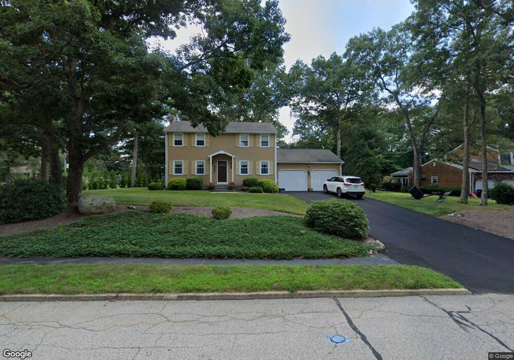
15 Silver Maple Dr Coventry, RI 02816
Estimated Value: $577,595 - $677,000
4
Beds
2
Baths
1,768
Sq Ft
$359/Sq Ft
Est. Value
About This Home
This home is located at 15 Silver Maple Dr, Coventry, RI 02816 and is currently estimated at $634,649, approximately $358 per square foot. 15 Silver Maple Dr is a home located in Kent County with nearby schools including Alan Shawn Feinstein Ms Of Cov, Coventry High School, and Father John V. Doyle School.
Ownership History
Date
Name
Owned For
Owner Type
Purchase Details
Closed on
Jul 25, 1997
Sold by
Robinson Michael T
Bought by
Dipaolo Robert A and Dipaolo Amy
Current Estimated Value
Create a Home Valuation Report for This Property
The Home Valuation Report is an in-depth analysis detailing your home's value as well as a comparison with similar homes in the area
Purchase History
| Date | Buyer | Sale Price | Title Company |
|---|---|---|---|
| Dipaolo Robert A | $154,000 | -- |
Source: Public Records
Mortgage History
| Date | Status | Borrower | Loan Amount |
|---|---|---|---|
| Open | Dipaolo Robert A | $111,500 | |
| Closed | Dipaolo Robert A | $120,000 | |
| Closed | Dipaolo Robert A | $75,000 |
Source: Public Records
Tax History
| Year | Tax Paid | Tax Assessment Tax Assessment Total Assessment is a certain percentage of the fair market value that is determined by local assessors to be the total taxable value of land and additions on the property. | Land | Improvement |
|---|---|---|---|---|
| 2025 | $6,700 | $416,400 | $161,100 | $255,300 |
| 2024 | $6,678 | $421,600 | $161,100 | $260,500 |
| 2023 | $6,463 | $421,600 | $161,100 | $260,500 |
| 2022 | $6,247 | $319,200 | $151,900 | $167,300 |
| 2021 | $6,192 | $319,200 | $151,900 | $167,300 |
| 2020 | $7,099 | $319,200 | $151,900 | $167,300 |
| 2019 | $6,285 | $282,600 | $131,100 | $151,500 |
| 2018 | $6,107 | $282,600 | $131,100 | $151,500 |
| 2017 | $5,929 | $282,600 | $131,100 | $151,500 |
| 2016 | $5,779 | $269,900 | $112,600 | $157,300 |
| 2015 | $5,622 | $269,900 | $112,600 | $157,300 |
| 2014 | $5,505 | $269,900 | $112,600 | $157,300 |
| 2013 | $5,219 | $279,700 | $123,400 | $156,300 |
Source: Public Records
Map
Nearby Homes
Your Personal Tour Guide
Ask me questions while you tour the home.