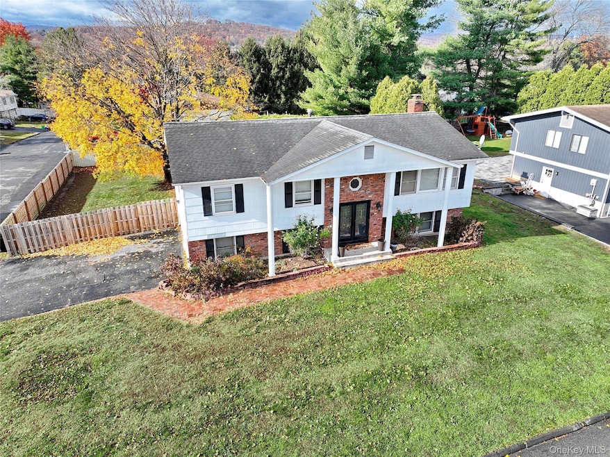
15 Stubbe Dr Stony Point, NY 10980
Estimated payment $4,181/month
Highlights
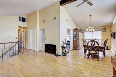
- Cathedral Ceiling
- Main Floor Bedroom
- Formal Dining Room
- Raised Ranch Architecture
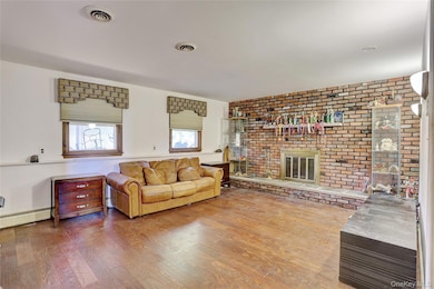
- 1 Fireplace
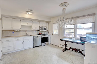
- Stainless Steel Appliances
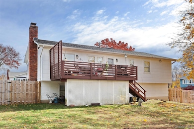
About This Home
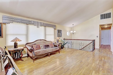
Just Listed! Charming High Ranch in Stony Point. 4 bedrooms, 2.5 bathrooms, eat-in-kitchen with door out to deck overlooking flat park-like property. Spacious living areas perfect for entertaining, plenty of storage, vaulted ceilings in living & dining room, family room with fireplace. Conveniently located on peaceful street, providing a serene atmosphere. Don't miss the opportunity to own this charming home and make it your own.
Listing Agent
Q Home Sales Brokerage Phone: 845-357-4663 License #10301208061 Listed on: 11/14/2025
Home Details
Home Type
- Single Family
Est. Annual Taxes
- $12,468
Year Built
- Built in 1983
Lot Details
- 0.27 Acre Lot
Parking
- 2 Car Garage
- Driveway
Home Design
- Raised Ranch Architecture
- Frame Construction
Interior Spaces
- 2,116 Sq Ft Home
- Cathedral Ceiling
- Chandelier
- 1 Fireplace
- Formal Dining Room
Kitchen
- Eat-In Kitchen
- Gas Range
- Dishwasher
- Stainless Steel Appliances
Bedrooms and Bathrooms
- 4 Bedrooms
- Main Floor Bedroom
- En-Suite Primary Bedroom
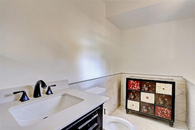
- Bathroom on Main Level
Schools
- James A Farley Elementary School
- Fieldstone Middle School
- North Rockland High School
Utilities
- Central Air
- Baseboard Heating
- Natural Gas Connected
- Cable TV Available
Listing and Financial Details
- Assessor Parcel Number 392800-020-011-0001-021-000-0000
Map
Home Values in the Area
Average Home Value in this Area
Tax History
| Year | Tax Paid | Tax Assessment Tax Assessment Total Assessment is a certain percentage of the fair market value that is determined by local assessors to be the total taxable value of land and additions on the property. | Land | Improvement |
|---|---|---|---|---|
| 2024 | $16,730 | $48,000 | $15,500 | $32,500 |
| 2023 | $16,730 | $48,000 | $15,500 | $32,500 |
| 2022 | $4,410 | $48,000 | $15,500 | $32,500 |
| 2021 | $4,410 | $48,000 | $15,500 | $32,500 |
| 2020 | $11,614 | $48,000 | $15,500 | $32,500 |
| 2019 | $3,625 | $48,000 | $15,500 | $32,500 |
| 2018 | $11,191 | $48,000 | $15,500 | $32,500 |
| 2017 | $11,012 | $48,000 | $15,500 | $32,500 |
| 2016 | $11,363 | $48,000 | $15,500 | $32,500 |
| 2015 | -- | $48,000 | $15,500 | $32,500 |
| 2014 | -- | $48,000 | $15,500 | $32,500 |
Property History
| Date | Event | Price | List to Sale | Price per Sq Ft |
|---|---|---|---|---|
| 12/01/2025 12/01/25 | For Sale | $599,000 | 0.0% | $283 / Sq Ft |
| 11/26/2025 11/26/25 | Off Market | $599,000 | -- | -- |
| 11/14/2025 11/14/25 | For Sale | $599,000 | -- | $283 / Sq Ft |
Purchase History
| Date | Type | Sale Price | Title Company |
|---|---|---|---|
| Bargain Sale Deed | -- | None Available | |
| Bargain Sale Deed | $325,000 | Fidelity National Title Insu | |
| Bargain Sale Deed | $325,000 | Fidelity National Title Insu | |
| Bargain Sale Deed | $325,000 | Fidelity National Title Insu | |
| Deed | $226,500 | Judicial Title | |
| Deed | $226,500 | Judicial Title | |
| Deed | $226,500 | Judicial Title |
Mortgage History
| Date | Status | Loan Amount | Loan Type |
|---|---|---|---|
| Previous Owner | $335,000 | Purchase Money Mortgage | |
| Previous Owner | $181,200 | Construction |
Source: OneKey® MLS
MLS Number: 935830
APN: 392800-020-011-0001-021-000-0000
Disclaimer: Certain information contained herein is derived from information provided by parties other than Homes.com. All information provided is deemed reliable, but is not guaranteed to be accurate and should be independently verified.
![]() The data relating to real estate for sale or lease on this web site comes in part from OneKey® MLS. Real estate listings held by brokerage firms other than Ten-X are marked with the OneKey® MLS logo or an abbreviated logo and detailed information about them includes the name of the listing broker.
The data relating to real estate for sale or lease on this web site comes in part from OneKey® MLS. Real estate listings held by brokerage firms other than Ten-X are marked with the OneKey® MLS logo or an abbreviated logo and detailed information about them includes the name of the listing broker.
IDX information is provided exclusively for personal, non-commercial use, and may not be used for any purpose other than to identify prospective properties consumers may be interested in purchasing.
Information is deemed reliable but not guaranteed.
Copyright 2025 OneKey® MLS. All rights reserved.
- 24 Govan Dr
- 137 Central Hwy
- 590 Rt 9 W
- 1 Anna Ct
- 7 Hudson Ave Unit 2
- 7 Brush Ct
- 11 Brush Ct
- 72 N Liberty Dr Unit 2
- 72 N Liberty Dr Unit 1
- 90-92 W Railroad Ave
- 1 Tomkins Ave
- 50 Kennedy Dr
- 73 E Railroad Ave Unit A
- 24 Mclaughlin Ave
- 58 Samsondale Ave Unit 58 A
- 1 Kensington Cir
- 135 Ramapo Rd
- 15 Ryder Ct
- 22 Sharp St
- 7 Pymm Ct Unit ID1328117P
