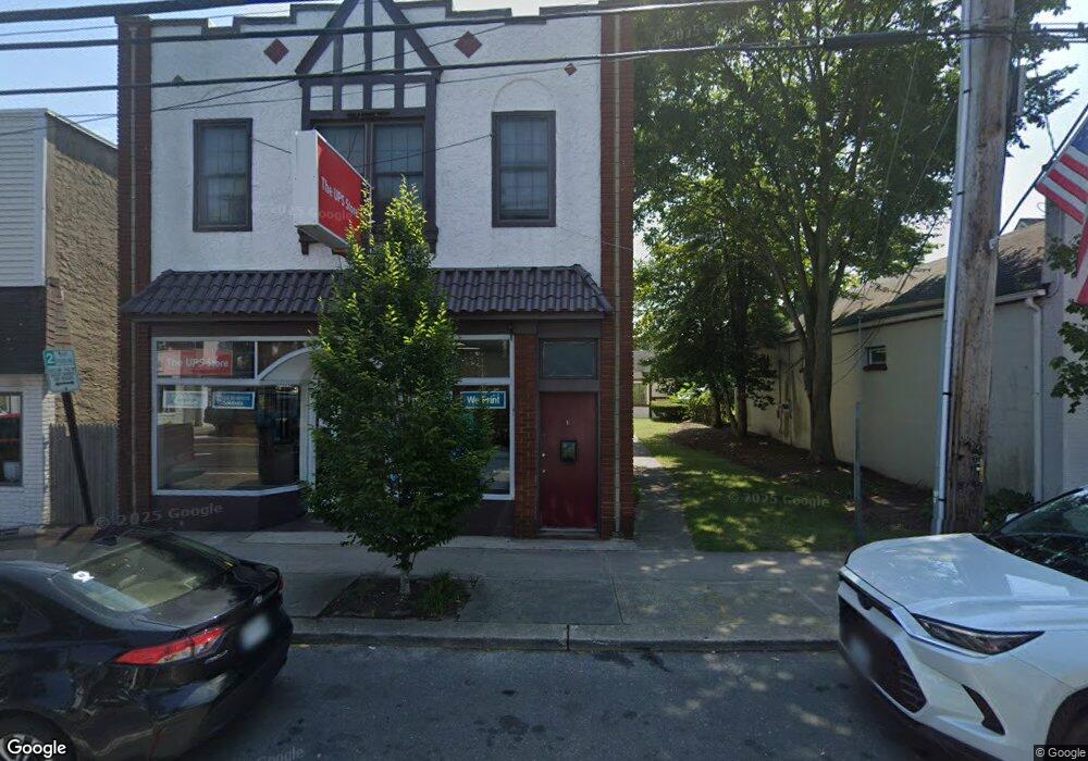
15 W Montauk Hwy Unit A Hampton Bays, NY 11946
Estimated Value: $1,023,000 - $1,039,321
--
Bed
--
Bath
3,708
Sq Ft
$278/Sq Ft
Est. Value
About This Home
This home is located at 15 W Montauk Hwy Unit A, Hampton Bays, NY 11946 and is currently estimated at $1,031,161, approximately $278 per square foot. 15 W Montauk Hwy Unit A is a home located in Suffolk County with nearby schools including Hampton Bays Secondary School, Hampton Bays Elementary School, and Hampton Bays Middle School.
Ownership History
Date
Name
Owned For
Owner Type
Purchase Details
Closed on
Feb 10, 2004
Sold by
J&S Montauk Highway Llc
Bought by
Argus Of The Hamptons Llc
Current Estimated Value
Purchase Details
Closed on
Aug 23, 1999
Sold by
Bangston John F and Bangston Robert A
Bought by
J & S Montauk Highway Llc
Home Financials for this Owner
Home Financials are based on the most recent Mortgage that was taken out on this home.
Original Mortgage
$200,000
Interest Rate
7.5%
Mortgage Type
Commercial
Create a Home Valuation Report for This Property
The Home Valuation Report is an in-depth analysis detailing your home's value as well as a comparison with similar homes in the area
Home Values in the Area
Average Home Value in this Area
Purchase History
| Date | Buyer | Sale Price | Title Company |
|---|---|---|---|
| Argus Of The Hamptons Llc | $546,500 | Fidelity National Title | |
| J & S Montauk Highway Llc | $285,000 | Fidelity National Title Ins |
Source: Public Records
Mortgage History
| Date | Status | Borrower | Loan Amount |
|---|---|---|---|
| Previous Owner | J & S Montauk Highway Llc | $200,000 |
Source: Public Records
Tax History Compared to Growth
Tax History
| Year | Tax Paid | Tax Assessment Tax Assessment Total Assessment is a certain percentage of the fair market value that is determined by local assessors to be the total taxable value of land and additions on the property. | Land | Improvement |
|---|---|---|---|---|
| 2024 | -- | $570,200 | $254,000 | $316,200 |
| 2023 | -- | $570,200 | $254,000 | $316,200 |
| 2022 | $9,742 | $570,200 | $254,000 | $316,200 |
| 2021 | $9,742 | $570,200 | $254,000 | $316,200 |
| 2020 | $8,848 | $570,200 | $254,000 | $316,200 |
| 2019 | $8,848 | $0 | $0 | $0 |
| 2018 | -- | $570,200 | $254,000 | $316,200 |
| 2017 | $9,625 | $570,200 | $254,000 | $316,200 |
| 2016 | $9,787 | $570,200 | $254,000 | $316,200 |
| 2015 | -- | $570,200 | $254,000 | $316,200 |
| 2014 | -- | $570,200 | $254,000 | $316,200 |
Source: Public Records
Map
Nearby Homes
- 9 Squiretown Rd
- 5 B Fanning Ave
- 7 Fanning Ave
- 9 Fanning Ave
- 29 Squiretown Rd Unit D
- 3A Suffolk Rd
- 10 Argonne Rd W
- 35 Suffolk Rd
- 13 Bittersweet Ave S
- 34 Nassau Rd
- 95 Springville Rd Unit 8
- 3 Emily Ct
- 105 Old Riverhead Rd
- 8 School St
- 70 Fanning Ave
- 9 Gravel Hill Rd
- 13 Ocean Ave
- 9 Debbie Trail
- 12 Wakefield Rd
- 11 Easterly Rd
- 13 W Montauk Hwy
- 17 W Montauk Hwy
- 11 W Montauk Hwy
- 10 And 14 Ponquogue Ave
- 25 W Montauk Hwy
- 3 W Montauk Hwy
- 12 W Montauk Hwy
- 10 W Montauk Hwy
- 4 Ponquogue Ave
- 4 Ponquogue Ave
- 2 Ponquogue Ave
- 2 W Montauk Hwy
- 6 W Montauk Hwy
- 24 W Montauk Hwy
- 2 E Montauk Hwy
- 15 Ponquogue Ave
- 15 Ponquogue Ave
- 15 Ponquogue Ave Unit 1
- 40 W Montauk Hwy
- 10 E Montauk Hwy