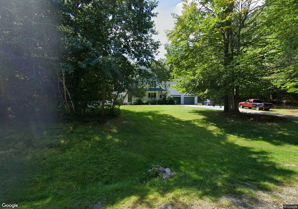
15 Whitetail Ln Chester, NH 03036
Estimated Value: $746,820 - $818,000
4
Beds
3
Baths
3,483
Sq Ft
$224/Sq Ft
Est. Value
About This Home
This home is located at 15 Whitetail Ln, Chester, NH 03036 and is currently estimated at $781,205, approximately $224 per square foot. 15 Whitetail Ln is a home with nearby schools including Chester Academy and Pinkerton Academy.
Ownership History
Date
Name
Owned For
Owner Type
Purchase Details
Closed on
Oct 31, 2016
Sold by
Chad Luby
Bought by
Pfannkoch Thomas and Pfannkoch Anne
Current Estimated Value
Home Financials for this Owner
Home Financials are based on the most recent Mortgage that was taken out on this home.
Original Mortgage
$225,000
Outstanding Balance
$180,920
Interest Rate
3.47%
Estimated Equity
$600,285
Purchase Details
Closed on
Sep 7, 2000
Sold by
Radzelovage James
Bought by
Pfannkoch Thomas A and Pfannkoch Anne K
Create a Home Valuation Report for This Property
The Home Valuation Report is an in-depth analysis detailing your home's value as well as a comparison with similar homes in the area
Home Values in the Area
Average Home Value in this Area
Purchase History
| Date | Buyer | Sale Price | Title Company |
|---|---|---|---|
| Pfannkoch Thomas | -- | -- | |
| Pfannkoch Thomas A | $64,400 | -- |
Source: Public Records
Mortgage History
| Date | Status | Borrower | Loan Amount |
|---|---|---|---|
| Open | Pfannkoch Thomas A | $225,000 | |
| Closed | Pfannkoch Thomas A | -- | |
| Previous Owner | Pfannkoch Thomas A | $263,000 | |
| Previous Owner | Pfannkoch Thomas A | $274,000 |
Source: Public Records
Tax History Compared to Growth
Tax History
| Year | Tax Paid | Tax Assessment Tax Assessment Total Assessment is a certain percentage of the fair market value that is determined by local assessors to be the total taxable value of land and additions on the property. | Land | Improvement |
|---|---|---|---|---|
| 2024 | $11,295 | $690,400 | $191,600 | $498,800 |
| 2023 | $10,071 | $434,100 | $127,800 | $306,300 |
| 2022 | $9,290 | $434,100 | $127,800 | $306,300 |
| 2021 | $9,047 | $434,100 | $127,800 | $306,300 |
| 2020 | $8,912 | $434,100 | $127,800 | $306,300 |
| 2019 | $9,029 | $434,100 | $127,800 | $306,300 |
| 2018 | $7,878 | $347,700 | $99,000 | $248,700 |
| 2016 | $8,304 | $347,300 | $99,000 | $248,300 |
| 2015 | $8,124 | $329,700 | $99,000 | $230,700 |
| 2014 | $8,427 | $329,700 | $99,000 | $230,700 |
Source: Public Records
Map
Nearby Homes
- 392 Fremont Rd
- 10 Raven Dr
- 37 Reed Rd
- 534 Main St
- 5 Lilac Ln
- 44 Pheasant Run Dr
- 30 Saw Mill Ridge
- 35 Royal Range Rd
- 27 Arabian Way
- 11 Towle Rd
- 61 Sargent Rd
- 8 Eastfield Loop
- 36 Croft Ln
- 21 Penacook Rd
- 00 Dump Rd Unit 20
- 209 Fremont Rd
- 23 Holman Way
- Lot 5 Robin Way
- Lot 2 Robin Way Unit 2
- Lot 7 Robin Way Unit 7
- 5 Whitetail Ln
- 25 Whitetail Ln
- 14 Whitetail Ln
- 7 Celeste Terrace
- 9 Celeste Terrace
- 1 Celeste Terrace
- 13 Celeste Terrace
- 28 Whitetail Ln
- 63 Hale True Rd
- 49 Hale True Rd
- 71 Hale True Rd
- 6 Celeste Terrace
- 40 Hale True Rd
- 17 Celeste Terrace
- 2 Celeste Terrace
- 12 Celeste Terrace
- 39 Hale True Rd
- 29 Hale True Rd
- 426 Fremont Rd
- 21 Celeste Terrace