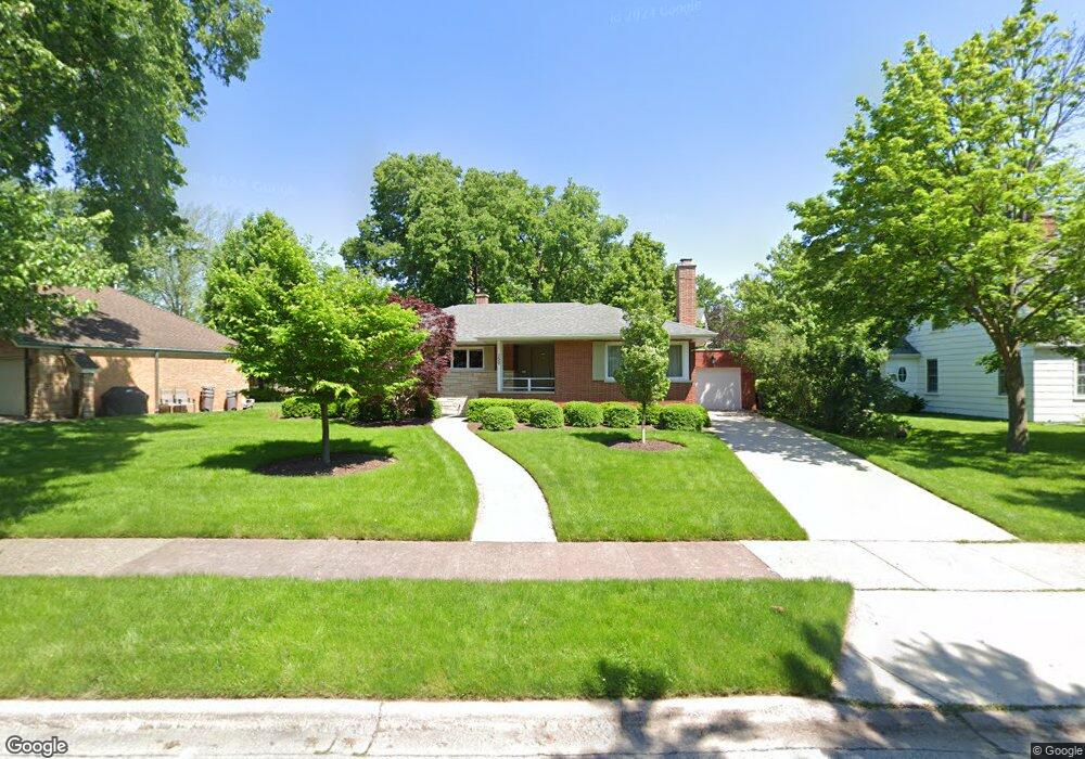
150 Addison Rd Riverside, IL 60546
Estimated Value: $549,000 - $589,000
4
Beds
1
Bath
1,778
Sq Ft
$320/Sq Ft
Est. Value
About This Home
This home is located at 150 Addison Rd, Riverside, IL 60546 and is currently estimated at $569,689, approximately $320 per square foot. 150 Addison Rd is a home located in Cook County with nearby schools including Central Elementary School, L J Hauser Jr High School, and Riverside Brookfield High School.
Ownership History
Date
Name
Owned For
Owner Type
Purchase Details
Closed on
Sep 26, 2005
Sold by
Delconte Raymond J and Delconte Del Conte
Bought by
Boldyga Edward and Boldyga Camille
Current Estimated Value
Home Financials for this Owner
Home Financials are based on the most recent Mortgage that was taken out on this home.
Original Mortgage
$359,650
Outstanding Balance
$183,024
Interest Rate
5.37%
Mortgage Type
Adjustable Rate Mortgage/ARM
Estimated Equity
$386,665
Purchase Details
Closed on
Oct 18, 2004
Sold by
First American Bank
Bought by
Delconte Raymond J and Delconte Carolyn K
Home Financials for this Owner
Home Financials are based on the most recent Mortgage that was taken out on this home.
Original Mortgage
$285,000
Interest Rate
4.87%
Mortgage Type
Unknown
Create a Home Valuation Report for This Property
The Home Valuation Report is an in-depth analysis detailing your home's value as well as a comparison with similar homes in the area
Home Values in the Area
Average Home Value in this Area
Purchase History
| Date | Buyer | Sale Price | Title Company |
|---|---|---|---|
| Boldyga Edward | $504,000 | Fidelity Natl Title Ins Co | |
| Delconte Raymond J | $300,000 | Pntn |
Source: Public Records
Mortgage History
| Date | Status | Borrower | Loan Amount |
|---|---|---|---|
| Open | Boldyga Edward | $359,650 | |
| Previous Owner | Delconte Raymond J | $285,000 |
Source: Public Records
Tax History
| Year | Tax Paid | Tax Assessment Tax Assessment Total Assessment is a certain percentage of the fair market value that is determined by local assessors to be the total taxable value of land and additions on the property. | Land | Improvement |
|---|---|---|---|---|
| 2025 | $12,338 | $40,051 | $11,781 | $28,270 |
| 2024 | $12,338 | $41,883 | $11,781 | $30,102 |
| 2023 | $11,950 | $41,883 | $11,781 | $30,102 |
| 2022 | $11,950 | $34,620 | $10,175 | $24,445 |
| 2021 | $11,515 | $34,618 | $10,174 | $24,444 |
| 2020 | $11,219 | $34,618 | $10,174 | $24,444 |
| 2019 | $9,788 | $31,240 | $9,371 | $21,869 |
| 2018 | $10,140 | $33,117 | $9,371 | $23,746 |
| 2017 | $10,538 | $35,256 | $9,371 | $25,885 |
| 2016 | $8,451 | $26,493 | $8,032 | $18,461 |
| 2015 | $8,214 | $26,493 | $8,032 | $18,461 |
| 2014 | $8,091 | $26,493 | $8,032 | $18,461 |
| 2013 | $11,015 | $37,937 | $8,032 | $29,905 |
Source: Public Records
Map
Nearby Homes
- 108 E Burlington St Unit B
- 269 Shenstone Rd
- 231 Bartram Rd
- 10 E Burlington St Unit 2C
- 10 E Burlington St Unit 2B
- 315 Bartram Rd
- 220 Maplewood Rd
- 78 Pine Ave
- 236 Maplewood Rd
- 305 Desplaines Ave
- 369 Addison Rd
- 101 Southcote Rd
- 8117 W 30th St
- 367 Bartram Rd
- 176 Riverside Rd
- 410 Repton Rd
- 280 Blackhawk Rd
- 475 Shenstone Rd Unit 104
- 475 Shenstone Rd Unit 304
- 475 Shenstone Rd Unit 303
- 156 Addison Rd
- 157 Longcommon Rd
- 165 Longcommon Rd
- 149 Longcommon Rd
- 168 Addison Rd
- 174 Addison Rd
- 177 Longcommon Rd
- 159 Addison Rd
- 180 Addison Rd
- 163 Addison Rd
- 155 Addison Rd
- 181 Longcommon Rd
- 175 Addison Rd
- 135 Longcommon Rd
- 190 Addison Rd
- 190 Addison Rd
- 183 Addison Rd
- 193 Longcommon Rd
- 131 Longcommon Rd
- 194 Addison Rd
Your Personal Tour Guide
Ask me questions while you tour the home.