150 N Union Ave East Wenatchee, WA 98802
Estimated Value: $328,000
--
Bed
--
Bath
2,160
Sq Ft
$152/Sq Ft
Est. Value
About This Home
This home is located at 150 N Union Ave, East Wenatchee, WA 98802 and is currently priced at $328,000, approximately $151 per square foot. 150 N Union Ave is a home located in Douglas County with nearby schools including Grant Elementary School, Clovis Point Intermediate School, and Kenroy Elementary School.
Ownership History
Date
Name
Owned For
Owner Type
Purchase Details
Closed on
Dec 20, 2019
Sold by
Port Of Chelan County
Bought by
Chelan Douglas Regional Port Authority
Current Estimated Value
Purchase Details
Closed on
Aug 21, 2017
Sold by
United State Of America
Bought by
Pangborn Memorial Airport
Purchase Details
Closed on
Sep 25, 2014
Sold by
Snyder Land Holdings Llc
Bought by
Pangborn Memorial Airport
Create a Home Valuation Report for This Property
The Home Valuation Report is an in-depth analysis detailing your home's value as well as a comparison with similar homes in the area
Home Values in the Area
Average Home Value in this Area
Purchase History
| Date | Buyer | Sale Price | Title Company |
|---|---|---|---|
| Chelan Douglas Regional Port Authority | -- | None Available | |
| Pangborn Memorial Airport | -- | None Available | |
| Pangborn Memorial Airport | -- | None Available |
Source: Public Records
Tax History Compared to Growth
Tax History
| Year | Tax Paid | Tax Assessment Tax Assessment Total Assessment is a certain percentage of the fair market value that is determined by local assessors to be the total taxable value of land and additions on the property. | Land | Improvement |
|---|---|---|---|---|
| 2025 | -- | $217,200 | $131,900 | $85,300 |
| 2024 | -- | $193,200 | $131,900 | $61,300 |
| 2023 | $0 | $193,200 | $131,900 | $61,300 |
| 2022 | $1,639 | $131,900 | $131,900 | $0 |
| 2021 | $1,576 | $131,900 | $131,900 | $0 |
| 2020 | $1,505 | $600,300 | $600,300 | $0 |
| 2018 | $1,255 | $600,300 | $600,300 | $0 |
| 2017 | $1,145 | $600,300 | $600,300 | $0 |
| 2016 | -- | $600,300 | $600,300 | $0 |
| 2015 | -- | $600,300 | $600,300 | $0 |
| 2014 | -- | $600,300 | $600,300 | $0 |
| 2013 | -- | $600,300 | $600,300 | $0 |
Source: Public Records
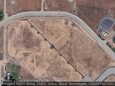
Map
Nearby Homes
- 89 S Texas Ave
- 3260 1st St SE
- 0 N Quincy Ave
- 312 Perry Ave N
- 2575 1st St SE
- 2526 1st St SE
- 2487 3rd St SE
- 2438 Noah St SE
- 812 N Newport Loop
- 2404 Noah St SE
- 819 N Newport Loop
- 861 N Newport Loop
- 2339 Noah St SE
- 898 N Nile Ave
- 2331 Noah St SE
- 2663 7th St SE
- 2321 Noah St SE
- 2311 Noah St SE
- 2380 4th St SE
- 561 Canyon Dr Unit 53
- 150 N Union Ave
- 0 N Union Ave Unit 1289225
- 0 N Union Ave Unit 1289234
- 0 N Union Ave Unit 1289038
- 0 N Union Ave Unit 1289044
- 0 N Union Ave Unit 1221700
- 0 N Union Ave Unit 1221860
- 0 N Union Ave Unit 1221858
- 0 N Union Ave Unit 1212146
- 0 N Union Ave Unit 1221698
- 0 S Union Ave
- 0 NNA N Union Ave Unit B
- 3220 Grant Rd
- 3224 Grant Rd
- 3214 Grant Rd
- 3210 Grant Rd
- 3200 Grant Rd
- 3243 Airway St
- 3245 Airway St
- 3120 Grant Rd