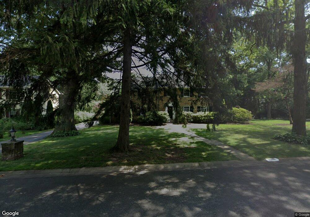
1500 Forrest Rd Wilmington, DE 19810
Estimated Value: $593,000 - $692,000
3
Beds
2
Baths
2,445
Sq Ft
$254/Sq Ft
Est. Value
About This Home
This home is located at 1500 Forrest Rd, Wilmington, DE 19810 and is currently estimated at $622,164, approximately $254 per square foot. 1500 Forrest Rd is a home located in New Castle County with nearby schools including Forwood Elementary School, Talley Middle School, and Mount Pleasant High School.
Ownership History
Date
Name
Owned For
Owner Type
Purchase Details
Closed on
Oct 22, 2004
Sold by
Hudson Kenneth J and Hudson Patricia A
Bought by
Raffo Ahmad Samir and Raffo Ahmad Jessica
Current Estimated Value
Home Financials for this Owner
Home Financials are based on the most recent Mortgage that was taken out on this home.
Original Mortgage
$358,000
Outstanding Balance
$178,249
Interest Rate
5.85%
Mortgage Type
Purchase Money Mortgage
Estimated Equity
$443,915
Create a Home Valuation Report for This Property
The Home Valuation Report is an in-depth analysis detailing your home's value as well as a comparison with similar homes in the area
Home Values in the Area
Average Home Value in this Area
Purchase History
| Date | Buyer | Sale Price | Title Company |
|---|---|---|---|
| Raffo Ahmad Samir | $447,500 | -- |
Source: Public Records
Mortgage History
| Date | Status | Borrower | Loan Amount |
|---|---|---|---|
| Open | Raffo Ahmad Samir | $358,000 | |
| Closed | Raffo Ahmad Samir | $67,125 |
Source: Public Records
Tax History Compared to Growth
Tax History
| Year | Tax Paid | Tax Assessment Tax Assessment Total Assessment is a certain percentage of the fair market value that is determined by local assessors to be the total taxable value of land and additions on the property. | Land | Improvement |
|---|---|---|---|---|
| 2024 | $3,908 | $102,700 | $23,100 | $79,600 |
| 2023 | $3,572 | $102,700 | $23,100 | $79,600 |
| 2022 | $3,633 | $102,700 | $23,100 | $79,600 |
| 2021 | $450 | $102,700 | $23,100 | $79,600 |
| 2020 | $450 | $102,700 | $23,100 | $79,600 |
| 2019 | $450 | $102,700 | $23,100 | $79,600 |
| 2018 | $3,472 | $102,700 | $23,100 | $79,600 |
| 2017 | $3,419 | $102,700 | $23,100 | $79,600 |
| 2016 | $3,416 | $102,700 | $23,100 | $79,600 |
| 2015 | $3,143 | $102,700 | $23,100 | $79,600 |
| 2014 | $3,141 | $102,700 | $23,100 | $79,600 |
Source: Public Records
Map
Nearby Homes
- 1900 Beechwood Dr
- 1224 Grinnell Rd
- 1607 Silverside Rd
- 1218 Winstead Rd
- 1425 Bucknell Rd
- 133 Marcella Rd
- 2247 Silverside Rd
- 1400 Carson Rd
- 2010 Kynwyd Rd
- 29 N Cliffe Dr
- 1108 Graylyn Rd
- 502 Ivydale Rd
- 1300 Hillside Blvd
- 1602 Harvey Rd
- 1902 Longcome Dr
- 2212 Grubb Rd
- 2115 Coventry Dr
- 1905 Harvey Rd
- 1820 Foulk Rd
- 200 Churchill Dr
- 1903 Woodbrook Dr
- 1502 Forrest Rd
- 1902 Woodbrook Dr
- 1402 Forrest Rd
- 1904 Greenbriar Dr
- 2000 Greenbriar Dr
- 2001 Woodbrook Dr
- 1901 Woodbrook Dr
- 1900 Woodbrook Dr
- 1901 Silverside Rd
- 2001 Greenbriar Dr
- 1400 Forrest Rd
- 1501 Trevalley Rd
- 1401 Trevalley Rd
- 1600 Forrest Rd
- 1403 Forrest Rd
- 2007 Greenbriar Dr
- 1903 Greenbriar Dr
- 2004 Greenbriar Dr
- 1401 Forrest Rd