Estimated Value: $124,000 - $191,000
3
Beds
1
Bath
1,389
Sq Ft
$103/Sq Ft
Est. Value
About This Home
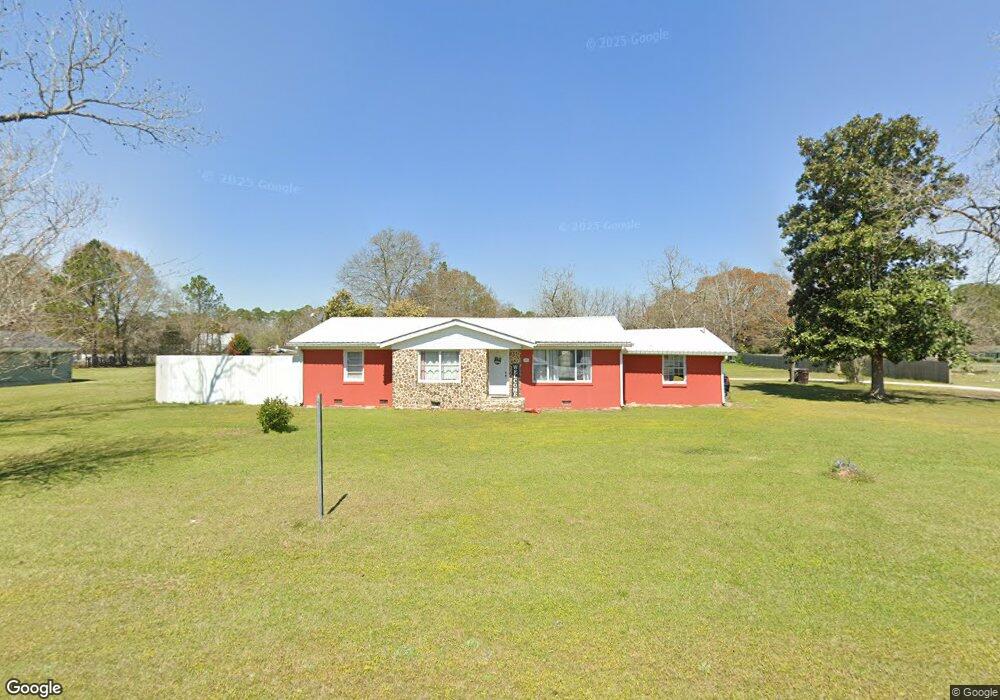
This home is located at 1500 W Mitchell St, Adel, GA 31620 and is currently estimated at $142,498, approximately $102 per square foot. 1500 W Mitchell St is a home located in Cook County with nearby schools including Cook Primary School, Cook Elementary School, and Cook County Middle School.
Ownership History
Date
Name
Owned For
Owner Type
Purchase Details
Closed on
Dec 4, 2015
Sold by
Kretlow Ann B
Bought by
Connell Maria and Zapeitia Claudia
Current Estimated Value
Home Financials for this Owner
Home Financials are based on the most recent Mortgage that was taken out on this home.
Original Mortgage
$46,365
Outstanding Balance
$36,216
Interest Rate
3.91%
Mortgage Type
New Conventional
Estimated Equity
$106,282
Purchase Details
Closed on
Feb 28, 2006
Sold by
Stalvey Debra B
Bought by
Kretlow Ann
Home Financials for this Owner
Home Financials are based on the most recent Mortgage that was taken out on this home.
Original Mortgage
$60,146
Interest Rate
6.19%
Mortgage Type
New Conventional
Create a Home Valuation Report for This Property
The Home Valuation Report is an in-depth analysis detailing your home's value as well as a comparison with similar homes in the area
Purchase History
| Date | Buyer | Sale Price | Title Company |
|---|---|---|---|
| Connell Maria | $49,900 | -- | |
| Kretlow Ann | -- | -- |
Source: Public Records
Mortgage History
| Date | Status | Borrower | Loan Amount |
|---|---|---|---|
| Open | Connell Maria | $46,365 | |
| Previous Owner | Kretlow Ann | $60,146 |
Source: Public Records
Tax History
| Year | Tax Paid | Tax Assessment Tax Assessment Total Assessment is a certain percentage of the fair market value that is determined by local assessors to be the total taxable value of land and additions on the property. | Land | Improvement |
|---|---|---|---|---|
| 2025 | $885 | $35,608 | $4,830 | $30,778 |
| 2024 | $865 | $32,117 | $3,818 | $28,299 |
| 2023 | $762 | $28,287 | $3,818 | $24,469 |
| 2022 | $751 | $27,878 | $3,409 | $24,469 |
| 2021 | $680 | $23,558 | $3,409 | $20,149 |
| 2020 | $680 | $23,558 | $3,409 | $20,149 |
| 2019 | $681 | $23,558 | $3,409 | $20,149 |
| 2018 | $681 | $23,558 | $3,409 | $20,149 |
| 2017 | $681 | $23,558 | $3,409 | $20,149 |
| 2016 | $578 | $23,558 | $3,409 | $20,149 |
| 2015 | $820 | $28,245 | $3,409 | $24,836 |
| 2014 | $821 | $28,245 | $3,409 | $24,836 |
| 2013 | -- | $28,245 | $3,409 | $24,836 |
Source: Public Records
Map
Nearby Homes
- 123 Westover Dr
- 414 Birch St
- 801 Glendale St
- 703 N Elm St
- 134 Brandy Ct
- 91 Apple Ln
- 814 N Cleveland Ave
- 309 Wayne St
- 729 W Seventh St
- 103 N College St
- 1607 Jimmy St
- 515 John Keigans Memorial
- 11 Antioch Rd
- 526 E Mitchell St
- 507 S Poplar St
- 1002 Bear Creek Rd
- 411 S Hutchinson Ave
- 1402 Bear Creek Rd
- 211 S Gordon Ave
- 1405 Pebblewood Dr
- 1530 W Mitchell St
- 1466 W Mitchell St
- 1550 W Mitchell St
- 65 Debbie Dr
- 1414 W Mitchell St
- 96 Westover Dr
- 22 Westover Dr
- 96 Debbie Dr
- 96 Debbie Dr
- 101 Debbie Dr
- 1515 W Mitchell St
- 55 Michael Dr
- 151 Debbie Dr
- 71 Westover Dr
- 99 Michael Dr
- 45 Westover Dr
- 1644 W Mitchell St
- 123 Westover Dr
- 0 Debbie Dr
- 183 Westover Dr
Your Personal Tour Guide
Ask me questions while you tour the home.