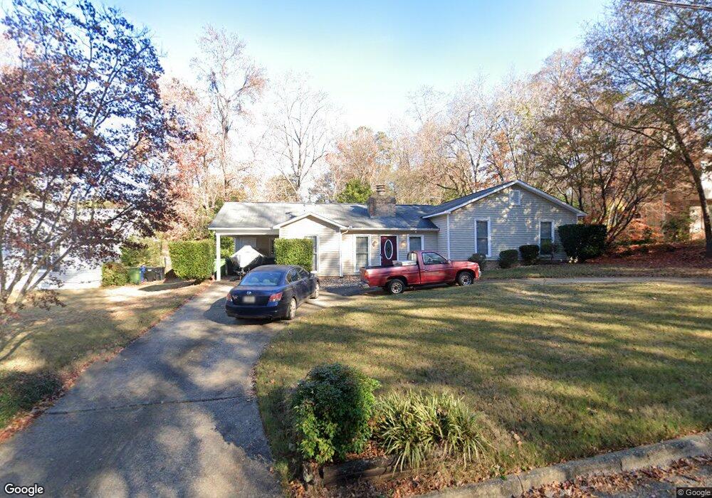
1501 Autumnridge Dr Columbus, GA 31904
Northern Columbus NeighborhoodEstimated Value: $180,000 - $232,280
3
Beds
3
Baths
1,571
Sq Ft
$127/Sq Ft
Est. Value
About This Home
This home is located at 1501 Autumnridge Dr, Columbus, GA 31904 and is currently estimated at $198,820, approximately $126 per square foot. 1501 Autumnridge Dr is a home located in Muscogee County with nearby schools including River Road Elementary School, Double Churches Middle School, and Northside High School.
Ownership History
Date
Name
Owned For
Owner Type
Purchase Details
Closed on
Jan 31, 2025
Sold by
Mcgrotha Christopher P and Mcgrotha Tammy Michelle
Bought by
Waller Preston and Waller Rodney Fontaine
Current Estimated Value
Home Financials for this Owner
Home Financials are based on the most recent Mortgage that was taken out on this home.
Original Mortgage
$170,050
Outstanding Balance
$169,028
Interest Rate
6.85%
Mortgage Type
New Conventional
Estimated Equity
$29,792
Purchase Details
Closed on
Nov 19, 2007
Sold by
Mcgrotha Christopher P
Bought by
Mcgrotha Christopher P and Lott Tammy
Home Financials for this Owner
Home Financials are based on the most recent Mortgage that was taken out on this home.
Original Mortgage
$140,000
Interest Rate
6.32%
Mortgage Type
Purchase Money Mortgage
Create a Home Valuation Report for This Property
The Home Valuation Report is an in-depth analysis detailing your home's value as well as a comparison with similar homes in the area
Home Values in the Area
Average Home Value in this Area
Purchase History
| Date | Buyer | Sale Price | Title Company |
|---|---|---|---|
| Waller Preston | $179,000 | None Listed On Document | |
| Mcgrotha Christopher P | -- | None Available | |
| Mcgrotha Christopher P | $140,000 | None Available |
Source: Public Records
Mortgage History
| Date | Status | Borrower | Loan Amount |
|---|---|---|---|
| Open | Waller Preston | $170,050 | |
| Previous Owner | Mcgrotha Christopher P | $140,000 |
Source: Public Records
Tax History Compared to Growth
Tax History
| Year | Tax Paid | Tax Assessment Tax Assessment Total Assessment is a certain percentage of the fair market value that is determined by local assessors to be the total taxable value of land and additions on the property. | Land | Improvement |
|---|---|---|---|---|
| 2025 | $978 | $63,656 | $22,532 | $41,124 |
| 2024 | $977 | $63,656 | $22,532 | $41,124 |
| 2023 | $289 | $63,656 | $22,532 | $41,124 |
| 2022 | $1,018 | $48,532 | $16,896 | $31,636 |
| 2021 | $1,011 | $49,480 | $16,896 | $32,584 |
| 2020 | $1,012 | $49,480 | $16,896 | $32,584 |
| 2019 | $1,017 | $49,480 | $16,896 | $32,584 |
| 2018 | $1,017 | $49,480 | $16,896 | $32,584 |
| 2017 | $1,022 | $49,480 | $16,896 | $32,584 |
| 2016 | $1,027 | $38,163 | $4,746 | $33,417 |
| 2015 | $1,029 | $38,163 | $4,746 | $33,417 |
| 2014 | $1,030 | $38,163 | $4,746 | $33,417 |
| 2013 | -- | $38,163 | $4,746 | $33,417 |
Source: Public Records
Map
Nearby Homes
- 1440 Blanchfield Dr
- 6802 Ellis Dr
- 6825 Ellis Dr
- 6817 Whitesville Rd
- 6810 Fawndale Dr
- 6818 Fawndale Dr
- 6836 Sharmel Ln
- 7233 Mobley Walk Dr
- 1512 Tom Buk Tu Ln
- 7047 Mellwood Rd
- 6969 Mobley Rd
- 1355 Cloverdale Rd
- 7185 Helen Dr
- 6233 Ashwood Dr
- 8008 Lagoon Ct
- 6200 Fox Chapel Dr
- 1255 Woodville Ct
- 1049 Red Maple Way
- 7313 Sesame St
- 18 Peppertree Ct
- 1457 Autumnridge Dr
- 1507 Autumnridge Dr
- 1456 Blanchfield Dr
- 1449 Autumnridge Dr
- 1517 Autumnridge Dr
- 1501 Fox Croft Loop
- 1501 Foxcroft Loop
- 1448 Blanchfield Dr
- 1450 Autumnridge Dr
- 1441 Autumnridge Dr
- 1453 Foxcroft Loop
- 1442 Autumnridge Dr
- 1453 Fox Croft Loop
- 1433 Autumnridge Dr
- 1526 Autumnridge Dr
- 1508 Fox Croft Loop
- 1502 Fox Croft Loop
- 1502 Foxcroft Loop
- 1447 Fox Croft Loop
- 1432 Blanchfield Dr