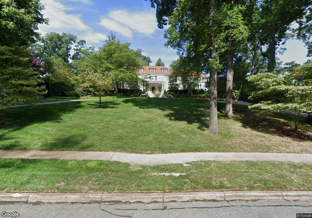
1501 Briarcliff Rd Greensboro, NC 27408
Old Irving Park NeighborhoodEstimated Value: $2,453,000 - $4,742,000
10
Beds
8
Baths
8,219
Sq Ft
$422/Sq Ft
Est. Value
About This Home
This home is located at 1501 Briarcliff Rd, Greensboro, NC 27408 and is currently estimated at $3,468,440, approximately $422 per square foot. 1501 Briarcliff Rd is a home located in Guilford County with nearby schools including Irving Park Elementary School, Mendenhall Middle School, and Page High School.
Ownership History
Date
Name
Owned For
Owner Type
Purchase Details
Closed on
Apr 8, 2024
Sold by
1501 Briarcliff Llc
Bought by
Samet Norman G and Samet Sylvia L
Current Estimated Value
Purchase Details
Closed on
Dec 5, 2004
Sold by
Samet Norman G and Samet Sylvia L
Bought by
1501 Briarcliff Llc
Purchase Details
Closed on
Jan 18, 2000
Sold by
Wilson Charles H and Wilson Judith R
Bought by
Brevorka Peter J
Create a Home Valuation Report for This Property
The Home Valuation Report is an in-depth analysis detailing your home's value as well as a comparison with similar homes in the area
Home Values in the Area
Average Home Value in this Area
Purchase History
| Date | Buyer | Sale Price | Title Company |
|---|---|---|---|
| Samet Norman G | -- | None Listed On Document | |
| 1501 Briarcliff Llc | -- | -- | |
| Brevorka Peter J | $2,272,500 | -- |
Source: Public Records
Tax History Compared to Growth
Tax History
| Year | Tax Paid | Tax Assessment Tax Assessment Total Assessment is a certain percentage of the fair market value that is determined by local assessors to be the total taxable value of land and additions on the property. | Land | Improvement |
|---|---|---|---|---|
| 2025 | $36,825 | $2,624,700 | $725,000 | $1,899,700 |
| 2024 | $36,825 | $2,624,700 | $725,000 | $1,899,700 |
| 2023 | $36,825 | $2,624,700 | $725,000 | $1,899,700 |
| 2022 | $35,775 | $2,624,700 | $725,000 | $1,899,700 |
| 2021 | $36,079 | $2,590,000 | $725,000 | $1,865,000 |
| 2020 | $36,079 | $2,590,000 | $725,000 | $1,865,000 |
| 2019 | $36,079 | $2,590,000 | $0 | $0 |
| 2018 | $0 | $2,590,000 | $0 | $0 |
| 2017 | $35,043 | $2,590,000 | $0 | $0 |
| 2016 | $32,928 | $2,378,600 | $0 | $0 |
| 2015 | $31,801 | $2,283,700 | $0 | $0 |
| 2014 | $32,029 | $2,283,700 | $0 | $0 |
Source: Public Records
Map
Nearby Homes
- 703 Woodland Dr
- 502 Nottingham Rd
- 815 Woodland Dr
- 404 Country Club Dr
- 2002 Cleburne St
- 301 Wentworth Dr
- 1604 Birch Ln
- 831 W Cornwallis Dr
- 1127 W Northwood St
- 706 W Cornwallis Dr
- 301 Country Club Dr
- 505 W Cornwallis Dr
- 211 Country Club Dr
- 2014 Pembroke Rd
- 1818 Saint Andrews Rd
- 1011 W Wendover Ave
- 2104 Cleburne St
- 105 Irving Park Ct
- 103 Wentworth Dr
- 100 Sunset Cir Unit 304