
Seller's Agent in 2025
Candice Fuller
Century 21 North Homes Realty
(503) 396-1468
50 Total Sales
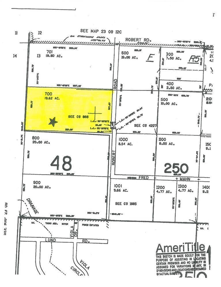
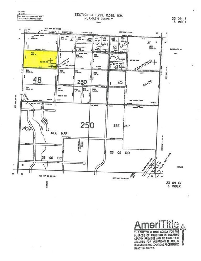
Almost 20 Acres of Privacy Galore! Well maintained roads and within the Walker Fire District.
Last Agent to Sell the Property
Gary Tingey
Alpine Real Estate License #200802192 Listed on: 06/26/2014
Last Buyer's Agent
Terryle St. Jeor
High Lakes Realty & Property M License #200303170
| Date | Type | Sale Price | Title Company |
|---|---|---|---|
| Warranty Deed | $900,000 | First American Title | |
| Warranty Deed | $900,000 | First American Title | |
| Warranty Deed | $970,000 | None Listed On Document | |
| Warranty Deed | $40,000 | Amerititle |
| Date | Status | Loan Amount | Loan Type |
|---|---|---|---|
| Previous Owner | $760,000 | New Conventional |
| Date | Event | Price | Change | Sq Ft Price |
|---|---|---|---|---|
| 07/03/2025 07/03/25 | Sold | $900,000 | -3.2% | $460 / Sq Ft |
| 06/19/2025 06/19/25 | Pending | -- | -- | -- |
| 04/23/2025 04/23/25 | Price Changed | $930,000 | -4.6% | $475 / Sq Ft |
| 03/06/2025 03/06/25 | For Sale | $975,000 | +0.5% | $498 / Sq Ft |
| 07/22/2022 07/22/22 | Sold | $970,000 | -3.0% | $496 / Sq Ft |
| 05/19/2022 05/19/22 | Pending | -- | -- | -- |
| 05/09/2022 05/09/22 | For Sale | $999,500 | +2398.8% | $511 / Sq Ft |
| 09/26/2014 09/26/14 | Sold | $40,000 | -52.9% | -- |
| 09/05/2014 09/05/14 | Pending | -- | -- | -- |
| 06/18/2013 06/18/13 | For Sale | $84,900 | -- | -- |
| Year | Tax Paid | Tax Assessment Tax Assessment Total Assessment is a certain percentage of the fair market value that is determined by local assessors to be the total taxable value of land and additions on the property. | Land | Improvement |
|---|---|---|---|---|
| 2024 | $3,759 | $296,900 | -- | -- |
| 2023 | $3,618 | $296,900 | $0 | $0 |
| 2022 | $3,520 | $279,870 | $0 | $0 |
| 2021 | $3,410 | $271,720 | $0 | $0 |
| 2020 | $3,309 | $263,810 | $0 | $0 |
| 2019 | $3,228 | $256,130 | $0 | $0 |
| 2018 | $2,473 | $194,760 | $0 | $0 |
| 2017 | $390 | $36,400 | $0 | $0 |
| 2016 | $378 | $35,340 | $0 | $0 |
| 2015 | $369 | $34,320 | $0 | $0 |
| 2014 | $354 | $33,330 | $0 | $0 |
| 2013 | -- | $32,360 | $0 | $0 |
Seller's Agent in 2025
Candice Fuller
Century 21 North Homes Realty
(503) 396-1468
50 Total Sales
B
Buyer's Agent in 2025
Breanne Brand
Cascade Hasson SIR
(541) 420-0420
57 Total Sales
Seller's Agent in 2022
Scott Asla
Windermere Realty Trust
(541) 815-3872
95 Total Sales
T
Seller Co-Listing Agent in 2022
Tyler Asla
Windermere Realty Trust
(541) 815-6971
82 Total Sales
B
Buyer's Agent in 2022
Brea Lindbo
Knipe Realty ERA Powered
(541) 797-0701
18 Total Sales
G
Seller's Agent in 2014
Gary Tingey
Alpine Real Estate
Source: Oregon Datashare
MLS Number: 201305659
APN: R126839
Disclaimer: Certain information contained herein is derived from information provided by parties other than Homes.com. All information provided is deemed reliable, but is not guaranteed to be accurate and should be independently verified.
![]() © 2025 Oregon Datashare (KCAR | MLSCO | SOMLS). All rights reserved. The data relating to real estate for sale on this web site comes in part from the Internet Data Exchange Program of the Oregon Datashare. Real estate listings held by IDX Brokerage firms other than Ten-X are marked with the Internet Data Exchange logo or the Internet Data Exchange thumbnail logo and detailed information about them includes the name of the listing Brokers. Information provided is for consumers' personal, non-commercial use and may not be used for any purpose other than to identify prospective properties the viewer may be interested in purchasing. The consumer will not copy, retransmit nor redistribute any of the content from this website. Information provided is deemed reliable, but not guaranteed.
© 2025 Oregon Datashare (KCAR | MLSCO | SOMLS). All rights reserved. The data relating to real estate for sale on this web site comes in part from the Internet Data Exchange Program of the Oregon Datashare. Real estate listings held by IDX Brokerage firms other than Ten-X are marked with the Internet Data Exchange logo or the Internet Data Exchange thumbnail logo and detailed information about them includes the name of the listing Brokers. Information provided is for consumers' personal, non-commercial use and may not be used for any purpose other than to identify prospective properties the viewer may be interested in purchasing. The consumer will not copy, retransmit nor redistribute any of the content from this website. Information provided is deemed reliable, but not guaranteed.