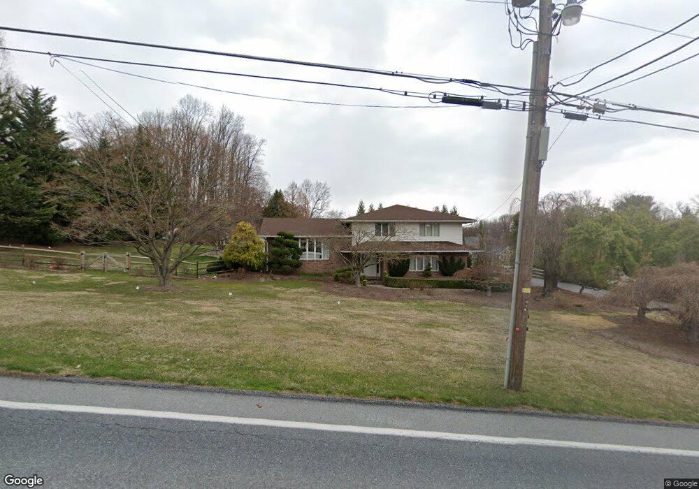
1503 Cedar Top Rd Reading, PA 19607
Estimated Value: $429,000 - $537,000
3
Beds
2
Baths
3,100
Sq Ft
$156/Sq Ft
Est. Value
About This Home
This home is located at 1503 Cedar Top Rd, Reading, PA 19607 and is currently estimated at $483,131, approximately $155 per square foot. 1503 Cedar Top Rd is a home located in Berks County with nearby schools including Cumru Elementary School, Governor Mifflin Intermediate School, and Governor Mifflin Middle School.
Ownership History
Date
Name
Owned For
Owner Type
Purchase Details
Closed on
Aug 28, 2007
Sold by
Miller D Scott and Miller Susanne R
Bought by
Miller D Scott and Miller Susanne R
Current Estimated Value
Create a Home Valuation Report for This Property
The Home Valuation Report is an in-depth analysis detailing your home's value as well as a comparison with similar homes in the area
Home Values in the Area
Average Home Value in this Area
Purchase History
| Date | Buyer | Sale Price | Title Company |
|---|---|---|---|
| Miller D Scott | -- | First American Title Ins Co |
Source: Public Records
Tax History Compared to Growth
Tax History
| Year | Tax Paid | Tax Assessment Tax Assessment Total Assessment is a certain percentage of the fair market value that is determined by local assessors to be the total taxable value of land and additions on the property. | Land | Improvement |
|---|---|---|---|---|
| 2025 | $3,348 | $187,600 | $48,900 | $138,700 |
| 2024 | $8,631 | $187,600 | $48,900 | $138,700 |
| 2023 | $8,390 | $187,600 | $48,900 | $138,700 |
| 2022 | $8,180 | $187,600 | $48,900 | $138,700 |
| 2021 | $8,017 | $187,600 | $48,900 | $138,700 |
| 2020 | $8,017 | $187,600 | $48,900 | $138,700 |
| 2019 | $19,411 | $187,600 | $48,900 | $138,700 |
| 2018 | $7,777 | $187,600 | $48,900 | $138,700 |
| 2017 | $7,626 | $187,600 | $48,900 | $138,700 |
| 2016 | $2,643 | $187,600 | $48,900 | $138,700 |
| 2015 | $2,643 | $187,600 | $48,900 | $138,700 |
| 2014 | $2,643 | $187,600 | $48,900 | $138,700 |
Source: Public Records
Map
Nearby Homes
- 1694 Cedar Top Rd
- 1189 Cedar Top Rd
- 127 Cedar Ln
- 6 Rim View Ln
- 1970 Cedar Top Rd
- 310 4th St
- 320 Hillside Dr
- 512 Mifflin Blvd
- 836 Scenic Dr
- 0 Cedar Top Rd
- 419 Holland St
- 322 New Holland Ave
- 15 Lake St
- 511 Grill Ave
- 131 E Wyomissing Ave
- 24 Philadelphia Ave
- 140 S Church St
- 120 E Wyomissing Ave
- 18 Front St
- 705 Cameron St
- 1519 Cedar Top Rd
- 1489 Cedar Top Rd
- 81 Flint Ridge Dr
- 1496 Cedar Top Rd
- 1520 Cedar Top Rd
- 83 Flint Ridge Dr
- 79 Flint Ridge Dr
- 1541 Cedar Top Rd
- 1461 Cedar Top Rd
- 77 Flint Ridge Dr
- 2 Albert Ln
- 1478 Cedar Top Rd
- 82 Flint Ridge Dr
- 75 Flint Ridge Dr
- 76 Harry Ave
- 1488 Cedar Top Rd
- 80 Flint Ridge Dr
- 74 Harry Ave
- 78 Flint Ridge Dr
- 1563 Cedar Top Rd