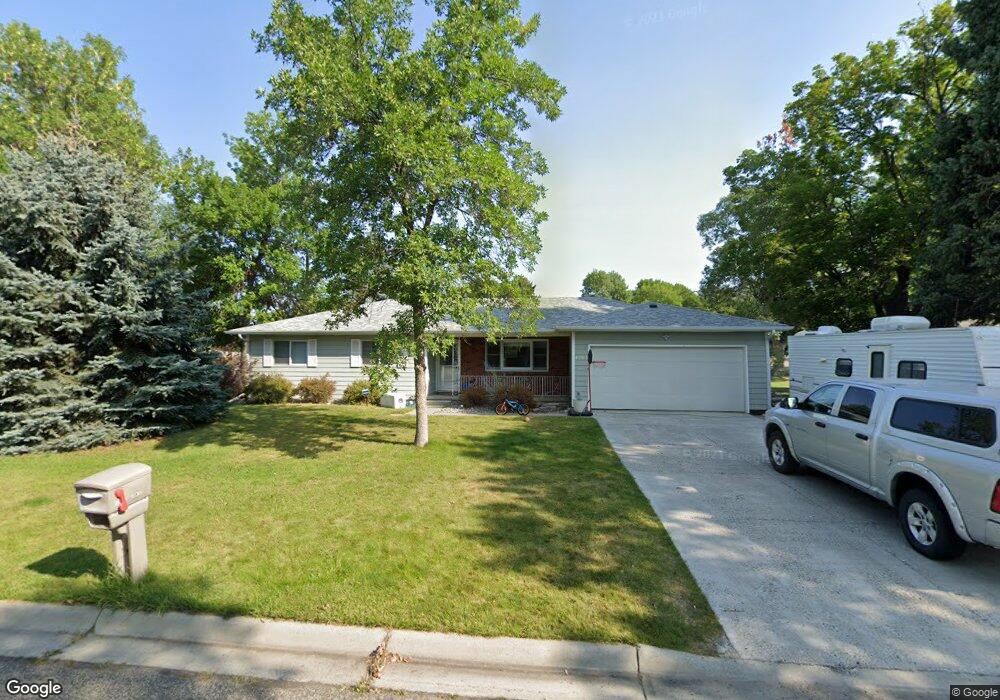
1503 Janie St Billings, MT 59105
Billings Heights NeighborhoodEstimated Value: $306,056 - $321,000
3
Beds
2
Baths
1,248
Sq Ft
$252/Sq Ft
Est. Value
About This Home
This home is located at 1503 Janie St, Billings, MT 59105 and is currently estimated at $314,014, approximately $251 per square foot. 1503 Janie St is a home located in Yellowstone County with nearby schools including Beartooth School, Medicine Crow Middle School, and Skyview High School.
Ownership History
Date
Name
Owned For
Owner Type
Purchase Details
Closed on
Mar 3, 2017
Sold by
Garner Kay and Schlosser Wanda
Bought by
Strum Brian Michael and Strum Rebekah Ann
Current Estimated Value
Home Financials for this Owner
Home Financials are based on the most recent Mortgage that was taken out on this home.
Original Mortgage
$178,383
Outstanding Balance
$148,007
Interest Rate
4.19%
Mortgage Type
New Conventional
Estimated Equity
$166,007
Purchase Details
Closed on
Jun 22, 2009
Sold by
Nagengast Kristine
Bought by
Garner Kay and Schlosser Wanda
Create a Home Valuation Report for This Property
The Home Valuation Report is an in-depth analysis detailing your home's value as well as a comparison with similar homes in the area
Home Values in the Area
Average Home Value in this Area
Purchase History
| Date | Buyer | Sale Price | Title Company |
|---|---|---|---|
| Strum Brian Michael | -- | First Montana Title | |
| Garner Kay | -- | Ctic |
Source: Public Records
Mortgage History
| Date | Status | Borrower | Loan Amount |
|---|---|---|---|
| Open | Strum Brian Michael | $178,383 |
Source: Public Records
Tax History
| Year | Tax Paid | Tax Assessment Tax Assessment Total Assessment is a certain percentage of the fair market value that is determined by local assessors to be the total taxable value of land and additions on the property. | Land | Improvement |
|---|---|---|---|---|
| 2025 | $2,799 | $308,400 | $63,887 | $244,513 |
| 2024 | $2,799 | $282,500 | $60,031 | $222,469 |
| 2023 | $2,814 | $282,500 | $60,031 | $222,469 |
| 2022 | $1,870 | $198,100 | $0 | $0 |
| 2021 | $2,172 | $198,100 | $0 | $0 |
| 2020 | $2,212 | $192,900 | $0 | $0 |
| 2019 | $2,113 | $192,900 | $0 | $0 |
| 2018 | $1,933 | $171,600 | $0 | $0 |
| 2017 | $1,878 | $171,600 | $0 | $0 |
| 2016 | $1,759 | $162,400 | $0 | $0 |
| 2015 | $1,719 | $162,400 | $0 | $0 |
| 2014 | $1,557 | $77,539 | $0 | $0 |
Source: Public Records
Map
Nearby Homes
- 1635 Elaine St
- 1602 Wicks Ln Unit 8
- 1312 Maurine St
- 1402 Emma Ave
- 1409 Carson Way
- 1724 Natalie St
- 1327 Tania Cir
- 1961 Bitterroot Dr
- 1518 S Ping Cir
- 1330 Anchor Ave
- 1615 Cherry Creek Loop
- 6 N Bing
- 1 Attika St N
- 1320 Mading Dr
- 1588 Peony Dr
- 1125 Competition Ave
- 1517 Peony Dr
- 4 Lapin St
- 1261 Cherry Island Dr
- 1272 Cherry Island Dr
Your Personal Tour Guide
Ask me questions while you tour the home.