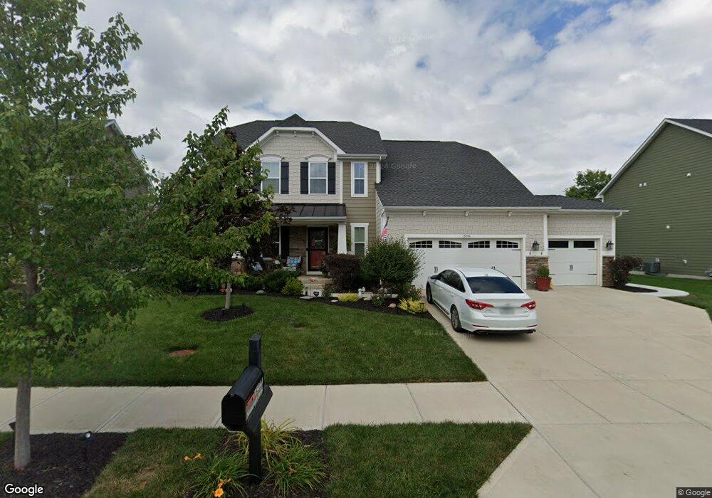
15044 Mancroft Dr Fishers, IN 46037
Estimated Value: $458,000 - $515,000
4
Beds
4
Baths
3,609
Sq Ft
$138/Sq Ft
Est. Value
About This Home
This home is located at 15044 Mancroft Dr, Fishers, IN 46037 and is currently estimated at $496,401, approximately $137 per square foot. 15044 Mancroft Dr is a home located in Hamilton County with nearby schools including Overland Park Elementary School, Southeastern Elementary School, and Hamilton Southeastern Intermediate / Junior High.
Ownership History
Date
Name
Owned For
Owner Type
Purchase Details
Closed on
Aug 29, 2014
Sold by
Saratoga Development Llc
Bought by
Nvr Inc
Current Estimated Value
Purchase Details
Closed on
Jan 15, 2014
Sold by
Nvr Inc
Bought by
Scoble Clinton B and Scoble Tina M
Home Financials for this Owner
Home Financials are based on the most recent Mortgage that was taken out on this home.
Original Mortgage
$301,382
Interest Rate
3.84%
Mortgage Type
New Conventional
Create a Home Valuation Report for This Property
The Home Valuation Report is an in-depth analysis detailing your home's value as well as a comparison with similar homes in the area
Home Values in the Area
Average Home Value in this Area
Purchase History
| Date | Buyer | Sale Price | Title Company |
|---|---|---|---|
| Nvr Inc | -- | None Available | |
| Scoble Clinton B | -- | None Available |
Source: Public Records
Mortgage History
| Date | Status | Borrower | Loan Amount |
|---|---|---|---|
| Previous Owner | Scoble Clinton B | $301,382 |
Source: Public Records
Tax History Compared to Growth
Tax History
| Year | Tax Paid | Tax Assessment Tax Assessment Total Assessment is a certain percentage of the fair market value that is determined by local assessors to be the total taxable value of land and additions on the property. | Land | Improvement |
|---|---|---|---|---|
| 2024 | $4,586 | $414,700 | $71,500 | $343,200 |
| 2023 | $4,586 | $400,700 | $71,500 | $329,200 |
| 2022 | $4,258 | $355,600 | $71,500 | $284,100 |
| 2021 | $3,794 | $317,600 | $71,500 | $246,100 |
| 2020 | $3,729 | $308,400 | $71,500 | $236,900 |
| 2019 | $3,721 | $307,700 | $68,300 | $239,400 |
| 2018 | $3,730 | $307,700 | $68,300 | $239,400 |
| 2017 | $3,650 | $306,100 | $68,300 | $237,800 |
| 2016 | $3,685 | $309,100 | $68,300 | $240,800 |
| 2014 | $13 | $600 | $600 | $0 |
Source: Public Records
Map
Nearby Homes
- 15063 Mancroft Dr
- 15311 Forest Glade Dr
- 13538 Longrise Ln
- 0 E 136th St Unit MBR22040185
- 15163 Farrington Way
- 15472 Cardonia Rd
- 15131 Farrington Way
- 15198 Swallow Falls Way
- 15464 Cardonia Rd
- 15147 Farrington Way
- 15123 Farrington Way
- 15444 Postman Rd
- 15104 Downham Dr
- 15269 Staffordshire Way
- Springfield Plan at Abbott Commons - Heritage
- 15480 Postman Rd
- 15511 Postman Rd
- 15363 Alperton Rd
- Kingston Plan at Abbott Commons - Venture
- Chartwell Plan at Abbott Commons - Heritage
- 15034 Mancroft Dr
- 15054 Mancroft Dr
- 15064 Mancroft Dr
- 15024 Mancroft Dr
- 15053 Mancroft Dr
- 15043 Mancroft Dr
- 15033 Mancroft Dr
- 15014 Mancroft Dr
- 15074 Mancroft Dr
- 15023 Mancroft Dr
- 15073 Mancroft Dr
- 15013 Mancroft Dr
- 15004 Mancroft Dr
- 15084 Mancroft Dr
- 15083 Mancroft Dr
- 14994 Mancroft Dr
- 14930 Dennison Dr
- 13397 Dennison Dr
- 15094 Bentfield Ct
- 14993 Mancroft Dr