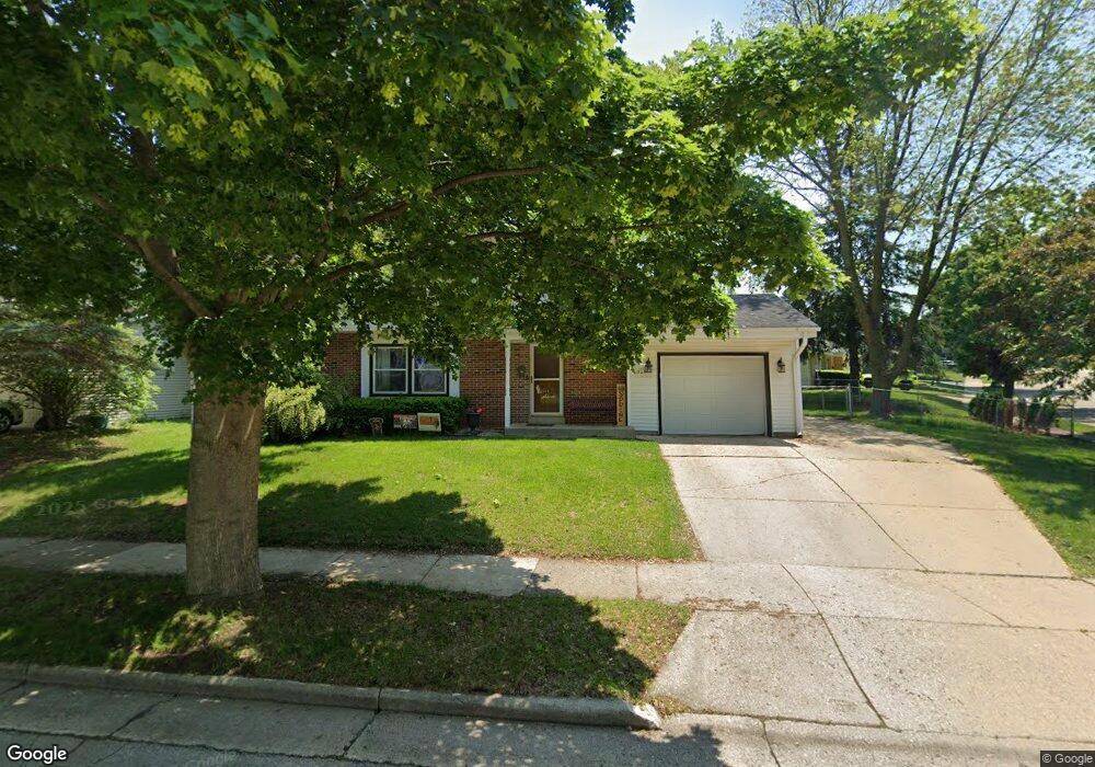
1505 Atlantic Dr Waukesha, WI 53186
Estimated Value: $369,882 - $399,000
4
Beds
2
Baths
1,740
Sq Ft
$220/Sq Ft
Est. Value
About This Home
This home is located at 1505 Atlantic Dr, Waukesha, WI 53186 and is currently estimated at $381,971, approximately $219 per square foot. 1505 Atlantic Dr is a home located in Waukesha County with nearby schools including John F. Miller School, Banting Elementary School, and Horning Middle School.
Ownership History
Date
Name
Owned For
Owner Type
Purchase Details
Closed on
May 30, 2007
Sold by
Mathwick Catherine A and Bayley Catherine A
Bought by
Duszynski Bradley M and Duszynski Irene S
Current Estimated Value
Home Financials for this Owner
Home Financials are based on the most recent Mortgage that was taken out on this home.
Original Mortgage
$184,500
Outstanding Balance
$113,017
Interest Rate
6.21%
Mortgage Type
Purchase Money Mortgage
Estimated Equity
$268,954
Create a Home Valuation Report for This Property
The Home Valuation Report is an in-depth analysis detailing your home's value as well as a comparison with similar homes in the area
Home Values in the Area
Average Home Value in this Area
Purchase History
| Date | Buyer | Sale Price | Title Company |
|---|---|---|---|
| Duszynski Bradley M | $205,000 | None Available |
Source: Public Records
Mortgage History
| Date | Status | Borrower | Loan Amount |
|---|---|---|---|
| Open | Duszynski Bradley M | $184,500 |
Source: Public Records
Tax History Compared to Growth
Tax History
| Year | Tax Paid | Tax Assessment Tax Assessment Total Assessment is a certain percentage of the fair market value that is determined by local assessors to be the total taxable value of land and additions on the property. | Land | Improvement |
|---|---|---|---|---|
| 2024 | $4,344 | $294,400 | $55,000 | $239,400 |
| 2023 | $4,219 | $294,400 | $55,000 | $239,400 |
| 2022 | $4,059 | $213,100 | $52,100 | $161,000 |
| 2021 | $4,151 | $213,100 | $52,100 | $161,000 |
| 2020 | $4,017 | $213,100 | $52,100 | $161,000 |
| 2019 | $3,888 | $213,100 | $52,100 | $161,000 |
| 2018 | $3,639 | $195,500 | $46,300 | $149,200 |
| 2017 | $3,633 | $195,500 | $46,300 | $149,200 |
| 2016 | $3,480 | $176,100 | $46,300 | $129,800 |
| 2015 | $3,461 | $176,100 | $46,300 | $129,800 |
| 2014 | $3,535 | $172,600 | $46,300 | $126,300 |
| 2013 | $3,535 | $172,600 | $46,300 | $126,300 |
Source: Public Records
Map
Nearby Homes
- 1112 Gertrude St
- 1116 Josephine St
- 1729 Stardust Dr Unit B
- 2109 Melody Ln
- 1308 Danny St
- 1415 Niagara St Unit 109
- 1333 Niagara St
- 1471 Cleveland Ave
- 918 Niagara St
- 1542 Whiterock Ave
- 937 E Moreland Blvd
- 1522 Pewaukee Rd
- 925 Harding Ave
- N10W23564 Robinhood Ct
- 440 Gascoigne Dr
- 1021 Aurora St
- 526 Peters Dr
- 1103 Arcadian Ave
- 1021 Arcadian Ave
- 1139 White Rock Ave
- 1508 Atlantic Dr
- 1512 Atlantic Dr
- 2031 Manhattan Dr
- 1511 Atlantic Dr
- 1500 Atlantic Dr
- 2027 Manhattan Dr
- 1433 Atlantic Dr
- 1519 Atlantic Dr
- 1432 Atlantic Dr
- 2021 Manhattan Dr
- 2044 Butler Dr
- 2026 Manhattan Dr
- 2038 Butler Dr
- 1426 Atlantic Dr
- 2020 Manhattan Dr
- 1520 Atlantic Dr
- 1427 Atlantic Dr
- 2032 Butler Dr
- 2137 Empire Dr
- 2017 Manhattan Dr