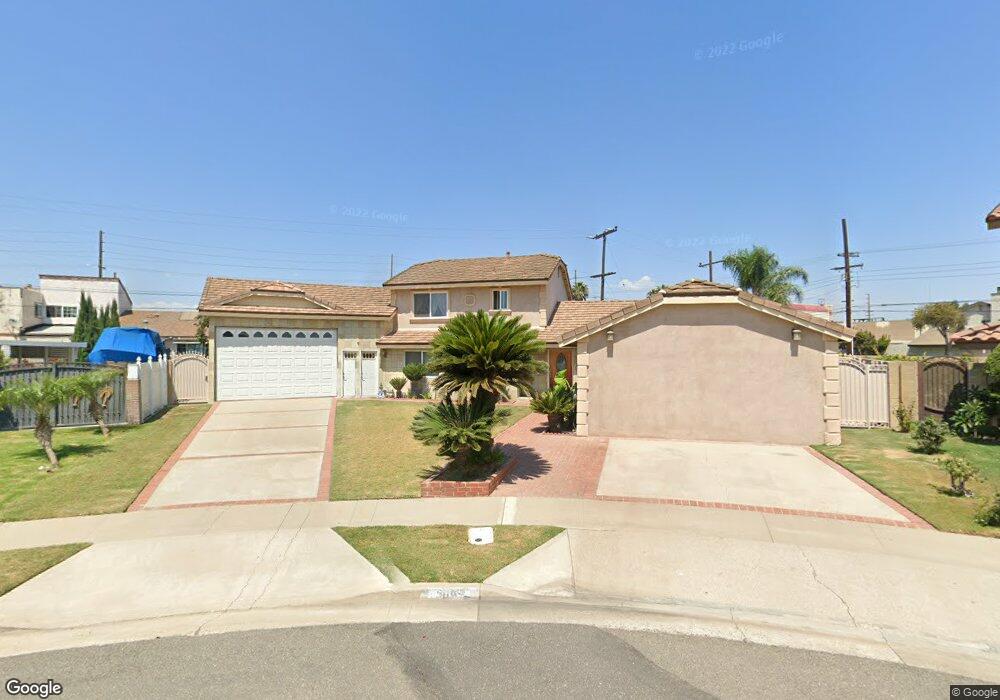
15062 Wales Cir Westminster, CA 92683
Star View NeighborhoodEstimated Value: $1,009,000 - $1,331,000
3
Beds
2
Baths
2,120
Sq Ft
$579/Sq Ft
Est. Value
About This Home
This home is located at 15062 Wales Cir, Westminster, CA 92683 and is currently estimated at $1,227,657, approximately $579 per square foot. 15062 Wales Cir is a home located in Orange County with nearby schools including Susan B. Anthony Elementary School, McGarvin Intermediate School, and La Quinta High School.
Ownership History
Date
Name
Owned For
Owner Type
Purchase Details
Closed on
Jan 5, 2004
Sold by
Tran Quy Kim
Bought by
Tran Hau
Current Estimated Value
Purchase Details
Closed on
Sep 2, 1994
Sold by
Tran Qui and Tran Thoai
Bought by
Tran Qui
Purchase Details
Closed on
Jun 13, 1994
Sold by
Tran Hien Thi
Bought by
Tran Thoai
Home Financials for this Owner
Home Financials are based on the most recent Mortgage that was taken out on this home.
Original Mortgage
$165,600
Interest Rate
8.25%
Purchase Details
Closed on
Jun 1, 1994
Sold by
Butner Norman L and Butner Angelina R
Bought by
Tran Quy and Tran Thoai
Home Financials for this Owner
Home Financials are based on the most recent Mortgage that was taken out on this home.
Original Mortgage
$165,600
Interest Rate
8.25%
Create a Home Valuation Report for This Property
The Home Valuation Report is an in-depth analysis detailing your home's value as well as a comparison with similar homes in the area
Home Values in the Area
Average Home Value in this Area
Purchase History
| Date | Buyer | Sale Price | Title Company |
|---|---|---|---|
| Tran Hau | -- | -- | |
| Tran Qui | -- | -- | |
| Tran Thoai | -- | North American Title Co | |
| Tran Quy | $207,000 | North American Title Co |
Source: Public Records
Mortgage History
| Date | Status | Borrower | Loan Amount |
|---|---|---|---|
| Previous Owner | Tran Quy | $165,600 |
Source: Public Records
Tax History
| Year | Tax Paid | Tax Assessment Tax Assessment Total Assessment is a certain percentage of the fair market value that is determined by local assessors to be the total taxable value of land and additions on the property. | Land | Improvement |
|---|---|---|---|---|
| 2025 | $7,423 | $625,582 | $489,946 | $135,636 |
| 2024 | $7,423 | $613,316 | $480,339 | $132,977 |
| 2023 | $7,284 | $601,291 | $470,921 | $130,370 |
| 2022 | $7,126 | $589,501 | $461,687 | $127,814 |
| 2021 | $7,035 | $577,943 | $452,635 | $125,308 |
| 2020 | $6,943 | $572,017 | $447,993 | $124,024 |
| 2019 | $6,812 | $560,801 | $439,208 | $121,593 |
| 2018 | $6,680 | $549,805 | $430,596 | $119,209 |
| 2017 | $6,594 | $539,025 | $422,153 | $116,872 |
| 2016 | $6,315 | $528,456 | $413,875 | $114,581 |
| 2015 | $6,231 | $520,519 | $407,659 | $112,860 |
| 2014 | $6,084 | $510,323 | $399,673 | $110,650 |
Source: Public Records
Map
Nearby Homes
- 14831 Deanann Place
- 10200 Bolsa Ave Unit 111
- 10200 Bolsa Ave Unit 69
- 10200 Bolsa Ave Unit 100
- 5326 W Henderson Place
- 602 S Deming St
- 5410 W Davit Ave
- 5317 Silver Dr
- 507 S Euclid St Unit 106
- 14799 Apricot Ln
- 10721 Hazard Ave
- 728 N Euclid St
- 14356 Taft St
- 9702 Bolsa Ave Unit 30
- 5002 W Mcfadden Ave
- 13322 Euclid St
- 15928 Prell Ct
- 1014 Sheffield St
- 842 S Corta Dr
- 9906 13th St
- 15082 Wales Cir
- 10480 Neal Dr Unit 12
- 10490 Neal Dr
- 10474 Neal Dr Unit 18
- 15061 Wales Cir
- 10470 Neal Dr
- 10471 Neal Dr Unit 4
- 10491 Neal Dr Unit 1
- 15092 Wales Cir
- 10460 Neal Dr Unit 16
- 15081 Wales Cir
- 10475 Neal Dr Unit 3
- 10461 Neal Dr Unit 5
- 10454 Neal Dr Unit 15
- 10481 Neal Dr
- 15052 Ward St
- 10450 Neal Dr
- 15091 Wales Cir
- 10490 Bolsa Ave
- 15082 Brighton St