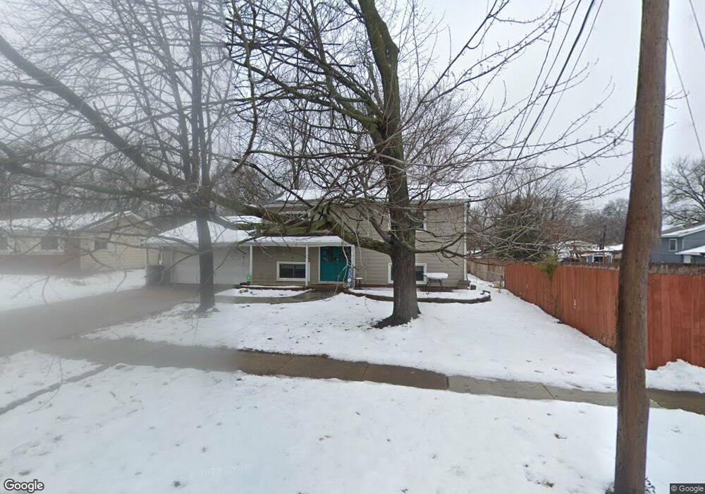
1507 Davis Rd Lawrence, KS 66046
Estimated Value: $225,000 - $245,000
4
Beds
2
Baths
1,570
Sq Ft
$152/Sq Ft
Est. Value
About This Home
This home is located at 1507 Davis Rd, Lawrence, KS 66046 and is currently estimated at $238,247, approximately $151 per square foot. 1507 Davis Rd is a home located in Douglas County with nearby schools including Kennedy Elementary School, Liberty Memorial Central Middle School, and Lawrence High School.
Ownership History
Date
Name
Owned For
Owner Type
Purchase Details
Closed on
Jul 22, 2025
Sold by
Zandieh Hooman
Bought by
Broadbent Rylee
Current Estimated Value
Home Financials for this Owner
Home Financials are based on the most recent Mortgage that was taken out on this home.
Original Mortgage
$200,000
Outstanding Balance
$199,656
Interest Rate
6.77%
Mortgage Type
New Conventional
Estimated Equity
$38,591
Purchase Details
Closed on
Feb 26, 2001
Sold by
Stevenson David L and Stevenson Christine L
Bought by
Kuzinski Matthew E and Kuzinski Molly
Home Financials for this Owner
Home Financials are based on the most recent Mortgage that was taken out on this home.
Original Mortgage
$98,800
Interest Rate
7.19%
Mortgage Type
Purchase Money Mortgage
Create a Home Valuation Report for This Property
The Home Valuation Report is an in-depth analysis detailing your home's value as well as a comparison with similar homes in the area
Home Values in the Area
Average Home Value in this Area
Purchase History
| Date | Buyer | Sale Price | Title Company |
|---|---|---|---|
| Broadbent Rylee | -- | Eland Title | |
| Broadbent Rylee | -- | Eland Title | |
| Kuzinski Matthew E | -- | Douglas County Title Co |
Source: Public Records
Mortgage History
| Date | Status | Borrower | Loan Amount |
|---|---|---|---|
| Open | Broadbent Rylee | $200,000 | |
| Closed | Broadbent Rylee | $200,000 | |
| Previous Owner | Kuzinski Matthew E | $98,800 |
Source: Public Records
Tax History Compared to Growth
Tax History
| Year | Tax Paid | Tax Assessment Tax Assessment Total Assessment is a certain percentage of the fair market value that is determined by local assessors to be the total taxable value of land and additions on the property. | Land | Improvement |
|---|---|---|---|---|
| 2025 | $3,227 | $26,514 | $5,750 | $20,764 |
| 2024 | $3,138 | $25,806 | $5,405 | $20,401 |
| 2023 | $3,056 | $24,047 | $5,175 | $18,872 |
| 2022 | $2,952 | $23,058 | $4,600 | $18,458 |
| 2021 | $2,507 | $18,906 | $4,368 | $14,538 |
| 2020 | $2,336 | $17,726 | $4,368 | $13,358 |
| 2019 | $2,220 | $16,882 | $3,798 | $13,084 |
| 2018 | $2,089 | $16,675 | $3,571 | $13,104 |
| 2017 | $2,093 | $15,640 | $3,571 | $12,069 |
| 2016 | $1,909 | $14,927 | $3,450 | $11,477 |
| 2015 | $1,821 | $14,249 | $3,450 | $10,799 |
| 2014 | $1,853 | $14,640 | $3,450 | $11,190 |
Source: Public Records
Map
Nearby Homes
- 2014 Maple Ln
- 1711 E 21st Terrace
- 1829 Brook St
- 1736 Brook St
- 1103 E 18th St
- 2200 Harper St Unit C24
- 1603 Harper St
- 1316 E 16th St
- 923 Ward Ave
- 5701 Johnson Ave
- 1221 E 25th St
- 331 E 19th St
- 1625 Pennsylvania St
- 2516 Kensington Rd
- 0 Delaware St
- 2028 New Hampshire St
- 1320 Pennsylvania St
- 1320 Pennsylvania St Unit apartment above gara
- 1424 New York St
- 2706 Bonanza St