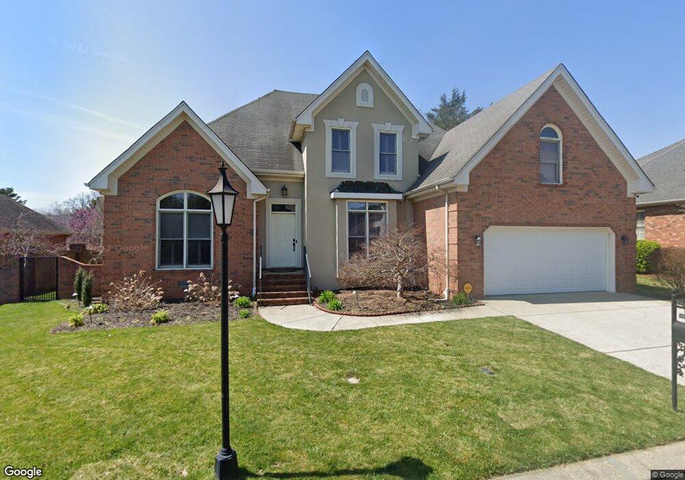
1507 Mohawk Trail Murfreesboro, TN 37129
Estimated Value: $464,000 - $545,000
Studio
3
Baths
2,218
Sq Ft
$223/Sq Ft
Est. Value
About This Home
This home is located at 1507 Mohawk Trail, Murfreesboro, TN 37129 and is currently estimated at $494,881, approximately $223 per square foot. 1507 Mohawk Trail is a home located in Rutherford County with nearby schools including Northfield Elementary School, Siegel Middle School, and Siegel High School.
Ownership History
Date
Name
Owned For
Owner Type
Purchase Details
Closed on
Oct 12, 2012
Sold by
Gray Thomas Richard
Bought by
Spies Justin B
Current Estimated Value
Home Financials for this Owner
Home Financials are based on the most recent Mortgage that was taken out on this home.
Original Mortgage
$198,900
Outstanding Balance
$138,314
Interest Rate
3.6%
Mortgage Type
Commercial
Estimated Equity
$356,567
Purchase Details
Closed on
Mar 23, 2009
Sold by
Gray Patricia Dawn
Bought by
Gray Thomas Richard
Create a Home Valuation Report for This Property
The Home Valuation Report is an in-depth analysis detailing your home's value as well as a comparison with similar homes in the area
Home Values in the Area
Average Home Value in this Area
Purchase History
| Date | Buyer | Sale Price | Title Company |
|---|---|---|---|
| Spies Justin B | $221,000 | -- | |
| Gray Thomas Richard | -- | -- |
Source: Public Records
Mortgage History
| Date | Status | Borrower | Loan Amount |
|---|---|---|---|
| Open | Spies Justin B | $198,900 |
Source: Public Records
Tax History
| Year | Tax Paid | Tax Assessment Tax Assessment Total Assessment is a certain percentage of the fair market value that is determined by local assessors to be the total taxable value of land and additions on the property. | Land | Improvement |
|---|---|---|---|---|
| 2025 | $2,642 | $93,400 | $13,750 | $79,650 |
| 2024 | $2,642 | $93,400 | $13,750 | $79,650 |
| 2023 | $1,752 | $93,400 | $13,750 | $79,650 |
| 2022 | $1,510 | $93,400 | $13,750 | $79,650 |
| 2021 | $1,383 | $62,300 | $11,875 | $50,425 |
| 2020 | $1,383 | $62,300 | $11,875 | $50,425 |
| 2019 | $1,383 | $62,300 | $11,875 | $50,425 |
| 2018 | $1,899 | $62,300 | $0 | $0 |
| 2017 | $2,061 | $53,025 | $0 | $0 |
| 2016 | $2,061 | $53,025 | $0 | $0 |
| 2015 | $2,061 | $53,025 | $0 | $0 |
| 2014 | $1,319 | $53,025 | $0 | $0 |
| 2013 | -- | $54,825 | $0 | $0 |
Source: Public Records
Map
Nearby Homes
- 1434 Sioux Place
- 1403 Cree Ct
- 1416 Mohawk Trail
- 1454 Indian Place
- Sinclair Plan at Slatewood
- Hibiscus Plan at Slatewood
- Buchanan II Plan at Slatewood
- 2701 Slatewood Way
- 1602 Balsawood Ln
- 1606 Balsawood Ln
- 2522 Wiltshire Dr
- 1604 Burlwood Ct
- 2910 Sulphur Springs Rd
- 2707 Bertram Ct
- 2250 Wiltshire Dr
- 1706 Wiltshire Dr
- 2606 Battleground Dr
- 2107 Moccasin Trail
- 1719 Waterford Rd
- 1611 Saltlick Place
- 1503 Mohawk Trail
- 1506 Yuma Ct
- 1511 Mohawk Trail
- 1506 Mohawk Trail
- 1419 Ottawa Place
- 1510 Mohawk Trail
- 2522 Apache Trail
- 1510 Yuma Ct
- 2518 Apache Trail
- 1428 Mohawk Trail
- 1406 Cree Ct
- 1423 Mohawk Trail
- 1414 Ottawa Place
- 1407 Ottawa Place
- 1418 Ottawa Place
- 2514 Apache Trail
- 1424 Mohawk Trail
- 1410 Ottawa Place
- 1407 Cree Ct
- 1511 Yuma Ct
Your Personal Tour Guide
Ask me questions while you tour the home.