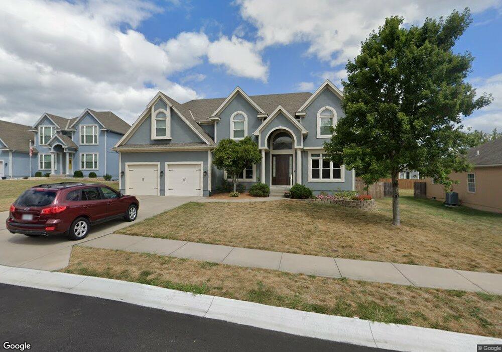
1508 SW 42nd Ct Lees Summit, MO 64082
Estimated Value: $572,288 - $641,000
4
Beds
5
Baths
3,135
Sq Ft
$191/Sq Ft
Est. Value
About This Home
This home is located at 1508 SW 42nd Ct, Lees Summit, MO 64082 and is currently estimated at $600,322, approximately $191 per square foot. 1508 SW 42nd Ct is a home located in Jackson County with nearby schools including Summit Pointe Elementary School, Summit Lakes Middle School, and Lee's Summit West High School.
Ownership History
Date
Name
Owned For
Owner Type
Purchase Details
Closed on
Jun 23, 2009
Sold by
North American Savings Bank Fsb
Bought by
Bruce Sherry E and Bruce Wendell K
Current Estimated Value
Home Financials for this Owner
Home Financials are based on the most recent Mortgage that was taken out on this home.
Original Mortgage
$212,280
Outstanding Balance
$135,562
Interest Rate
4.97%
Mortgage Type
Seller Take Back
Estimated Equity
$464,760
Purchase Details
Closed on
Feb 5, 2009
Sold by
Mcgovern Builders Inc
Bought by
North American Savings Bank Fsb
Purchase Details
Closed on
Jun 30, 2005
Sold by
Stoney Creek Development Llc
Bought by
Mcgovern Builders Inc
Home Financials for this Owner
Home Financials are based on the most recent Mortgage that was taken out on this home.
Original Mortgage
$273,190
Interest Rate
5.67%
Mortgage Type
Purchase Money Mortgage
Create a Home Valuation Report for This Property
The Home Valuation Report is an in-depth analysis detailing your home's value as well as a comparison with similar homes in the area
Home Values in the Area
Average Home Value in this Area
Purchase History
| Date | Buyer | Sale Price | Title Company |
|---|---|---|---|
| Bruce Sherry E | -- | Chicago | |
| North American Savings Bank Fsb | $216,750 | None Available | |
| Mcgovern Builders Inc | -- | Coffelt Land Title Inc |
Source: Public Records
Mortgage History
| Date | Status | Borrower | Loan Amount |
|---|---|---|---|
| Open | Bruce Sherry E | $212,280 | |
| Previous Owner | Mcgovern Builders Inc | $273,190 |
Source: Public Records
Tax History Compared to Growth
Tax History
| Year | Tax Paid | Tax Assessment Tax Assessment Total Assessment is a certain percentage of the fair market value that is determined by local assessors to be the total taxable value of land and additions on the property. | Land | Improvement |
|---|---|---|---|---|
| 2025 | $7,548 | $93,221 | $15,458 | $77,763 |
| 2024 | $7,493 | $104,538 | $12,958 | $91,580 |
| 2023 | $7,493 | $104,538 | $12,276 | $92,262 |
| 2022 | $5,690 | $70,490 | $8,066 | $62,424 |
| 2021 | $5,808 | $70,490 | $8,066 | $62,424 |
| 2020 | $5,582 | $67,092 | $8,066 | $59,026 |
| 2019 | $5,430 | $67,092 | $8,066 | $59,026 |
| 2018 | $5,092 | $58,391 | $7,020 | $51,371 |
| 2017 | $4,758 | $58,391 | $7,020 | $51,371 |
| 2016 | $4,758 | $53,998 | $8,379 | $45,619 |
| 2014 | $4,816 | $53,580 | $8,379 | $45,201 |
Source: Public Records
Map
Nearby Homes
- 1520 SW 41st St
- Serenade Plan at Stoney Creek - Bliss Collection
- Oasis Plan at Stoney Creek - Bliss Collection
- Devotion Plan at Stoney Creek - Bliss Collection
- Brookside Plan at Stoney Creek - Premier Collection
- Serenity Plan at Stoney Creek - Bliss Collection
- Avalon Plan at Stoney Creek - Premier Collection
- Harmony Plan at Stoney Creek - Bliss Collection
- 1937 SW Merryman Dr
- Lexington Plan at Stoney Creek - Premier Collection
- Crestwood Plan at Stoney Creek - Premier Collection
- 3940 SW Flintrock Dr
- 4104 SW Flintrock Dr
- 3932 SW Flintrock Dr
- 3925 SW Flintrock Dr
- 3916 SW Flintrock Dr
- 4120 SW Flintrock Dr
- 3917 SW Flintrock Dr
- 3904 SW Flintrock Dr
- Heather Plan at Napa Valley
- 1504 SW 42nd Ct
- 1500 SW 42nd Ct
- 1509 SW 41st St
- 1509 SW 42nd Ct
- 1513 SW 41st St
- 1505 SW 42nd Ct
- 1505 SW 41st St
- 1505 SW 42nd Cir
- 1501 SW 42nd Ct
- 1516 SW 42nd Ct
- 1521 SW 41st St
- 1501 SW 41st St
- 1525 SW 41st St
- 1508 SW 41st St
- 1512 SW 41st St
- 1517 SW 42nd Ct
- 1508 SW 41st St
- 1529 SW 41st St
- 1504 SW 41st St
- 1504 SW 41st Cir