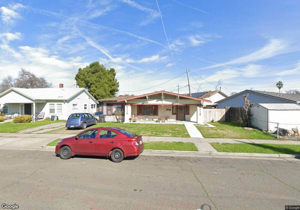
1509 N Berkeley Ave Stockton, CA 95205
Midtown NeighborhoodEstimated Value: $260,000 - $287,284
2
Beds
1
Bath
985
Sq Ft
$275/Sq Ft
Est. Value
About This Home
This home is located at 1509 N Berkeley Ave, Stockton, CA 95205 and is currently estimated at $270,571, approximately $274 per square foot. 1509 N Berkeley Ave is a home located in San Joaquin County with nearby schools including Grunsky Elementary School, Harrison Elementary School, and August Elementary School.
Ownership History
Date
Name
Owned For
Owner Type
Purchase Details
Closed on
Jul 3, 2018
Sold by
Hafley Barbara C
Bought by
Hafley Barbara and The Barbara Hafley Trust
Current Estimated Value
Purchase Details
Closed on
Jun 27, 2000
Sold by
Hafley Barbara C
Bought by
Hafley Barbara C
Home Financials for this Owner
Home Financials are based on the most recent Mortgage that was taken out on this home.
Original Mortgage
$65,000
Interest Rate
8.67%
Mortgage Type
Stand Alone First
Create a Home Valuation Report for This Property
The Home Valuation Report is an in-depth analysis detailing your home's value as well as a comparison with similar homes in the area
Home Values in the Area
Average Home Value in this Area
Purchase History
| Date | Buyer | Sale Price | Title Company |
|---|---|---|---|
| Hafley Barbara | -- | None Available | |
| Hafley Barbara C | -- | Fidelity National Title Co |
Source: Public Records
Mortgage History
| Date | Status | Borrower | Loan Amount |
|---|---|---|---|
| Closed | Hafley Barbara C | $65,000 |
Source: Public Records
Tax History Compared to Growth
Tax History
| Year | Tax Paid | Tax Assessment Tax Assessment Total Assessment is a certain percentage of the fair market value that is determined by local assessors to be the total taxable value of land and additions on the property. | Land | Improvement |
|---|---|---|---|---|
| 2025 | $1,414 | $70,189 | $29,432 | $40,757 |
| 2024 | $953 | $68,813 | $28,855 | $39,958 |
| 2023 | $1,739 | $67,465 | $28,290 | $39,175 |
| 2022 | $1,098 | $66,143 | $27,736 | $38,407 |
| 2021 | $867 | $64,847 | $27,193 | $37,654 |
| 2020 | $882 | $64,183 | $26,915 | $37,268 |
| 2019 | $1,301 | $62,926 | $26,388 | $36,538 |
| 2018 | $953 | $61,693 | $25,871 | $35,822 |
| 2017 | $820 | $60,484 | $25,364 | $35,120 |
| 2016 | $744 | $59,298 | $24,867 | $34,431 |
| 2014 | $796 | $57,264 | $24,014 | $33,250 |
Source: Public Records
Map
Nearby Homes
- 1272 N Airport Way
- 1372 Bradford St
- 1818 West Ln
- 1155 N Pilgrim St
- 1135 N Pilgrim St
- 1711 E Walnut St
- 1751 Sycamore Ave
- 1620 Sycamore Ave
- 1037 N Airport Way
- 1751 Sunnyside Ave
- 1702 Sunnyside Ave
- 1600 Sunnyside Ave
- 1257 Sunnyside Ave
- 1902 E Harding Way
- 1813 E Anita St
- 1143 E Park St
- 1123 E Park St
- 434 E Cleveland St
- 1845 E Poplar St
- 644 N Airport Way
- 1515 N Berkeley Ave
- 1615 West Ln
- 1605 West Ln
- 1627 West Ln
- 1616 N Berkeley Ave
- 1635 West Ln
- 1516 N Berkeley Ave
- 1217 E Harding Way
- 1620 N Berkeley Ave
- 1215 E Harding Way
- 1223 E Harding Way
- 1637 West Ln
- 1520 N Berkeley Ave
- 1626 N Berkeley Ave
- 1639 West Ln
- 1209 E Harding Way
- 1138 E Fairfax Rd
- 1630 N Berkeley Ave
- 952 West Ln Unit 1
- 1518 West Ln