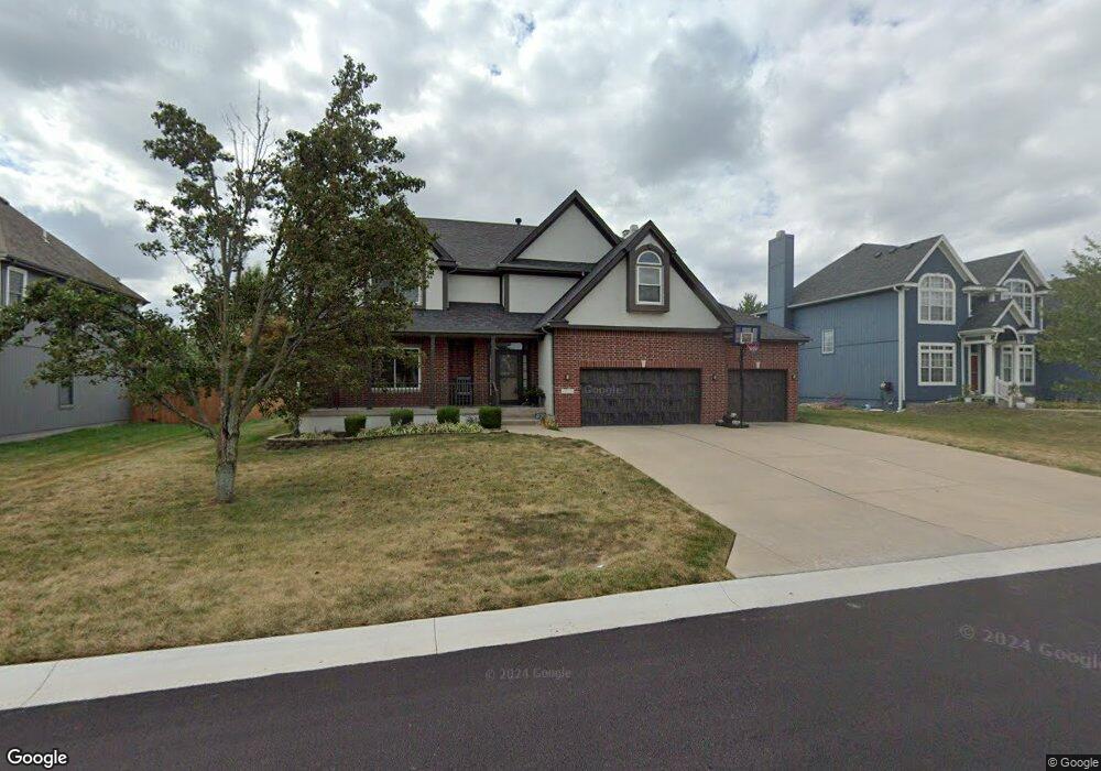
1509 SW 41st St Lees Summit, MO 64082
Estimated Value: $517,910 - $569,000
4
Beds
4
Baths
3,171
Sq Ft
$171/Sq Ft
Est. Value
About This Home
This home is located at 1509 SW 41st St, Lees Summit, MO 64082 and is currently estimated at $543,478, approximately $171 per square foot. 1509 SW 41st St is a home located in Jackson County with nearby schools including Summit Pointe Elementary School, Summit Lakes Middle School, and Lee's Summit West High School.
Ownership History
Date
Name
Owned For
Owner Type
Purchase Details
Closed on
Sep 30, 2009
Sold by
North American Savings Bank Fsb
Bought by
Davis Keith and Davis Loretta
Current Estimated Value
Home Financials for this Owner
Home Financials are based on the most recent Mortgage that was taken out on this home.
Original Mortgage
$266,385
Outstanding Balance
$174,300
Interest Rate
5.12%
Mortgage Type
Seller Take Back
Estimated Equity
$369,178
Purchase Details
Closed on
Feb 5, 2009
Sold by
Mcgovern Builders Inc
Bought by
North American Savings Bank Fsb
Purchase Details
Closed on
Jun 30, 2005
Sold by
Stoney Creek Development Llc
Bought by
Mcgovern Builders Inc
Home Financials for this Owner
Home Financials are based on the most recent Mortgage that was taken out on this home.
Original Mortgage
$266,065
Interest Rate
5.67%
Mortgage Type
Purchase Money Mortgage
Create a Home Valuation Report for This Property
The Home Valuation Report is an in-depth analysis detailing your home's value as well as a comparison with similar homes in the area
Home Values in the Area
Average Home Value in this Area
Purchase History
| Date | Buyer | Sale Price | Title Company |
|---|---|---|---|
| Davis Keith | -- | Chicago | |
| North American Savings Bank Fsb | $216,750 | None Available | |
| Mcgovern Builders Inc | -- | Coffelt Land Title Inc |
Source: Public Records
Mortgage History
| Date | Status | Borrower | Loan Amount |
|---|---|---|---|
| Open | Davis Keith | $266,385 | |
| Previous Owner | Mcgovern Builders Inc | $266,065 |
Source: Public Records
Tax History
| Year | Tax Paid | Tax Assessment Tax Assessment Total Assessment is a certain percentage of the fair market value that is determined by local assessors to be the total taxable value of land and additions on the property. | Land | Improvement |
|---|---|---|---|---|
| 2025 | $7,766 | $85,433 | $15,458 | $69,975 |
| 2024 | $7,710 | $107,555 | $12,591 | $94,964 |
| 2023 | $7,710 | $107,555 | $11,945 | $95,610 |
| 2022 | $5,215 | $64,600 | $7,754 | $56,846 |
| 2021 | $5,323 | $64,600 | $7,754 | $56,846 |
| 2020 | $5,369 | $64,527 | $7,754 | $56,773 |
| 2019 | $5,222 | $64,527 | $7,754 | $56,773 |
| 2018 | $4,898 | $56,159 | $6,748 | $49,411 |
| 2016 | $4,574 | $51,908 | $8,208 | $43,700 |
Source: Public Records
Map
Nearby Homes
- 1937 SW Merryman Dr
- 3940 SW Flintrock Dr
- 3932 SW Flintrock Dr
- 1409 SW Whistle Dr
- 3925 SW Flintrock Dr
- 3916 SW Flintrock Dr
- 3904 SW Flintrock Dr
- 3916 SW Granite Ln
- 4244 SW Stoney Brook Dr
- 4212 SW Stoney Brook Dr
- 1505 SW Georgetown Dr
- 4404 SW Flintrock Dr
- 1620 SW Napa Valley Dr
- 4413 SW Flintrock Dr
- 4407 SW Briarbrook Dr
- 3920 SW Stoney Brook Dr
- 1329 SW Merryman Dr
- 3904 SW Stoney Brook Dr
- 1009 SW Drake Cir
- 1008 SW Whistle Dr
- 1505 SW 41st St
- 1508 SW 41st St
- 1513 SW 41st St
- 1508 SW 41st St
- 1512 SW 41st St
- 1504 SW 41st St
- 1504 SW 41st Cir
- 1508 SW 42nd Ct
- 1501 SW 41st St
- 1521 SW 41st St
- 1500 SW 41st St
- 1516 SW 41st St
- 1504 SW 42nd Ct
- 1500 SW 42nd Ct
- 4018 SW Flintrock Dr
- 1525 SW 41st St
- 4014 SW Flintrock Dr
- 1516 SW 42nd Ct
- 4022 SW Flintrock Dr
- 1505 SW 42nd Ct
Your Personal Tour Guide
Ask me questions while you tour the home.