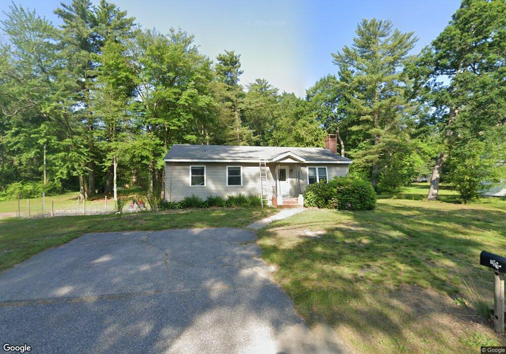
151 Back River Rd Bedford, NH 03110
Bedford NeighborhoodEstimated Value: $473,846 - $592,000
2
Beds
1
Bath
1,176
Sq Ft
$434/Sq Ft
Est. Value
About This Home
This home is located at 151 Back River Rd, Bedford, NH 03110 and is currently estimated at $510,712, approximately $434 per square foot. 151 Back River Rd is a home located in Hillsborough County with nearby schools including Mckelvie Intermediate School, Ross A. Lurgio Middle School, and Bedford High School.
Ownership History
Date
Name
Owned For
Owner Type
Purchase Details
Closed on
Oct 17, 2016
Sold by
Noga Nancy M
Bought by
Noga Aaron C and Noga Elise C
Current Estimated Value
Home Financials for this Owner
Home Financials are based on the most recent Mortgage that was taken out on this home.
Original Mortgage
$140,800
Outstanding Balance
$112,878
Interest Rate
3.46%
Mortgage Type
Purchase Money Mortgage
Estimated Equity
$397,834
Create a Home Valuation Report for This Property
The Home Valuation Report is an in-depth analysis detailing your home's value as well as a comparison with similar homes in the area
Home Values in the Area
Average Home Value in this Area
Purchase History
| Date | Buyer | Sale Price | Title Company |
|---|---|---|---|
| Noga Aaron C | $176,000 | -- |
Source: Public Records
Mortgage History
| Date | Status | Borrower | Loan Amount |
|---|---|---|---|
| Open | Noga Aaron C | $140,800 |
Source: Public Records
Tax History Compared to Growth
Tax History
| Year | Tax Paid | Tax Assessment Tax Assessment Total Assessment is a certain percentage of the fair market value that is determined by local assessors to be the total taxable value of land and additions on the property. | Land | Improvement |
|---|---|---|---|---|
| 2024 | $6,348 | $401,500 | $227,000 | $174,500 |
| 2023 | $5,942 | $401,500 | $227,000 | $174,500 |
| 2022 | $5,771 | $327,900 | $168,200 | $159,700 |
| 2021 | $5,620 | $327,900 | $168,200 | $159,700 |
| 2020 | $5,223 | $260,900 | $122,200 | $138,700 |
| 2019 | $4,944 | $260,900 | $122,200 | $138,700 |
| 2018 | $4,823 | $236,400 | $115,000 | $121,400 |
| 2017 | $4,470 | $236,400 | $115,000 | $121,400 |
| 2016 | $4,306 | $192,500 | $86,200 | $106,300 |
| 2015 | $4,381 | $192,500 | $86,200 | $106,300 |
| 2014 | $4,331 | $192,500 | $86,200 | $106,300 |
| 2013 | $4,268 | $192,500 | $86,200 | $106,300 |
Source: Public Records
Map
Nearby Homes
- 197 Liberty Hill Rd
- 18 Horizon Dr
- 10 Barrington Dr
- 29 Pebble Beach Dr
- 15 Spyglass Point Cir
- 20 Pebble Beach Dr Unit 22-89-20
- 34 Chatham Dr
- 116 Nashua Rd
- 7 Hamilton Way
- 82 Pilgrim Dr
- 12 Knoll Crest Dr Unit Lot 5 - The Hannah
- 155 Wallace Rd
- 769 Daniel Webster Hwy
- 150 Wallace Rd
- 32 Puritan Dr
- 17-4-28 Boiling Kettle Way
- 17-4-28 Boiling Kettle Way Unit 28
- 4243 Brown Ave
- 20 Liberty Hill Rd
- 56 Greenfield Pkwy
- 147 Back River Rd
- 145 Back River Rd
- 2 Southgate Dr
- 158 Back River Rd
- 8 Southgate Dr
- 159 Back River Rd
- 5 Southgate Dr
- 157 Back River Rd
- 0 Sebbins Pond Dr Unit Lot 34 / 28
- 154 Back River Rd
- 10 Southgate Dr
- 1 Southgate Dr
- 144 Back River Rd
- 163 Back River Rd
- 9 Southgate Dr
- 164 Back River Rd
- 14 Southgate Dr
- 11 Southgate Dr
- 167 Back River Rd
- 142 Back River Rd