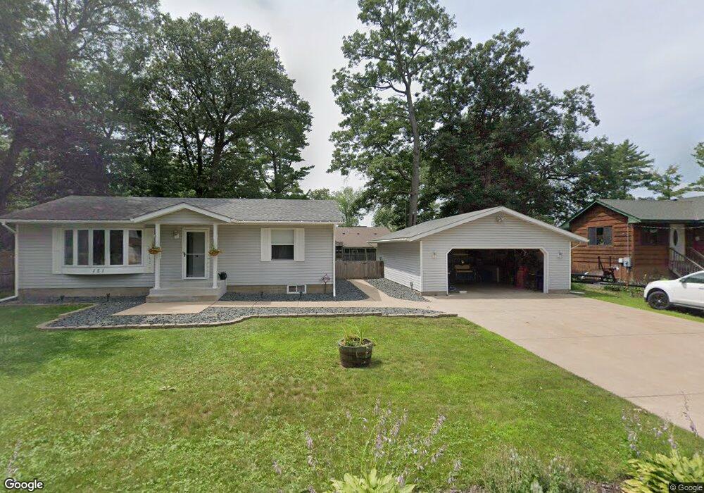
151 Laurel Rd Wyoming, MN 55092
Estimated Value: $316,000 - $359,180
3
Beds
2
Baths
1,760
Sq Ft
$194/Sq Ft
Est. Value
About This Home
This home is located at 151 Laurel Rd, Wyoming, MN 55092 and is currently estimated at $342,295, approximately $194 per square foot. 151 Laurel Rd is a home located in Anoka County with nearby schools including Linwood Elementary School and Forest Lake Area High School.
Ownership History
Date
Name
Owned For
Owner Type
Purchase Details
Closed on
Oct 14, 2021
Sold by
Dummer Jonathan
Bought by
Seline Michael and Seline Alicia
Current Estimated Value
Home Financials for this Owner
Home Financials are based on the most recent Mortgage that was taken out on this home.
Original Mortgage
$280,500
Outstanding Balance
$255,790
Interest Rate
2.8%
Mortgage Type
New Conventional
Estimated Equity
$86,505
Purchase Details
Closed on
Jul 16, 1998
Sold by
Haugstad Gary A and Haugstad Carol J
Bought by
Leslie Karen K and Kane Miles M
Create a Home Valuation Report for This Property
The Home Valuation Report is an in-depth analysis detailing your home's value as well as a comparison with similar homes in the area
Home Values in the Area
Average Home Value in this Area
Purchase History
| Date | Buyer | Sale Price | Title Company |
|---|---|---|---|
| Seline Michael | $330,000 | Minnesota Title | |
| Leslie Karen K | $76,000 | -- |
Source: Public Records
Mortgage History
| Date | Status | Borrower | Loan Amount |
|---|---|---|---|
| Open | Seline Michael | $280,500 |
Source: Public Records
Tax History
| Year | Tax Paid | Tax Assessment Tax Assessment Total Assessment is a certain percentage of the fair market value that is determined by local assessors to be the total taxable value of land and additions on the property. | Land | Improvement |
|---|---|---|---|---|
| 2025 | $2,522 | $274,000 | $77,000 | $197,000 |
| 2024 | $2,522 | $268,500 | $75,500 | $193,000 |
| 2023 | $2,319 | $254,100 | $60,900 | $193,200 |
| 2022 | $2,227 | $257,300 | $53,500 | $203,800 |
| 2021 | $2,561 | $216,500 | $52,900 | $163,600 |
| 2020 | $2,482 | $219,900 | $64,800 | $155,100 |
| 2019 | $2,242 | $202,700 | $51,600 | $151,100 |
| 2018 | $2,097 | $174,100 | $0 | $0 |
| 2017 | $2,089 | $169,200 | $0 | $0 |
| 2016 | $1,800 | $132,200 | $0 | $0 |
| 2015 | -- | $132,200 | $25,300 | $106,900 |
| 2014 | -- | $121,800 | $29,000 | $92,800 |
Source: Public Records
Map
Nearby Homes
- 213 Elm Rd
- 188 Dogwood Rd
- 218 Birch Rd
- 18922 Yalta St NE
- 20042 Wild Rice Dr NE
- L2 B1 Viking Blvd NE
- 4725 Lexington Ave NE
- 4810 Lexington Ave NE
- 18XXX Harpers St NE
- 3841 Interlachen Dr NE
- 3729 172nd Ln NE
- 20790 Durant St NE
- 20715 Minnie B Grant Ln NE
- 16921 Vickers St NE
- TBD S 179th Ave NE
- 3521 170th Ln NE
- 2441 179th Ave NE
- 2458 179th Ave NE
- 21948 Edison St NE
- 21087 National St NE
Your Personal Tour Guide
Ask me questions while you tour the home.