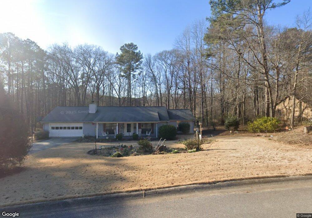
151 Stokes Dr Unit 3 Stockbridge, GA 30281
Estimated Value: $213,191 - $268,000
3
Beds
2
Baths
1,576
Sq Ft
$155/Sq Ft
Est. Value
About This Home
This home is located at 151 Stokes Dr Unit 3, Stockbridge, GA 30281 and is currently estimated at $245,048, approximately $155 per square foot. 151 Stokes Dr Unit 3 is a home located in Henry County with nearby schools including Fairview Elementary School, Austin Road Middle School, and Stockbridge High School.
Ownership History
Date
Name
Owned For
Owner Type
Purchase Details
Closed on
Feb 23, 1998
Sold by
Tallent Harold M and Tallent Ola Anne
Bought by
Tallent Harold M and Tallent Phyllis D
Current Estimated Value
Home Financials for this Owner
Home Financials are based on the most recent Mortgage that was taken out on this home.
Original Mortgage
$76,900
Outstanding Balance
$13,553
Interest Rate
6.95%
Mortgage Type
New Conventional
Estimated Equity
$231,495
Create a Home Valuation Report for This Property
The Home Valuation Report is an in-depth analysis detailing your home's value as well as a comparison with similar homes in the area
Home Values in the Area
Average Home Value in this Area
Purchase History
| Date | Buyer | Sale Price | Title Company |
|---|---|---|---|
| Tallent Harold M | $10,000 | -- |
Source: Public Records
Mortgage History
| Date | Status | Borrower | Loan Amount |
|---|---|---|---|
| Open | Tallent Harold M | $76,900 |
Source: Public Records
Tax History Compared to Growth
Tax History
| Year | Tax Paid | Tax Assessment Tax Assessment Total Assessment is a certain percentage of the fair market value that is determined by local assessors to be the total taxable value of land and additions on the property. | Land | Improvement |
|---|---|---|---|---|
| 2025 | $551 | $111,804 | $14,000 | $97,804 |
| 2024 | $551 | $101,280 | $14,000 | $87,280 |
| 2023 | $319 | $97,720 | $14,000 | $83,720 |
| 2022 | $464 | $77,120 | $10,000 | $67,120 |
| 2021 | $464 | $61,000 | $10,000 | $51,000 |
| 2020 | $464 | $53,800 | $8,000 | $45,800 |
| 2019 | $464 | $47,960 | $8,000 | $39,960 |
| 2018 | $464 | $45,120 | $8,000 | $37,120 |
| 2016 | $365 | $37,080 | $6,000 | $31,080 |
| 2015 | $338 | $33,800 | $6,000 | $27,800 |
| 2014 | $250 | $27,920 | $4,800 | $23,120 |
Source: Public Records
Map
Nearby Homes
- 7001 Coatsworth Dr Unit LOT 1
- 7031 Coatsworth Dr Unit 2
- 2132 E Atlanta Rd
- 2122 E Atlanta Rd
- 232 Clarkdell Dr
- 1773 E Atlanta Rd
- 145 Glenloch Pkwy
- 219 Thorncrest
- 90 Country Roads Dr
- 68 Pine Dr
- 230 Flintlock Trail
- 4301 Rex Rd Unit I
- 5904 Foxfield Trail
- 491 Thurman Rd Unit TRACT C
- 20 Lamp Post Ct
- 110 Stagecoach Trail
- 230 Carriage Cir
- 300 Redford Trail
- 305 Belmont Farms Dr
- 153 Stokes Dr
- 152 Stokes Dr Unit 3
- 140 Stokes Dr
- 157 Stokes Dr
- 157 Stokes Dr Unit 3
- 160 Stokes Dr
- 154 Stokes Dr Unit 3
- 130 Stokes Dr
- 159 Stokes Dr
- 156 Stokes Dr Unit 3
- 155 Stokes Dr
- 155 Stokes Dr Unit 3
- 145 Stokes Dr Unit 1
- 0 Stokes Dr Unit 7249251
- 0 Stokes Dr Unit 8085492
- 0 Stokes Dr Unit 7527926
- 0 Stokes Dr Unit 3241432
- 0 Stokes Dr Unit 9042630
- 0 Stokes Dr Unit 8824755
- 0 Stokes Dr Unit 3093553