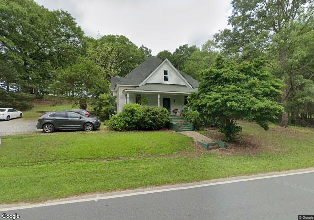
151 W Mcintosh Rd Brooks, GA 30205
Estimated Value: $279,028 - $530,000
--
Bed
1
Bath
1,503
Sq Ft
$262/Sq Ft
Est. Value
About This Home
This home is located at 151 W Mcintosh Rd, Brooks, GA 30205 and is currently estimated at $393,507, approximately $261 per square foot. 151 W Mcintosh Rd is a home located in Fayette County with nearby schools including Peeples Elementary School, Whitewater Middle School, and Whitewater High School.
Ownership History
Date
Name
Owned For
Owner Type
Purchase Details
Closed on
Nov 1, 2006
Sold by
Roberts Michael L and Roberts Wanda L
Bought by
Hilpine Llc
Current Estimated Value
Purchase Details
Closed on
Nov 14, 2003
Sold by
Roberts Michael L and Roberts Wanda L
Bought by
Gaddy James A and Gaddy Jamie
Home Financials for this Owner
Home Financials are based on the most recent Mortgage that was taken out on this home.
Original Mortgage
$164,800
Interest Rate
5.93%
Mortgage Type
New Conventional
Create a Home Valuation Report for This Property
The Home Valuation Report is an in-depth analysis detailing your home's value as well as a comparison with similar homes in the area
Home Values in the Area
Average Home Value in this Area
Purchase History
| Date | Buyer | Sale Price | Title Company |
|---|---|---|---|
| Hilpine Llc | $148,000 | -- | |
| Gaddy James A | $106,000 | -- |
Source: Public Records
Mortgage History
| Date | Status | Borrower | Loan Amount |
|---|---|---|---|
| Previous Owner | Gaddy James A | $164,800 |
Source: Public Records
Tax History Compared to Growth
Tax History
| Year | Tax Paid | Tax Assessment Tax Assessment Total Assessment is a certain percentage of the fair market value that is determined by local assessors to be the total taxable value of land and additions on the property. | Land | Improvement |
|---|---|---|---|---|
| 2024 | $2,397 | $84,780 | $27,064 | $57,716 |
| 2023 | $2,397 | $78,664 | $23,784 | $54,880 |
| 2022 | $2,129 | $73,360 | $21,320 | $52,040 |
| 2021 | $1,918 | $65,680 | $19,680 | $46,000 |
| 2020 | $1,691 | $58,400 | $18,040 | $40,360 |
| 2019 | $1,644 | $56,160 | $18,040 | $38,120 |
| 2018 | $1,507 | $50,824 | $15,584 | $35,240 |
| 2017 | $1,336 | $44,800 | $14,760 | $30,040 |
| 2016 | $1,244 | $40,720 | $14,760 | $25,960 |
| 2015 | $1,187 | $38,120 | $14,760 | $23,360 |
| 2014 | $1,115 | $35,080 | $14,760 | $20,320 |
| 2013 | -- | $33,464 | $0 | $0 |
Source: Public Records
Map
Nearby Homes
- 0 W Mcintosh Rd Unit 10527676
- 190 Gable Rd
- 130 Brooklet Way
- 0 Price Rd Unit LOT 2
- 0 Price Rd Unit LOT 1
- 160 Carrington Ln
- 786 Highway 85 Connector
- 395 W Mcintosh Rd
- 165 Grace Hope Dr
- 0 Hogan Rd Unit 10611382
- 291 Morgan Mill Rd
- 250 Friendship Church Rd
- 360 Morgan Mill Rd
- 423 Mask Rd
- 0 Mask and Lynch Rd Unit 10611467
- 5555 W Mcintosh Rd
- 684 Brooks Woolsey Rd
- 4249 W Ellis Rd
- 0 Huckaby Rd Unit 10361347
- 531 Grant Rd
- 139 W Mcintosh Rd
- 165 W Mcintosh Rd
- 126 W Mcintosh Rd
- 0 Gable Rd Lot 3
- 2 Gable Rd
- 166 W Mcintosh Rd
- 167 W Mcintosh Rd
- 110 Gable Rd
- 0 Hwy 85 Connector T 3 Unit 5293311
- 0 Hwy 85 Connector T 4 Unit 5293322
- 180 W Mcintosh Rd
- 113 W Mcintosh Rd
- 183 W Mcintosh Rd
- 114 Railroad St
- 968 Highway 85 Connector
- 0 Railroad Ave Unit 8853141
- 0 Railroad Ave
- 190 W Mcintosh Rd
- 124 Gable Rd
- 957 Highway 85 Connector