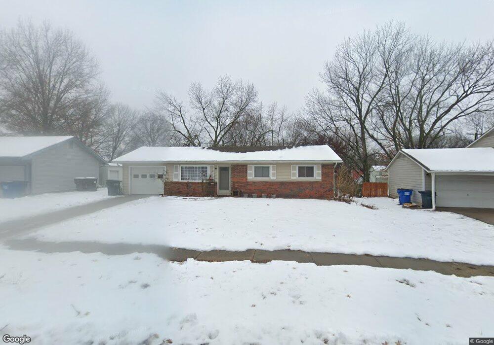
1511 Davis Rd Lawrence, KS 66046
Estimated Value: $139,031 - $277,000
3
Beds
1
Bath
1,181
Sq Ft
$187/Sq Ft
Est. Value
About This Home
This home is located at 1511 Davis Rd, Lawrence, KS 66046 and is currently estimated at $221,258, approximately $187 per square foot. 1511 Davis Rd is a home located in Douglas County with nearby schools including Kennedy Elementary School, Liberty Memorial Central Middle School, and Lawrence High School.
Ownership History
Date
Name
Owned For
Owner Type
Purchase Details
Closed on
Oct 1, 2014
Sold by
Berrios Stephen N
Bought by
Wilson Victoria
Current Estimated Value
Home Financials for this Owner
Home Financials are based on the most recent Mortgage that was taken out on this home.
Original Mortgage
$109,600
Outstanding Balance
$84,024
Interest Rate
4.1%
Mortgage Type
New Conventional
Estimated Equity
$137,234
Purchase Details
Closed on
Apr 3, 2008
Sold by
Hoover Lance L and Hoover Amy M
Bought by
Travis Hayley
Create a Home Valuation Report for This Property
The Home Valuation Report is an in-depth analysis detailing your home's value as well as a comparison with similar homes in the area
Purchase History
| Date | Buyer | Sale Price | Title Company |
|---|---|---|---|
| Wilson Victoria | -- | Capital Title Ins Company Lc | |
| Travis Hayley | -- | Kansas Secured Title |
Source: Public Records
Mortgage History
| Date | Status | Borrower | Loan Amount |
|---|---|---|---|
| Open | Wilson Victoria | $109,600 |
Source: Public Records
Tax History
| Year | Tax Paid | Tax Assessment Tax Assessment Total Assessment is a certain percentage of the fair market value that is determined by local assessors to be the total taxable value of land and additions on the property. | Land | Improvement |
|---|---|---|---|---|
| 2025 | $1,491 | $12,974 | $0 | $12,974 |
| 2024 | $1,477 | $12,855 | $0 | $12,855 |
| 2023 | $1,606 | $12,989 | $0 | $12,989 |
| 2022 | $1,541 | $12,371 | $0 | $12,371 |
| 2021 | $1,820 | $13,818 | $0 | $13,818 |
| 2020 | $1,508 | $11,563 | $0 | $11,563 |
| 2019 | $1,479 | $11,364 | $0 | $11,364 |
| 2018 | $1,469 | $11,203 | $0 | $11,203 |
| 2017 | $1,479 | $11,155 | $0 | $11,155 |
| 2016 | $1,374 | $10,845 | $0 | $10,845 |
| 2015 | -- | $10,465 | $0 | $10,465 |
| 2014 | -- | $10,465 | $0 | $10,465 |
Source: Public Records
Map
Nearby Homes
- 2014 Maple Ln
- 1628 E 18th Terrace
- 1708 E 21st Terrace
- 2200 Harper St Unit C24
- 5701 Johnson Ave
- 5804 Johnson Ave
- 1625 Delaware St
- 1820 Hampton St
- 1950 Barker Ave
- 1909 E 25th Terrace
- 2604 Mayfair Dr
- 2613 Mayfair Dr
- 1226 Delaware St Unit 12
- 1327 New Jersey St
- 1300 New York St Unit A & B
- 1300 New York St
- 2208 Massachusetts St
- 2115 Massachusetts St
- 1341 Rhode Island St
- 1128 Pennsylvania St
Your Personal Tour Guide
Ask me questions while you tour the home.