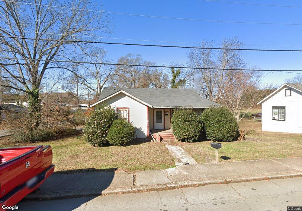
1511 Westside Dr Gainesville, GA 30501
Browns Bridge NeighborhoodEstimated Value: $215,000 - $302,035
2
Beds
1
Bath
996
Sq Ft
$248/Sq Ft
Est. Value
About This Home
This home is located at 1511 Westside Dr, Gainesville, GA 30501 and is currently estimated at $246,759, approximately $247 per square foot. 1511 Westside Dr is a home located in Hall County with nearby schools including Lyman Hall Elementary School, West Hall Middle School, and West Hall High School.
Ownership History
Date
Name
Owned For
Owner Type
Purchase Details
Closed on
May 21, 2024
Sold by
David Pierce Family L P
Bought by
Maruri Arturo
Current Estimated Value
Home Financials for this Owner
Home Financials are based on the most recent Mortgage that was taken out on this home.
Original Mortgage
$19,000
Outstanding Balance
$17,745
Interest Rate
6.44%
Mortgage Type
New Conventional
Estimated Equity
$229,014
Purchase Details
Closed on
Mar 25, 2016
Sold by
Pierce Herbert David
Bought by
David Pierce Family Lp
Purchase Details
Closed on
Apr 14, 1999
Sold by
Loggins Clyde E and Loggins Bessie Inez
Bought by
Black Harold A and Smith Robert W
Home Financials for this Owner
Home Financials are based on the most recent Mortgage that was taken out on this home.
Original Mortgage
$103,466
Interest Rate
7.13%
Mortgage Type
New Conventional
Create a Home Valuation Report for This Property
The Home Valuation Report is an in-depth analysis detailing your home's value as well as a comparison with similar homes in the area
Home Values in the Area
Average Home Value in this Area
Purchase History
| Date | Buyer | Sale Price | Title Company |
|---|---|---|---|
| Maruri Arturo | $2,000,000 | -- | |
| David Pierce Family Lp | -- | -- | |
| Pierce Herbert David | $85,000 | -- | |
| Black Harold A | $105,000 | -- |
Source: Public Records
Mortgage History
| Date | Status | Borrower | Loan Amount |
|---|---|---|---|
| Open | Maruri Arturo | $19,000 | |
| Previous Owner | Black Harold A | $103,466 |
Source: Public Records
Tax History
| Year | Tax Paid | Tax Assessment Tax Assessment Total Assessment is a certain percentage of the fair market value that is determined by local assessors to be the total taxable value of land and additions on the property. | Land | Improvement |
|---|---|---|---|---|
| 2025 | $1,825 | $73,480 | $17,440 | $56,040 |
| 2024 | $1,637 | $63,320 | $15,000 | $48,320 |
| 2023 | $1,274 | $46,600 | $15,000 | $31,600 |
| 2022 | $1,049 | $37,880 | $8,840 | $29,040 |
| 2021 | $915 | $32,040 | $8,080 | $23,960 |
| 2020 | $980 | $33,520 | $8,080 | $25,440 |
| 2019 | $1,155 | $39,640 | $8,080 | $31,560 |
| 2018 | $1,034 | $34,080 | $8,080 | $26,000 |
| 2017 | $956 | $31,640 | $8,080 | $23,560 |
| 2016 | $793 | $26,444 | $8,080 | $18,364 |
| 2015 | $743 | $24,404 | $6,040 | $18,364 |
| 2014 | $743 | $24,404 | $6,040 | $18,364 |
Source: Public Records
Map
Nearby Homes
- 1322 Ralston St
- 1322 Hazel St
- 593 Shallowford Rd NW
- 49 Highland Ave
- 1639 Whiting Dr
- 1824 Gaines Dr
- 4171 Millstone Park Ln
- 235 Tower Heights Rd
- 0 Hilton Dr Unit 10529633
- 0 Hilton Southwest Dr Unit 7697592
- 2054 Spring Rd
- 1255 Purina Dr
- 2147 Spring Rd
- 219 Shallowford Dr
- 221 Shallowford Dr
- 132 Shallowford Rd NW
- 2244 Bennett Cir
- 1122 Villa Clara Way
- 515 Nightfire Ct SW
- 510 Nightfire Ct SW
- 1510 Westside Dr
- 2400 W Carter St
- 1602 Westside Dr
- 1512 W Carter St
- 2400 SW West Carter St
- 1508 Westside Dr
- 1606 Westside Dr
- 1506 Westside Dr
- 1517 Browns Bridge Rd
- 12 Tate St
- 1505 Westside Dr
- 1606 Lyman St
- 1521 Westside Dr
- 10 Tate St
- 1511 Browns Bridge Rd
- 1610 Lyman St
- 1501 Westside Dr
- 1507 Browns Bridge Rd
- 1538 Lyman St
- 1608 Lyman St
Your Personal Tour Guide
Ask me questions while you tour the home.