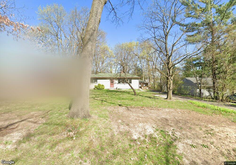
1512 Newport Rd Ann Arbor, MI 48103
Water Hill NeighborhoodEstimated Value: $427,000 - $519,000
2
Beds
2
Baths
1,146
Sq Ft
$410/Sq Ft
Est. Value
About This Home
This home is located at 1512 Newport Rd, Ann Arbor, MI 48103 and is currently estimated at $469,539, approximately $409 per square foot. 1512 Newport Rd is a home located in Washtenaw County with nearby schools including Wines Elementary School, Forsythe Middle School, and Skyline High School.
Ownership History
Date
Name
Owned For
Owner Type
Purchase Details
Closed on
Jul 19, 2005
Sold by
Leonard Jane R
Bought by
Maxey John
Current Estimated Value
Home Financials for this Owner
Home Financials are based on the most recent Mortgage that was taken out on this home.
Original Mortgage
$186,200
Outstanding Balance
$96,192
Interest Rate
5.5%
Mortgage Type
Fannie Mae Freddie Mac
Estimated Equity
$373,347
Purchase Details
Closed on
Nov 29, 2004
Sold by
Leonard Jane R
Bought by
Leonard Jane R and Jane R Leonard Trust
Create a Home Valuation Report for This Property
The Home Valuation Report is an in-depth analysis detailing your home's value as well as a comparison with similar homes in the area
Home Values in the Area
Average Home Value in this Area
Purchase History
| Date | Buyer | Sale Price | Title Company |
|---|---|---|---|
| Maxey John | -- | -- | |
| Leonard Jane R | -- | -- |
Source: Public Records
Mortgage History
| Date | Status | Borrower | Loan Amount |
|---|---|---|---|
| Open | Maxey John | $186,200 |
Source: Public Records
Tax History Compared to Growth
Tax History
| Year | Tax Paid | Tax Assessment Tax Assessment Total Assessment is a certain percentage of the fair market value that is determined by local assessors to be the total taxable value of land and additions on the property. | Land | Improvement |
|---|---|---|---|---|
| 2025 | $7,719 | $203,800 | $0 | $0 |
| 2024 | $7,507 | $178,300 | $0 | $0 |
| 2023 | $8,936 | $171,500 | $0 | $0 |
| 2022 | $6,482 | $176,900 | $0 | $0 |
| 2021 | $11,499 | $164,000 | $0 | $0 |
| 2020 | $7,772 | $161,200 | $0 | $0 |
| 2019 | $7,413 | $142,200 | $142,200 | $0 |
| 2018 | $7,273 | $137,800 | $0 | $0 |
| 2017 | $7,016 | $138,200 | $0 | $0 |
| 2016 | $6,726 | $108,711 | $0 | $0 |
| 2015 | $4,995 | $108,386 | $0 | $0 |
| 2014 | $4,995 | $107,378 | $0 | $0 |
| 2013 | -- | $107,378 | $0 | $0 |
Source: Public Records
Map
Nearby Homes
- 1797 Miller Ave
- 2374 Newport Rd
- 2174 Overlook Ct Unit 326
- 701 Pomona Rd
- 822 Brooks St
- 2108 Newport Rd Unit Parcel 2108
- 2108 Newport Rd
- 915 Westwood Ave
- 601 Cressfield Ln
- 827 Westwood Ave
- 2136 Newport Rd
- 1431 Hatcher Crescent
- 2134 Overlook Ct
- 1006 Duncan St
- 508 W Summit St
- 518 Hiscock St
- 1115 Western Dr
- 215 Bucholz Ct
- 1132 Longshore Dr Unit 2
- 408 Felch St
- 1496 Newport Rd
- 1518 Newport Rd
- 1526 Newport Rd
- 1480 Newport Rd
- 1301 Pomona Rd
- 1325 Pomona Rd
- 1223 Pomona Rd
- 1311 Pomona Rd
- 1319 Pomona Rd
- 1532 Newport Rd
- 1422 Red Oak Rd
- 1331 Pomona Rd
- 1217 Pomona Rd
- 1361 Newport Rd
- 1483 Newport Rd
- 1576 Newport Rd
- 1310 Pomona Rd
- 1318 Pomona Rd
- 1400 Red Oak Rd
- 1300 Pomona Rd